Property Record
1420 Nw 28Th Ave, Camas, WA 98607


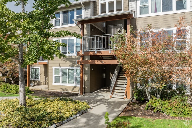
Property Detail
1420 Nw 28Th Ave
081958-128
#120 SEC 3 T1N R3EWM 3.04A M/L FOR ASSESSOR USE ONLY THT PTN NWQ OF SEQ SEC 3-1-3E DAF: BEG AT SW COR OF SEQ SD SEC & RNG TH N 0DG 12MIN 42SEC E ALG W LI SD SEQ 2636.49 FT TO SLY R/W LI OF NW 28TH AVE & TPOB TH S 0DG 12MIN 42SEC W ALG SD W LI 391.19
Multifamilydwelling
Clark
MF-10
Washington
B and X Area of moderate flood hazard, usually the area between the limits of the 100-year and 500-year floods.
3.04 AC
0
Outlying Vancouver
2025
Portland
041400
Portland-Vancouver-Hillsboro, OR-WA
52,631 SF
NEARBY LISTINGS FOR SALE OR LEASE
-
-
View all Camas listings for sale on LoopNet.com
DEMOGRAPHICS near 1420 Nw 28Th Ave
1 mile
3 mile
5 mile
2025 Total Population
10,662
41,107
120,068
2030 Population
11,018
42,765
122,952
Pop Growth 2025-2030
+ 3.34%
+ 4.03%
+ 2.40%
Average Age
39
40
41
2025 Total Households
3,528
14,346
44,296
HH Growth 2025-2030
+ 3.49%
+ 4.22%
+ 2.49%
Median Household Inc
$147,779
$129,229
$102,356
Avg Household Size
3.00
2.80
2.70
2025 Avg HH Vehicles
2.00
2.00
2.00
Median Home Value
$748,647
$720,682
$608,578
Median Year Built
1997
2000
1995
Nearby Places
Map Layers
Map Styles
 Street
 Aerial
Layers
 Traffic
 Biking
Places
Listings with unknown addresses are not visible on the map
- Restaurants
- Banks
- Shops
- Fitness
- Groceries
PUBLIC TRANSPORTATION
AIRPORT
Portland International
Drive
Walk
Distance
Portland International
24 min
12.7 mi
Freight Ports
Port of Vancouver
Drive
Walk
Distance
Port of Vancouver
29 min
16.1 mi
Nearby Properties
Address
Land Use
TOTAL SIZE
Lot Size
Zoning
Address
Land Use
TOTAL SIZE
Lot Size
Zoning
1,500,000 SF
189.27 AC
HI
Address
Land Use
TOTAL SIZE
Lot Size
Zoning
309,088 SF
17.57 AC
RC
Address
Land Use
TOTAL SIZE
Lot Size
Zoning
817,650 SF
119.73 AC
LI/BP
Address
Land Use
TOTAL SIZE
Lot Size
Zoning
929,350 SF
143.57 AC
LI/BP
Address
Land Use
TOTAL SIZE
Lot Size
Zoning
255,683 SF
32.06 AC
R-7.5
Address
Land Use
TOTAL SIZE
Lot Size
Zoning
233,766 SF
5.34 AC
R-30
Address
Land Use
TOTAL SIZE
Lot Size
Zoning
247,598 SF
45.75 AC
CG
Address
Land Use
TOTAL SIZE
Lot Size
Zoning
603,750 SF
49.11 AC
IL
Address
Land Use
TOTAL SIZE
Lot Size
Zoning
174,510 SF
9.76 AC
BP
Address
Land Use
TOTAL SIZE
Lot Size
Zoning
44,228 SF
8.01 AC
LI/BP
Address
Land Use
TOTAL SIZE
Lot Size
Zoning
186,702 SF
34.20 AC
R-4
Address
Land Use
TOTAL SIZE
Lot Size
Zoning
126,012 SF
7.04 AC
MF-18
Address
Land Use
TOTAL SIZE
Lot Size
Zoning
114,205 SF
15.13 AC
RC
Address
Land Use
TOTAL SIZE
Lot Size
Zoning
114,205 SF
13.52 AC
RC
Address
Land Use
TOTAL SIZE
Lot Size
Zoning
114,205 SF
9.77 AC
RC
Address
Land Use
TOTAL SIZE
Lot Size
Zoning
224,500 SF
12.30 AC
R-7.5
Address
Land Use
TOTAL SIZE
Lot Size
Zoning
114,696 SF
2.29 AC
MF-18
Address
Land Use
TOTAL SIZE
Lot Size
Zoning
102,128 SF
1.94 AC
CC
Address
Land Use
TOTAL SIZE
Lot Size
Zoning
74,375 SF
33.73 AC
R-7.5
Address
Land Use
TOTAL SIZE
Lot Size
Zoning
261,214 SF
4.01 AC
CG
Address
Land Use
TOTAL SIZE
Lot Size
Zoning
125,110 SF
29.56 AC
LI/BP
Address
Land Use
TOTAL SIZE
Lot Size
Zoning
139,248 SF
2.88 AC
CC
Address
Land Use
TOTAL SIZE
Lot Size
Zoning
204,503 SF
10.40 AC
LI/BP
Address
Land Use
TOTAL SIZE
Lot Size
Zoning
126,722 SF
6.42 AC
R-18
Address
Land Use
TOTAL SIZE
Lot Size
Zoning
65,604 SF
11.35 AC
R-7.5
Address
Land Use
TOTAL SIZE
Lot Size
Zoning
108,148 SF
57.60 AC
LI/BP
Address
Land Use
TOTAL SIZE
Lot Size
Zoning
185,651 SF
11.05 AC
BP
Address
Land Use
TOTAL SIZE
Lot Size
Zoning
149,619 SF
13.95 AC
CC
Address
Land Use
TOTAL SIZE
Lot Size
Zoning
139,099 SF
13.47 AC
MX
Address
Land Use
TOTAL SIZE
Lot Size
Zoning
177,040 SF
10 AC
LI/BP
The World's #1 Commercial Real Estate Marketplace
Connect with us
© 2026 CoStar Group
The information above has been obtained from sources believed reliable. While we do not doubt its accuracy we have not verified it and make no guarantee, warranty or representation about it. It is your responsibility to independently confirm its accuracy and completeness. Any projections, opinions, assumptions, or estimates used are for example only and do not represent the current or future performance of the property. The value of this transaction to you depends on tax and other factors which should be evaluated by your tax, financial, and legal advisors. You and your advisors should conduct a careful, independent investigation of the property to determine to your satisfaction the suitability of the property for your needs.