Property Record
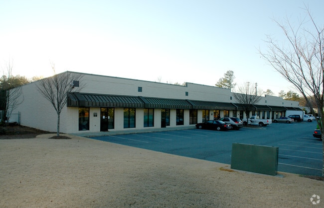
1420 White Cir, Marietta, GA 30066
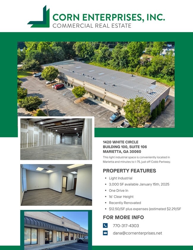
Current Lease Availabilities
NEARBY LISTINGS FOR SALE OR LEASE
Property Detail
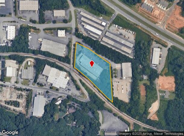
1420 White Cir
16-0865-0-001-0
Surv Prepared/Loris Woolard
Commercialnec
Cobb
X
Georgia
13067C0102J
865
2025
2.68 AC
2025
SE Cobb Cnty/Marietta
030361
Atlanta
26,175 SF
Atlanta-Sandy Springs-Roswell, GA
DEMOGRAPHICS near 1420 White Cir
1 Mile
3 Mile
5 Mile
2024 Total Population
7,217
52,742
173,681
2029 Population
7,470
53,928
176,823
Pop Growth 2024-2029
+ 3.51%
+ 2.25%
+ 1.81%
Average Age
36
39
39
2024 Total Households
3,322
21,915
66,517
HH Growth 2024-2029
+ 3.67%
+ 2.33%
+ 1.82%
Median Household Inc
$83,182
$79,433
$83,317
Avg Household Size
2.10
2.30
2.50
2024 Avg HH Vehicles
2.00
2.00
2.00
Median Home Value
$344,783
$369,488
$340,996
Median Year Built
2002
1995
1990
Nearby Places
- Restaurants
- Banks
- Shops
- Fitness
- Groceries
PUBLIC TRANSPORTATION
AIRPORT
Hartsfield - Jackson Atlanta International
DRIVE
WALK
Distance
Hartsfield - Jackson Atlanta International
43 min
31.5 mi
Nearby Properties
Address
Land Use
TOTAL SIZE
Lot Size
Zoning
Address
Land Use
TOTAL SIZE
Lot Size
Zoning
379,750 SF
11.14 AC
Address
Land Use
TOTAL SIZE
Lot Size
Zoning
578,456 SF
60 AC
RM-12
Address
Land Use
TOTAL SIZE
Lot Size
Zoning
449,337 SF
53.52 AC
RM-12
Address
Land Use
TOTAL SIZE
Lot Size
Zoning
4,812 SF
4.20 AC
PVC
Address
Land Use
TOTAL SIZE
Lot Size
Zoning
416,821 SF
12.96 AC
Address
Land Use
TOTAL SIZE
Lot Size
Zoning
35,085 SF
3.77 AC
RRC
Address
Land Use
TOTAL SIZE
Lot Size
Zoning
95,228 SF
12.97 AC
CBD
Address
Land Use
TOTAL SIZE
Lot Size
Zoning
507,196 SF
67.83 AC
RM-12
Address
Land Use
TOTAL SIZE
Lot Size
Zoning
7.79 AC
RRC
Address
Land Use
TOTAL SIZE
Lot Size
Zoning
31.37 AC
PVC
Address
Land Use
TOTAL SIZE
Lot Size
Zoning
69,476 SF
8.11 AC
PVC
Address
Land Use
TOTAL SIZE
Lot Size
Zoning
326,166 SF
40 AC
RM-12/WS
Address
Land Use
TOTAL SIZE
Lot Size
Zoning
617,562 SF
35.22 AC
PSC
Address
Land Use
TOTAL SIZE
Lot Size
Zoning
300,369 SF
10.64 AC
Address
Land Use
TOTAL SIZE
Lot Size
Zoning
385,954 SF
31 AC
RM-12
Address
Land Use
TOTAL SIZE
Lot Size
Zoning
304,376 SF
19.86 AC
RM-12/WS
Address
Land Use
TOTAL SIZE
Lot Size
Zoning
312,765 SF
12.59 AC
UVC
Address
Land Use
TOTAL SIZE
Lot Size
Zoning
437,231 SF
5.79 AC
PVC
Address
Land Use
TOTAL SIZE
Lot Size
Zoning
283,134 SF
13.10 AC
PVC
Address
Land Use
TOTAL SIZE
Lot Size
Zoning
3.16 AC
PVC
Address
Land Use
TOTAL SIZE
Lot Size
Zoning
375,544 SF
27.82 AC
RM-12
Address
Land Use
TOTAL SIZE
Lot Size
Zoning
245,066 SF
15.41 AC
UC
Address
Land Use
TOTAL SIZE
Lot Size
Zoning
272,064 SF
22.59 AC
RM-12
Address
Land Use
TOTAL SIZE
Lot Size
Zoning
183,262 SF
19.35 AC
RM-12
Address
Land Use
TOTAL SIZE
Lot Size
Zoning
99,863 SF
21.90 AC
UC
Address
Land Use
TOTAL SIZE
Lot Size
Zoning
288,926 SF
75 AC
LI
Address
Land Use
TOTAL SIZE
Lot Size
Zoning
218,895 SF
8.10 AC
PVC
Address
Land Use
TOTAL SIZE
Lot Size
Zoning
129,168 SF
0.82 AC
OI
Address
Land Use
TOTAL SIZE
Lot Size
Zoning
198,423 SF
15.31 AC
OI
Address
Land Use
TOTAL SIZE
Lot Size
Zoning
347,298 SF
30.41 AC
GC/HI/WS
The World's #1 Commercial Real Estate Marketplace
Connect with us
© 2025 CoStar Group
The information above has been obtained from sources believed reliable. While we do not doubt its accuracy we have not verified it and make no guarantee, warranty or representation about it. It is your responsibility to independently confirm its accuracy and completeness. Any projections, opinions, assumptions, or estimates used are for example only and do not represent the current or future performance of the property. The value of this transaction to you depends on tax and other factors which should be evaluated by your tax, financial, and legal advisors. You and your advisors should conduct a careful, independent investigation of the property to determine to your satisfaction the suitability of the property for your needs.