Property Record
540 N Litchfield Rd, Goodyear, AZ 85338


NEARBY LISTINGS FOR SALE OR LEASE
-
-
-
-
-
-
-
-
-
-
No Photo
-
View all Goodyear listings for sale on LoopNet.com
Property Detail
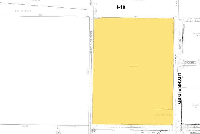
540 N Litchfield Rd
500-04-003H
TH POR E2 SEC 4 DAF COM AT SE COR SD SEC 4 TH N 1130.32F TH W 65F TH S 45D 18M W 22.63F TH W 264F TO TPOB TH CONT W 875.71F TO PT ON E R/W LN SPRR TH N 1501.27F TH E 92.49F TH N 20F TO PT ON S BDRY EH RENBERG-PHX HWY TH ALG SD BDRY E 1047.05F TH S 25
Farms
Maricopa
X
Arizona
04013C2155M
38.86 AC
2025
West I-10
2025
Phoenix
061024
Phoenix-Mesa-Scottsdale, AZ
DEMOGRAPHICS near 540 N Litchfield Rd
1 Mile
3 Mile
5 Mile
2024 Total Population
6,254
90,487
205,182
2029 Population
6,827
99,079
223,673
Pop Growth 2024-2029
+ 9.16%
+ 9.50%
+ 9.01%
Average Age
36
37
37
2024 Total Households
2,106
30,727
66,424
HH Growth 2024-2029
+ 9.26%
+ 9.62%
+ 9.24%
Median Household Inc
$57,637
$74,894
$84,730
Avg Household Size
2.90
2.90
3.00
2024 Avg HH Vehicles
2.00
2.00
2.00
Median Home Value
$372,518
$357,302
$359,901
Median Year Built
1992
2002
2004
Nearby Places
Map Layers
Map Styles
 Street
 Aerial
- Restaurants
- Banks
- Shops
- Fitness
- Groceries
PUBLIC TRANSPORTATION
AIRPORT
Phoenix Sky Harbor International
DRIVE
WALK
Distance
Phoenix Sky Harbor International
30 min
23.1 mi
Freight Ports
Port of San Diego
DRIVE
WALK
Distance
Port of San Diego
376 min
338.7 mi
Nearby Properties
Address
Land Use
TOTAL SIZE
Lot Size
Zoning
Address
Land Use
TOTAL SIZE
Lot Size
Zoning
16.70 AC
Address
Land Use
TOTAL SIZE
Lot Size
Zoning
76,301 SF
15.91 AC
Address
Land Use
TOTAL SIZE
Lot Size
Zoning
12.80 AC
Address
Land Use
TOTAL SIZE
Lot Size
Zoning
49,475 SF
5.70 AC
PAD
Address
Land Use
TOTAL SIZE
Lot Size
Zoning
370,726 SF
23.41 AC
PAD
Address
Land Use
TOTAL SIZE
Lot Size
Zoning
324,374 SF
18.26 AC
PAD
Address
Land Use
TOTAL SIZE
Lot Size
Zoning
90,008 SF
20.42 AC
M-H
Address
Land Use
TOTAL SIZE
Lot Size
Zoning
2.51 AC
Address
Land Use
TOTAL SIZE
Lot Size
Zoning
418,000 SF
23.58 AC
I-1
Address
Land Use
TOTAL SIZE
Lot Size
Zoning
563,328 SF
24.43 AC
C2
Address
Land Use
TOTAL SIZE
Lot Size
Zoning
401,714 SF
100.01 AC
PAD
Address
Land Use
TOTAL SIZE
Lot Size
Zoning
1,126,656 SF
35.76 AC
I1
Address
Land Use
TOTAL SIZE
Lot Size
Zoning
901,699 SF
49.92 AC
I1
Address
Land Use
TOTAL SIZE
Lot Size
Zoning
220,494 SF
50.53 AC
AG
Address
Land Use
TOTAL SIZE
Lot Size
Zoning
855,336 SF
45.11 AC
Address
Land Use
TOTAL SIZE
Lot Size
Zoning
802,671 SF
48.81 AC
I1
Address
Land Use
TOTAL SIZE
Lot Size
Zoning
320,888 SF
31.41 AC
C-G
Address
Land Use
TOTAL SIZE
Lot Size
Zoning
398,872 SF
9.39 AC
PAD
Address
Land Use
TOTAL SIZE
Lot Size
Zoning
790,980 SF
42.95 AC
I1
Address
Land Use
TOTAL SIZE
Lot Size
Zoning
295,014 SF
37.63 AC
PAD
Address
Land Use
TOTAL SIZE
Lot Size
Zoning
222,900 SF
15.99 AC
Address
Land Use
TOTAL SIZE
Lot Size
Zoning
355,597 SF
14.83 AC
PAD
Address
Land Use
TOTAL SIZE
Lot Size
Zoning
295,635 SF
16.57 AC
PAD
Address
Land Use
TOTAL SIZE
Lot Size
Zoning
293,849 SF
33.20 AC
PAD
Address
Land Use
TOTAL SIZE
Lot Size
Zoning
663,150 SF
34.49 AC
Address
Land Use
TOTAL SIZE
Lot Size
Zoning
450,619 SF
28.95 AC
I2
Address
Land Use
TOTAL SIZE
Lot Size
Zoning
54,562 SF
7.65 AC
PAD
Address
Land Use
TOTAL SIZE
Lot Size
Zoning
292,218 SF
15.12 AC
PAD
Address
Land Use
TOTAL SIZE
Lot Size
Zoning
328,244 SF
18.44 AC
PAD
Address
Land Use
TOTAL SIZE
Lot Size
Zoning
422,300 SF
21.26 AC
I1
The World's #1 Commercial Real Estate Marketplace
Connect with us
© 2025 CoStar Group
The information above has been obtained from sources believed reliable. While we do not doubt its accuracy we have not verified it and make no guarantee, warranty or representation about it. It is your responsibility to independently confirm its accuracy and completeness. Any projections, opinions, assumptions, or estimates used are for example only and do not represent the current or future performance of the property. The value of this transaction to you depends on tax and other factors which should be evaluated by your tax, financial, and legal advisors. You and your advisors should conduct a careful, independent investigation of the property to determine to your satisfaction the suitability of the property for your needs.