Property Record
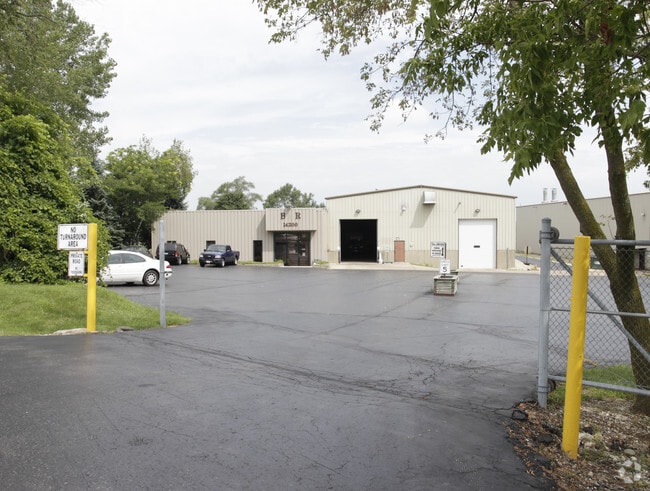
14200 Washington St, Woodstock, IL 60098


NEARBY LISTINGS FOR SALE OR LEASE
Property Detail
14200 Washington St
07-36-400-012
DOC 2022R0036082 PC N CEN RT 120 PT E1/2 E1/2
Industrialgeneral
McHenry
X
Illinois
17111C0178J
4.78 AC
2024
McHenry County
2024
Chicago
870200
Chicago-Naperville-Elgin, IL-IN-WI
DEMOGRAPHICS near 14200 Washington St
1 Mile
3 Mile
5 Mile
2024 Total Population
1,110
22,091
30,270
2029 Population
1,109
22,050
30,292
Pop Growth 2024-2029
(0.09%)
(0.19%)
+ 0.07%
Average Age
42
41
41
2024 Total Households
401
8,428
11,483
HH Growth 2024-2029
(0.25%)
(0.21%)
+ 0.03%
Median Household Inc
$81,048
$73,234
$77,560
Avg Household Size
2.60
2.50
2.50
2024 Avg HH Vehicles
2.00
2.00
2.00
Median Home Value
$189,999
$191,598
$219,211
Median Year Built
1975
1976
1982
Nearby Places
Map Layers
Map Styles
 Street
 Aerial
- Restaurants
- Banks
- Shops
- Fitness
- Groceries
PUBLIC TRANSPORTATION
COMMUTER RAIL
Woodstock Station (Union Pacific Northwest Line - Northeast Illinois Regional Commuter Railroad (Metra))
DRIVE
WALK
Distance
Woodstock Station (Union Pacific Northwest Line - Northeast Illinois Regional Commuter Railroad (Metra))
4 min
2.0 mi
Freight Ports
Port Milwaukee
DRIVE
WALK
Distance
Port Milwaukee
96 min
69.8 mi
SALE & LEASE HISTORY
LISTING DATE
SALE/LEASE

Sep 25, 2016
For Lease
Nearby Properties
Address
Land Use
TOTAL SIZE
Lot Size
Zoning
Address
Land Use
TOTAL SIZE
Lot Size
Zoning
129,755 SF
13.01 AC
Address
Land Use
TOTAL SIZE
Lot Size
Zoning
64,528 SF
9.51 AC
Address
Land Use
TOTAL SIZE
Lot Size
Zoning
50,749 SF
5.92 AC
Address
Land Use
TOTAL SIZE
Lot Size
Zoning
96,633 SF
3.97 AC
Address
Land Use
TOTAL SIZE
Lot Size
Zoning
164,167 SF
16.11 AC
Address
Land Use
TOTAL SIZE
Lot Size
Zoning
72,582 SF
3.74 AC
Address
Land Use
TOTAL SIZE
Lot Size
Zoning
45,876 SF
5.02 AC
Address
Land Use
TOTAL SIZE
Lot Size
Zoning
12,699 SF
8 AC
Address
Land Use
TOTAL SIZE
Lot Size
Zoning
2.78 AC
Address
Land Use
TOTAL SIZE
Lot Size
Zoning
24,968 SF
0.50 AC
Address
Land Use
TOTAL SIZE
Lot Size
Zoning
32,754 SF
0.11 AC
Address
Land Use
TOTAL SIZE
Lot Size
Zoning
Address
Land Use
TOTAL SIZE
Lot Size
Zoning
Address
Land Use
TOTAL SIZE
Lot Size
Zoning
22,724 SF
3.63 AC
Address
Land Use
TOTAL SIZE
Lot Size
Zoning
24,164 SF
4.99 AC
Address
Land Use
TOTAL SIZE
Lot Size
Zoning
25,650 SF
0.19 AC
Address
Land Use
TOTAL SIZE
Lot Size
Zoning
17,973 SF
8.64 AC
Address
Land Use
TOTAL SIZE
Lot Size
Zoning
139,352 SF
29.32 AC
Address
Land Use
TOTAL SIZE
Lot Size
Zoning
47,637 SF
1.09 AC
Address
Land Use
TOTAL SIZE
Lot Size
Zoning
Address
Land Use
TOTAL SIZE
Lot Size
Zoning
35,389 SF
4.44 AC
Address
Land Use
TOTAL SIZE
Lot Size
Zoning
Address
Land Use
TOTAL SIZE
Lot Size
Zoning
30,855 SF
1.57 AC
Address
Land Use
TOTAL SIZE
Lot Size
Zoning
7,740 SF
1.12 AC
Address
Land Use
TOTAL SIZE
Lot Size
Zoning
39,860 SF
2.10 AC
Address
Land Use
TOTAL SIZE
Lot Size
Zoning
15,000 SF
2.28 AC
Address
Land Use
TOTAL SIZE
Lot Size
Zoning
4,978 SF
1.39 AC
Address
Land Use
TOTAL SIZE
Lot Size
Zoning
78,482 SF
3.63 AC
Address
Land Use
TOTAL SIZE
Lot Size
Zoning
4,038 SF
0.85 AC
The World's #1 Commercial Real Estate Marketplace
Connect with us
© 2026 CoStar Group
The information above has been obtained from sources believed reliable. While we do not doubt its accuracy we have not verified it and make no guarantee, warranty or representation about it. It is your responsibility to independently confirm its accuracy and completeness. Any projections, opinions, assumptions, or estimates used are for example only and do not represent the current or future performance of the property. The value of this transaction to you depends on tax and other factors which should be evaluated by your tax, financial, and legal advisors. You and your advisors should conduct a careful, independent investigation of the property to determine to your satisfaction the suitability of the property for your needs.