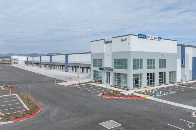
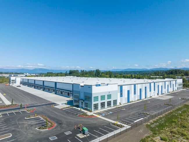
Property Record
14201 40Th Ave Ne, Marysville, WA 98271
Current Lease Availabilities
NEARBY LISTINGS FOR SALE OR LEASE
Property Detail
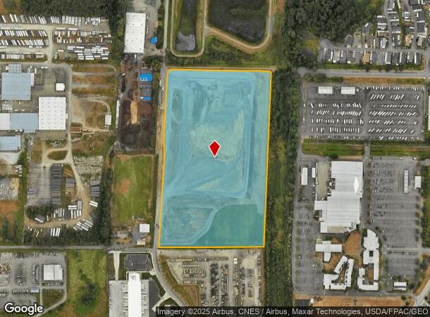
14201 40Th Ave Ne
310533-003-031-00
Mortons Crossing
Industrialgeneral
SECTION 33 TOWNSHIP 31 RANGE 5 QUARTER SW - TR 998 CITY OF MAR BSP PA 08-030 REC AFN 200909305003 & AMD BSP REC AFN 200911245003 BEING A PTN OF SE1/4 SW1/4
X
Snohomish
53061C0710F
Washington
2024
23.32 AC
2025
N Snohomish County
940001
Seattle/Puget Sound
336,508 SF
Seattle-Tacoma-Bellevue, WA
DEMOGRAPHICS near 14201 40Th Ave Ne
1 Mile
3 Mile
5 Mile
2024 Total Population
5,300
35,435
83,370
2029 Population
5,523
37,001
87,027
Pop Growth 2024-2029
+ 4.21%
+ 4.42%
+ 4.39%
Average Age
39
39
39
2024 Total Households
1,952
12,698
29,970
HH Growth 2024-2029
+ 4.30%
+ 4.55%
+ 4.49%
Median Household Inc
$100,104
$91,291
$93,078
Avg Household Size
2.70
2.70
2.70
2024 Avg HH Vehicles
2.00
2.00
2.00
Median Home Value
$474,615
$476,513
$485,630
Median Year Built
1993
1993
1991
Nearby Places
Map Layers
Map Styles
 Street
 Aerial
- Restaurants
- Banks
- Shops
- Fitness
- Groceries
PUBLIC TRANSPORTATION
AIRPORT
Seattle Paine Field International
DRIVE
WALK
Distance
Seattle Paine Field International
33 min
20.6 mi
Freight Ports
Port of Everett
DRIVE
WALK
Distance
Port of Everett
23 min
13.1 mi
Nearby Properties
Address
Land Use
TOTAL SIZE
Lot Size
Zoning
Address
Land Use
TOTAL SIZE
Lot Size
Zoning
2,623,172 SF
32.78 AC
Address
Land Use
TOTAL SIZE
Lot Size
Zoning
407,929 SF
20.45 AC
R12 MFL
Address
Land Use
TOTAL SIZE
Lot Size
Zoning
242,217 SF
157.97 AC
AF
Address
Land Use
TOTAL SIZE
Lot Size
Zoning
3.14 AC
IP
Address
Land Use
TOTAL SIZE
Lot Size
Zoning
113,927 SF
576.83 AC
TRIBES
Address
Land Use
TOTAL SIZE
Lot Size
Zoning
33,140 SF
135.95 AC
BP
Address
Land Use
TOTAL SIZE
Lot Size
Zoning
201,141 SF
7.37 AC
MU
Address
Land Use
TOTAL SIZE
Lot Size
Zoning
229,606 SF
9.28 AC
R18 MFM
Address
Land Use
TOTAL SIZE
Lot Size
Zoning
206,135 SF
4.05 AC
HC
Address
Land Use
TOTAL SIZE
Lot Size
Zoning
1,664 SF
16.93 AC
LI
Address
Land Use
TOTAL SIZE
Lot Size
Zoning
189,663 SF
8.21 AC
MU
Address
Land Use
TOTAL SIZE
Lot Size
Zoning
205,213 SF
8.81 AC
NC
Address
Land Use
TOTAL SIZE
Lot Size
Zoning
231,030 SF
18.48 AC
LI
Address
Land Use
TOTAL SIZE
Lot Size
Zoning
83.67 AC
SQ
Address
Land Use
TOTAL SIZE
Lot Size
Zoning
165,762 SF
7.12 AC
MU
Address
Land Use
TOTAL SIZE
Lot Size
Zoning
186,723 SF
5.36 AC
HC
Address
Land Use
TOTAL SIZE
Lot Size
Zoning
131,319 SF
4.72 AC
MU
Address
Land Use
TOTAL SIZE
Lot Size
Zoning
1,128 SF
40 AC
LI
Address
Land Use
TOTAL SIZE
Lot Size
Zoning
82.67 AC
R4.5 SFM
Address
Land Use
TOTAL SIZE
Lot Size
Zoning
9.87 AC
R4.5 SFM
Address
Land Use
TOTAL SIZE
Lot Size
Zoning
117,532 SF
4.72 AC
R18 MFM
Address
Land Use
TOTAL SIZE
Lot Size
Zoning
68,424 SF
2.09 AC
HC
Address
Land Use
TOTAL SIZE
Lot Size
Zoning
46,272 SF
77.08 AC
AF
Address
Land Use
TOTAL SIZE
Lot Size
Zoning
174,661 SF
12.98 AC
CB
Address
Land Use
TOTAL SIZE
Lot Size
Zoning
182,316 SF
15.03 AC
HC
Address
Land Use
TOTAL SIZE
Lot Size
Zoning
70,712 SF
4 AC
GC
Address
Land Use
TOTAL SIZE
Lot Size
Zoning
62,035 SF
58.88 AC
AF
Address
Land Use
TOTAL SIZE
Lot Size
Zoning
155,543 SF
20.20 AC
HC
The World's #1 Commercial Real Estate Marketplace
Connect with us
© 2025 CoStar Group
The information above has been obtained from sources believed reliable. While we do not doubt its accuracy we have not verified it and make no guarantee, warranty or representation about it. It is your responsibility to independently confirm its accuracy and completeness. Any projections, opinions, assumptions, or estimates used are for example only and do not represent the current or future performance of the property. The value of this transaction to you depends on tax and other factors which should be evaluated by your tax, financial, and legal advisors. You and your advisors should conduct a careful, independent investigation of the property to determine to your satisfaction the suitability of the property for your needs.