Property Record
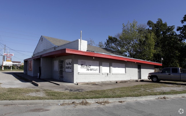
14201 Main St, Houston, TX 77035


NEARBY LISTINGS FOR SALE OR LEASE
Property Detail
14201 Main St
0731690020001
Wylie Terrace
Bartavern
TR 1 BLK 2 WYLIE TERRACE
X
Harris
48201C0865M
Texas
2024
0.35 AC
2025
Near SW Central
330303
Houston
3,100 SF
Houston-The Woodlands-Sugar Land, TX
DEMOGRAPHICS near 14201 Main St
1 Mile
3 Mile
5 Mile
2024 Total Population
16,380
136,472
363,992
2029 Population
16,721
144,223
388,033
Pop Growth 2024-2029
+ 2.08%
+ 5.68%
+ 6.60%
Average Age
36
37
37
2024 Total Households
5,986
47,351
126,660
HH Growth 2024-2029
+ 1.97%
+ 5.48%
+ 6.53%
Median Household Inc
$41,834
$53,558
$52,764
Avg Household Size
2.70
2.80
2.80
2024 Avg HH Vehicles
1.00
2.00
2.00
Median Home Value
$161,606
$191,165
$191,142
Median Year Built
1979
1977
1978
Nearby Places
Map Layers
Map Styles
 Street
 Aerial
- Restaurants
- Banks
- Shops
- Fitness
- Groceries
PUBLIC TRANSPORTATION
AIRPORT
William P Hobby
DRIVE
WALK
Distance
William P Hobby
30 min
18.3 mi
George Bush Intcntl/Houston
DRIVE
WALK
Distance
George Bush Intcntl/Houston
44 min
31.3 mi
SALE & LEASE HISTORY
LISTING DATE
SALE/LEASE

Sep 23, 2019
For Sale
Sep 23, 2016
For Sale
May 07, 2025
For Sale
Jun 19, 2025
For Lease
Jun 04, 2021
For Sale
Jan 22, 2025
For Lease
Jan 06, 2023
For Lease
Dec 10, 2021
For Lease
Dec 10, 2021
For Sale
Aug 12, 2020
For Sale
Nearby Properties
Address
Land Use
TOTAL SIZE
Lot Size
Zoning
Address
Land Use
TOTAL SIZE
Lot Size
Zoning
1,139,160 SF
75.11 AC
Address
Land Use
TOTAL SIZE
Lot Size
Zoning
15.46 AC
Address
Land Use
TOTAL SIZE
Lot Size
Zoning
552,900 SF
27.86 AC
Address
Land Use
TOTAL SIZE
Lot Size
Zoning
967,659 SF
75.03 AC
Address
Land Use
TOTAL SIZE
Lot Size
Zoning
344,620 SF
53.65 AC
STHQZ
Address
Land Use
TOTAL SIZE
Lot Size
Zoning
35.85 AC
Address
Land Use
TOTAL SIZE
Lot Size
Zoning
305,512 SF
13.74 AC
Address
Land Use
TOTAL SIZE
Lot Size
Zoning
429,368 SF
27.94 AC
Address
Land Use
TOTAL SIZE
Lot Size
Zoning
428,538 SF
45.50 AC
Address
Land Use
TOTAL SIZE
Lot Size
Zoning
93,310 SF
13.41 AC
Address
Land Use
TOTAL SIZE
Lot Size
Zoning
534,800 SF
33.43 AC
Address
Land Use
TOTAL SIZE
Lot Size
Zoning
Address
Land Use
TOTAL SIZE
Lot Size
Zoning
382,505 SF
21.68 AC
Address
Land Use
TOTAL SIZE
Lot Size
Zoning
456,076 SF
19.09 AC
Address
Land Use
TOTAL SIZE
Lot Size
Zoning
423,270 SF
32.95 AC
Address
Land Use
TOTAL SIZE
Lot Size
Zoning
490,720 SF
26.78 AC
S
Address
Land Use
TOTAL SIZE
Lot Size
Zoning
304,006 SF
11.14 AC
Address
Land Use
TOTAL SIZE
Lot Size
Zoning
Address
Land Use
TOTAL SIZE
Lot Size
Zoning
371,335 SF
31.65 AC
Address
Land Use
TOTAL SIZE
Lot Size
Zoning
383,515 SF
12.61 AC
Address
Land Use
TOTAL SIZE
Lot Size
Zoning
391,473 SF
17.11 AC
Address
Land Use
TOTAL SIZE
Lot Size
Zoning
186,759 SF
42.60 AC
Address
Land Use
TOTAL SIZE
Lot Size
Zoning
18.23 AC
Address
Land Use
TOTAL SIZE
Lot Size
Zoning
434,744 SF
16.74 AC
Address
Land Use
TOTAL SIZE
Lot Size
Zoning
39.26 AC
Address
Land Use
TOTAL SIZE
Lot Size
Zoning
24.49 AC
QSY
Address
Land Use
TOTAL SIZE
Lot Size
Zoning
240,000 SF
12.45 AC
Address
Land Use
TOTAL SIZE
Lot Size
Zoning
256,810 SF
22.65 AC
Address
Land Use
TOTAL SIZE
Lot Size
Zoning
21.84 AC
QSY
Address
Land Use
TOTAL SIZE
Lot Size
Zoning
294,941 SF
18.86 AC
The World's #1 Commercial Real Estate Marketplace
Connect with us
© 2025 CoStar Group
The information above has been obtained from sources believed reliable. While we do not doubt its accuracy we have not verified it and make no guarantee, warranty or representation about it. It is your responsibility to independently confirm its accuracy and completeness. Any projections, opinions, assumptions, or estimates used are for example only and do not represent the current or future performance of the property. The value of this transaction to you depends on tax and other factors which should be evaluated by your tax, financial, and legal advisors. You and your advisors should conduct a careful, independent investigation of the property to determine to your satisfaction the suitability of the property for your needs.