Property Record
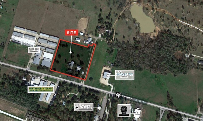
14202 Fm 1097 Rd W, Willis, TX 77318
NEARBY LISTINGS FOR SALE OR LEASE
Property Detail
14202 Fm 1097 Rd W
Houston-The Woodlands-Sugar Land, TX
Martin Neal
0026-01-01801
A0026 - MARTIN NEAL, TRACT 18E1-A, ACRES 1.4252
Commercialnec
Montgomery
X
Texas
48339C0225G
f
2024
1.50 AC
2025
Outlying Montgomery Cnty
694204
Houston
9,780 SF
DEMOGRAPHICS near 14202 Fm 1097 Rd W
1 Mile
3 Mile
5 Mile
2024 Total Population
2,738
18,752
46,646
2029 Population
3,359
23,324
57,945
Pop Growth 2024-2029
+ 22.68%
+ 24.38%
+ 24.22%
Average Age
47
45
45
2024 Total Households
1,141
7,581
18,784
HH Growth 2024-2029
+ 22.79%
+ 24.54%
+ 24.36%
Median Household Inc
$150,798
$91,180
$94,043
Avg Household Size
2.40
2.40
2.50
2024 Avg HH Vehicles
2.00
2.00
2.00
Median Home Value
$457,317
$300,788
$320,224
Median Year Built
2001
2000
2001
Nearby Places
Map Layers
Map Styles
 Street
 Aerial
- Restaurants
- Banks
- Shops
- Fitness
- Groceries
SALE & LEASE HISTORY
LISTING DATE
SALE/LEASE

Oct 05, 2020
For Sale
Nearby Properties
Address
Land Use
TOTAL SIZE
Lot Size
Zoning
Address
Land Use
TOTAL SIZE
Lot Size
Zoning
193,578 SF
16.68 AC
4
Address
Land Use
TOTAL SIZE
Lot Size
Zoning
44,049 SF
42.47 AC
Address
Land Use
TOTAL SIZE
Lot Size
Zoning
153,804 SF
9.36 AC
4
Address
Land Use
TOTAL SIZE
Lot Size
Zoning
218,525 SF
7.02 AC
4
Address
Land Use
TOTAL SIZE
Lot Size
Zoning
84,985 SF
12 AC
4
Address
Land Use
TOTAL SIZE
Lot Size
Zoning
27,359 SF
3.15 AC
4
Address
Land Use
TOTAL SIZE
Lot Size
Zoning
1,178 SF
18.27 AC
4
Address
Land Use
TOTAL SIZE
Lot Size
Zoning
78,346 SF
4 AC
4
Address
Land Use
TOTAL SIZE
Lot Size
Zoning
139,874 SF
20 AC
4
Address
Land Use
TOTAL SIZE
Lot Size
Zoning
7,790 SF
2.40 AC
3
Address
Land Use
TOTAL SIZE
Lot Size
Zoning
13,840 SF
2.76 AC
4
Address
Land Use
TOTAL SIZE
Lot Size
Zoning
1,740 SF
13.41 AC
4
Address
Land Use
TOTAL SIZE
Lot Size
Zoning
48,640 SF
5 AC
Address
Land Use
TOTAL SIZE
Lot Size
Zoning
20,787 SF
3.43 AC
4
Address
Land Use
TOTAL SIZE
Lot Size
Zoning
5,551 SF
15.30 AC
4
Address
Land Use
TOTAL SIZE
Lot Size
Zoning
63,323 SF
13.21 AC
4
Address
Land Use
TOTAL SIZE
Lot Size
Zoning
79,079 SF
9.22 AC
4
Address
Land Use
TOTAL SIZE
Lot Size
Zoning
27,500 SF
2.80 AC
Address
Land Use
TOTAL SIZE
Lot Size
Zoning
10,835 SF
1.59 AC
4
Address
Land Use
TOTAL SIZE
Lot Size
Zoning
18,128 SF
1.39 AC
4
Address
Land Use
TOTAL SIZE
Lot Size
Zoning
7,688 SF
1.21 AC
4
Address
Land Use
TOTAL SIZE
Lot Size
Zoning
8,374 SF
2 AC
4
Address
Land Use
TOTAL SIZE
Lot Size
Zoning
8,976 SF
1.63 AC
Address
Land Use
TOTAL SIZE
Lot Size
Zoning
12,564 SF
4.29 AC
Address
Land Use
TOTAL SIZE
Lot Size
Zoning
17,640 SF
1.95 AC
4
Address
Land Use
TOTAL SIZE
Lot Size
Zoning
7,188 SF
12.68 AC
4
Address
Land Use
TOTAL SIZE
Lot Size
Zoning
9,090 SF
2.20 AC
Address
Land Use
TOTAL SIZE
Lot Size
Zoning
40,240 SF
7.48 AC
4
Address
Land Use
TOTAL SIZE
Lot Size
Zoning
50,018 SF
3.73 AC
4
Address
Land Use
TOTAL SIZE
Lot Size
Zoning
10,099 SF
7.23 AC
3
The World's #1 Commercial Real Estate Marketplace
Connect with us
© 2025 CoStar Group
The information above has been obtained from sources believed reliable. While we do not doubt its accuracy we have not verified it and make no guarantee, warranty or representation about it. It is your responsibility to independently confirm its accuracy and completeness. Any projections, opinions, assumptions, or estimates used are for example only and do not represent the current or future performance of the property. The value of this transaction to you depends on tax and other factors which should be evaluated by your tax, financial, and legal advisors. You and your advisors should conduct a careful, independent investigation of the property to determine to your satisfaction the suitability of the property for your needs.