Property Record
1421 N 15Th Ave, Tucson, AZ 85705


Save to a Folder
{{folder.Name}}
{{folder.ListingIds.length}} Properties
{{folder.ListingIds.length}} Property
Create a New Folder
Property Detail
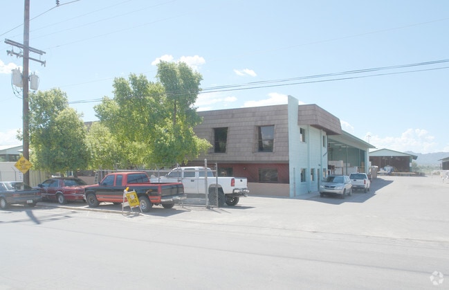
1421 N 15Th Ave
115-18-032F
PTN W2 SE4 ADJ TO E LINE OF SP RR 2.73 AC SEC 2-14-13
Industrialgeneral
Pima
I1
Arizona
AE The base floodplain where base flood elevations are provided. AE Zones are now used on new format FIRMs instead of A1-A30 Zones.
137
2025
2.73 AC
2026
NW Tucson/Oro Valley
001200
Tucson
7,640 SF
Tucson, AZ
NEARBY LISTINGS FOR SALE OR LEASE
DEMOGRAPHICS near 1421 N 15Th Ave
1 mile
3 mile
5 mile
2025 Total Population
11,812
118,496
259,303
2030 Population
12,234
122,268
267,293
Pop Growth 2025-2030
+ 3.57%
+ 3.18%
+ 3.08%
Average Age
37
36
38
2025 Total Households
5,433
51,441
113,510
HH Growth 2025-2030
+ 3.64%
+ 3.41%
+ 3.23%
Median Household Inc
$41,223
$43,055
$47,909
Avg Household Size
2.10
2.10
2.10
2025 Avg HH Vehicles
1.00
1.00
2.00
Median Home Value
$242,217
$274,328
$272,658
Median Year Built
1973
1976
1975
Nearby Places
Map Layers
Map Styles
 Street
 Aerial
Layers
 Traffic
 Biking
Places
Listings with unknown addresses are not visible on the map
- Restaurants
- Banks
- Shops
- Fitness
- Groceries
PUBLIC TRANSPORTATION
COMMUTER RAIL
Tucson Amtrak Station (Sunset Limited - Amtrak, Texas Eagle - Amtrak)
Drive
Walk
Distance
Tucson Amtrak Station (Sunset Limited - Amtrak, Texas Eagle - Amtrak)
5 min
1.9 mi
AIRPORT
Tucson International
Drive
Walk
Distance
Tucson International
19 min
10.3 mi
Freight Ports
Port of San Diego
Drive
Walk
Distance
Port of San Diego
433 min
407.6 mi
Nearby Properties
Address
Land Use
TOTAL SIZE
Lot Size
Zoning
Address
Land Use
TOTAL SIZE
Lot Size
Zoning
251,851 SF
0.74 AC
Address
Land Use
TOTAL SIZE
Lot Size
Zoning
6,691,842 SF
179.97 AC
Address
Land Use
TOTAL SIZE
Lot Size
Zoning
1,811,513 SF
29.85 AC
Address
Land Use
TOTAL SIZE
Lot Size
Zoning
1,316,364 SF
12.21 AC
Address
Land Use
TOTAL SIZE
Lot Size
Zoning
1,811,513 SF
30.09 AC
Address
Land Use
TOTAL SIZE
Lot Size
Zoning
134,710 SF
9.59 AC
I1
Address
Land Use
TOTAL SIZE
Lot Size
Zoning
106,852 SF
19.50 AC
I1
Address
Land Use
TOTAL SIZE
Lot Size
Zoning
813,186 SF
3.65 AC
OCR2
Address
Land Use
TOTAL SIZE
Lot Size
Zoning
89,497 SF
0.51 AC
Address
Land Use
TOTAL SIZE
Lot Size
Zoning
657,188 SF
24.97 AC
PAD5
Address
Land Use
TOTAL SIZE
Lot Size
Zoning
866,763 SF
17.17 AC
O3
Address
Land Use
TOTAL SIZE
Lot Size
Zoning
326,845 SF
0.71 AC
Address
Land Use
TOTAL SIZE
Lot Size
Zoning
837,885 SF
16.41 AC
R2
Address
Land Use
TOTAL SIZE
Lot Size
Zoning
60,426 SF
0.43 AC
OCR2
Address
Land Use
TOTAL SIZE
Lot Size
Zoning
60,377 SF
6.25 AC
I1
Address
Land Use
TOTAL SIZE
Lot Size
Zoning
239,060 SF
7.85 AC
Address
Land Use
TOTAL SIZE
Lot Size
Zoning
495,871 SF
3.56 AC
Address
Land Use
TOTAL SIZE
Lot Size
Zoning
226,240 SF
0.33 AC
R2
Address
Land Use
TOTAL SIZE
Lot Size
Zoning
278,566 SF
0.60 AC
C1
Address
Land Use
TOTAL SIZE
Lot Size
Zoning
21,126 SF
1.10 AC
O3
Address
Land Use
TOTAL SIZE
Lot Size
Zoning
652,898 SF
233.08 AC
RX2
Address
Land Use
TOTAL SIZE
Lot Size
Zoning
299,658 SF
0.77 AC
Address
Land Use
TOTAL SIZE
Lot Size
Zoning
172,623 SF
0.15 AC
R1
Address
Land Use
TOTAL SIZE
Lot Size
Zoning
360,881 SF
21.39 AC
Address
Land Use
TOTAL SIZE
Lot Size
Zoning
1.45 AC
HR1
Address
Land Use
TOTAL SIZE
Lot Size
Zoning
296,286 SF
0.71 AC
Address
Land Use
TOTAL SIZE
Lot Size
Zoning
377,470 SF
17.48 AC
R1
Address
Land Use
TOTAL SIZE
Lot Size
Zoning
141,450 SF
0.14 AC
R1
Address
Land Use
TOTAL SIZE
Lot Size
Zoning
346,246 SF
0.14 AC
R2
Address
Land Use
TOTAL SIZE
Lot Size
Zoning
213,400 SF
0.46 AC
The World's #1 Commercial Real Estate Marketplace
Connect with us
© 2026 CoStar Group
The information above has been obtained from sources believed reliable. While we do not doubt its accuracy we have not verified it and make no guarantee, warranty or representation about it. It is your responsibility to independently confirm its accuracy and completeness. Any projections, opinions, assumptions, or estimates used are for example only and do not represent the current or future performance of the property. The value of this transaction to you depends on tax and other factors which should be evaluated by your tax, financial, and legal advisors. You and your advisors should conduct a careful, independent investigation of the property to determine to your satisfaction the suitability of the property for your needs.