Property Record
1421 S Narcoossee Rd, Saint Cloud, FL 34771
NEARBY LISTINGS FOR SALE OR LEASE
Property Detail
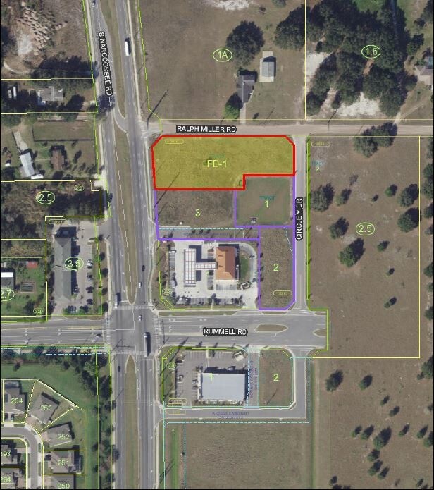
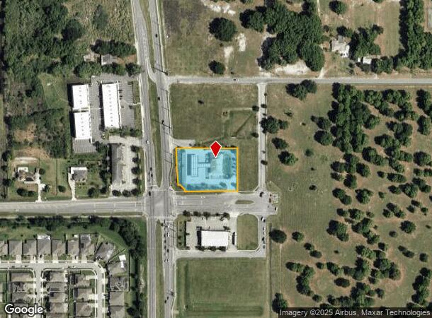
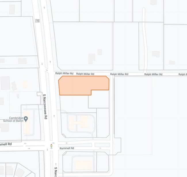
1421 S Narcoossee Rd
Orlando-Kissimmee-Sanford, FL
Narcoossee Rummell Commercial Center Ph
32-25-31-0636-0001-0010
NARCOOSSEE RUMMELL COMMERCIAL CENTER PH 1 PB 23 PG 28 LOT 1
Storebuilding
Osceola
X
Florida
12095C0675G
1
2024
1.39 AC
2025
Osceola Outlying
043700
Orlando
9,939 SF
DEMOGRAPHICS near 1421 S Narcoossee Rd
1 Mile
3 Mile
5 Mile
2024 Total Population
2,802
28,469
67,959
2029 Population
3,336
34,655
82,287
Pop Growth 2024-2029
+ 19.06%
+ 21.73%
+ 21.08%
Average Age
39
39
39
2024 Total Households
956
9,957
23,699
HH Growth 2024-2029
+ 18.83%
+ 21.51%
+ 20.89%
Median Household Inc
$81,485
$74,043
$71,434
Avg Household Size
3.00
2.90
2.80
2024 Avg HH Vehicles
2.00
2.00
2.00
Median Home Value
$362,681
$348,222
$327,806
Median Year Built
2003
2002
2002
Nearby Places
Map Layers
Map Styles
 Street
 Aerial
- Restaurants
- Banks
- Shops
- Fitness
- Groceries
PUBLIC TRANSPORTATION
AIRPORT
Orlando International
DRIVE
WALK
Distance
Orlando International
30 min
19.1 mi
Freight Ports
Port Canaveral
DRIVE
WALK
Distance
Port Canaveral
67 min
52.6 mi
SALE & LEASE HISTORY
LISTING DATE
SALE/LEASE

Oct 19, 2022
For Lease
Nov 09, 2019
For Sale
May 05, 2018
For Sale
Jan 30, 2019
For Sale
Apr 27, 2021
For Sale
Nearby Properties
Address
Land Use
TOTAL SIZE
Lot Size
Zoning
Address
Land Use
TOTAL SIZE
Lot Size
Zoning
185,953 SF
63.41 AC
SP
Address
Land Use
TOTAL SIZE
Lot Size
Zoning
77,928 SF
24.79 AC
SHB
Address
Land Use
TOTAL SIZE
Lot Size
Zoning
127,960 SF
14.40 AC
SPUD
Address
Land Use
TOTAL SIZE
Lot Size
Zoning
55,521 SF
10.75 AC
SHB
Address
Land Use
TOTAL SIZE
Lot Size
Zoning
89,482 SF
4.82 AC
SPUD
Address
Land Use
TOTAL SIZE
Lot Size
Zoning
30,520 SF
5.94 AC
SHB
Address
Land Use
TOTAL SIZE
Lot Size
Zoning
159.30 AC
Address
Land Use
TOTAL SIZE
Lot Size
Zoning
13.38 AC
Address
Land Use
TOTAL SIZE
Lot Size
Zoning
60,211 SF
6.46 AC
SPUD
Address
Land Use
TOTAL SIZE
Lot Size
Zoning
44,380 SF
7.84 AC
SHB
Address
Land Use
TOTAL SIZE
Lot Size
Zoning
5,782 SF
60.30 AC
OAC
Address
Land Use
TOTAL SIZE
Lot Size
Zoning
159.24 AC
OAC
Address
Land Use
TOTAL SIZE
Lot Size
Zoning
20,634 SF
4.55 AC
SHB
Address
Land Use
TOTAL SIZE
Lot Size
Zoning
57,600 SF
4.83 AC
SHB
Address
Land Use
TOTAL SIZE
Lot Size
Zoning
13,900 SF
3.90 AC
SI3
Address
Land Use
TOTAL SIZE
Lot Size
Zoning
50,570 SF
4.98 AC
SPUD
Address
Land Use
TOTAL SIZE
Lot Size
Zoning
99.81 AC
Address
Land Use
TOTAL SIZE
Lot Size
Zoning
14,234 SF
1.79 AC
SHB
Address
Land Use
TOTAL SIZE
Lot Size
Zoning
68,472 SF
0.80 AC
SCB1
Address
Land Use
TOTAL SIZE
Lot Size
Zoning
23,000 SF
3.09 AC
SI3
Address
Land Use
TOTAL SIZE
Lot Size
Zoning
48,306 SF
3.13 AC
SHB
Address
Land Use
TOTAL SIZE
Lot Size
Zoning
13,406 SF
33.31 AC
SP
Address
Land Use
TOTAL SIZE
Lot Size
Zoning
4,308 SF
1.84 AC
RM-2
Address
Land Use
TOTAL SIZE
Lot Size
Zoning
50,442 SF
13.86 AC
E-1
Address
Land Use
TOTAL SIZE
Lot Size
Zoning
35,838 SF
20.56 AC
SA
Address
Land Use
TOTAL SIZE
Lot Size
Zoning
13,712 SF
1.06 AC
SNB
Address
Land Use
TOTAL SIZE
Lot Size
Zoning
44,565 SF
7 AC
AC
Address
Land Use
TOTAL SIZE
Lot Size
Zoning
5,755 SF
1.76 AC
SHB
Address
Land Use
TOTAL SIZE
Lot Size
Zoning
31,640 SF
2.04 AC
SI3
Address
Land Use
TOTAL SIZE
Lot Size
Zoning
31,430 SF
2.07 AC
SI3
The World's #1 Commercial Real Estate Marketplace
Connect with us
© 2025 CoStar Group
The information above has been obtained from sources believed reliable. While we do not doubt its accuracy we have not verified it and make no guarantee, warranty or representation about it. It is your responsibility to independently confirm its accuracy and completeness. Any projections, opinions, assumptions, or estimates used are for example only and do not represent the current or future performance of the property. The value of this transaction to you depends on tax and other factors which should be evaluated by your tax, financial, and legal advisors. You and your advisors should conduct a careful, independent investigation of the property to determine to your satisfaction the suitability of the property for your needs.