Property Record
1421 Teaneck Rd, Teaneck, NJ 07666
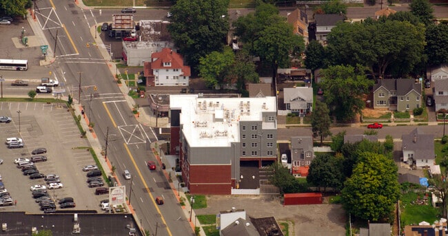

Property Detail
1421 Teaneck Rd
New York-Jersey City-White Plains, NY-NJ
120X123 40 UN SEN HSG PILOT PUBLIC HOUSING
60-05703-0000-00011
BERGEN
Taxexempt
New Jersey
P
11
B and X Area of moderate flood hazard, usually the area between the limits of the 100-year and 500-year floods.
0.34 AC
2024
West Englewood
2025
Northern New Jersey
054500
NEARBY LISTINGS FOR SALE OR LEASE
DEMOGRAPHICS near 1421 Teaneck Rd
1 mile
3 mile
5 mile
2025 Total Population
28,406
210,665
607,842
2030 Population
29,404
218,143
628,880
Pop Growth 2025-2030
+ 3.51%
+ 3.55%
+ 3.46%
Average Age
40
41
43
2025 Total Households
9,202
75,419
231,941
HH Growth 2025-2030
+ 3.55%
+ 3.68%
+ 3.62%
Median Household Inc
$117,107
$112,280
$100,472
Avg Household Size
3.00
2.70
2.50
2025 Avg HH Vehicles
2.00
2.00
1.00
Median Home Value
$490,919
$569,954
$587,846
Median Year Built
1948
1955
1955
Nearby Places
Map Layers
Map Styles
 Street
 Aerial
Layers
 Traffic
 Biking
Places
Listings with unknown addresses are not visible on the map
- Restaurants
- Banks
- Shops
- Fitness
- Groceries
PUBLIC TRANSPORTATION
COMMUTER RAIL
New Bridge Landing (Pascack Valley Line - NJ Transit Commuter Rail (NJ Transit))
Drive
Walk
Distance
New Bridge Landing (Pascack Valley Line - NJ Transit Commuter Rail (NJ Transit))
5 min
3.2 mi
Anderson Street (Pascack Valley Line - NJ Transit Commuter Rail (NJ Transit))
Drive
Walk
Distance
Anderson Street (Pascack Valley Line - NJ Transit Commuter Rail (NJ Transit))
7 min
3.4 mi
AIRPORT
LaGuardia
Drive
Walk
Distance
LaGuardia
26 min
15.6 mi
Newark Liberty International
Drive
Walk
Distance
Newark Liberty International
22 min
18.2 mi
Westchester County
Drive
Walk
Distance
Westchester County
47 min
31.4 mi
Freight Ports
NY - Red Hook Container Terminal
Drive
Walk
Distance
NY - Red Hook Container Terminal
36 min
20.5 mi
Nearby Properties
Address
Land Use
TOTAL SIZE
Lot Size
Zoning
Address
Land Use
TOTAL SIZE
Lot Size
Zoning
512,862 SF
14.16 AC
Address
Land Use
TOTAL SIZE
Lot Size
Zoning
572,137 SF
14.11 AC
R-D
Address
Land Use
TOTAL SIZE
Lot Size
Zoning
20.07 AC
H
Address
Land Use
TOTAL SIZE
Lot Size
Zoning
102,070 SF
29.70 AC
BL
Address
Land Use
TOTAL SIZE
Lot Size
Zoning
74,550 SF
11.28 AC
OI
Address
Land Use
TOTAL SIZE
Lot Size
Zoning
13.09 AC
C3
Address
Land Use
TOTAL SIZE
Lot Size
Zoning
100,151 SF
22.13 AC
B2
Address
Land Use
TOTAL SIZE
Lot Size
Zoning
232,368 SF
5.10 AC
Address
Land Use
TOTAL SIZE
Lot Size
Zoning
25,620 SF
21.37 AC
Address
Land Use
TOTAL SIZE
Lot Size
Zoning
5.22 AC
APT
Address
Land Use
TOTAL SIZE
Lot Size
Zoning
4.54 AC
R-M3
Address
Land Use
TOTAL SIZE
Lot Size
Zoning
2.55 AC
RC-1
Address
Land Use
TOTAL SIZE
Lot Size
Zoning
261,303 SF
5.60 AC
O
Address
Land Use
TOTAL SIZE
Lot Size
Zoning
303,434 SF
13.34 AC
Address
Land Use
TOTAL SIZE
Lot Size
Zoning
15.76 AC
B2
Address
Land Use
TOTAL SIZE
Lot Size
Zoning
Address
Land Use
TOTAL SIZE
Lot Size
Zoning
2,191 SF
1.34 AC
B2
Address
Land Use
TOTAL SIZE
Lot Size
Zoning
13 AC
B-3
Address
Land Use
TOTAL SIZE
Lot Size
Zoning
2.92 AC
RC-2
Address
Land Use
TOTAL SIZE
Lot Size
Zoning
5.53 AC
RS
Address
Land Use
TOTAL SIZE
Lot Size
Zoning
340,218 SF
8.69 AC
B-3
Address
Land Use
TOTAL SIZE
Lot Size
Zoning
Address
Land Use
TOTAL SIZE
Lot Size
Zoning
1.22 AC
RC3
Address
Land Use
TOTAL SIZE
Lot Size
Zoning
65,087 SF
4 AC
Address
Land Use
TOTAL SIZE
Lot Size
Zoning
140 AC
RS
Address
Land Use
TOTAL SIZE
Lot Size
Zoning
97.39 AC
R1
Address
Land Use
TOTAL SIZE
Lot Size
Zoning
3.40 AC
Address
Land Use
TOTAL SIZE
Lot Size
Zoning
367,715 SF
8.28 AC
C3
Address
Land Use
TOTAL SIZE
Lot Size
Zoning
5.03 AC
B-3
Address
Land Use
TOTAL SIZE
Lot Size
Zoning
161,204 SF
5.39 AC
B2
The World's #1 Commercial Real Estate Marketplace
Connect with us
© 2026 CoStar Group
The information above has been obtained from sources believed reliable. While we do not doubt its accuracy we have not verified it and make no guarantee, warranty or representation about it. It is your responsibility to independently confirm its accuracy and completeness. Any projections, opinions, assumptions, or estimates used are for example only and do not represent the current or future performance of the property. The value of this transaction to you depends on tax and other factors which should be evaluated by your tax, financial, and legal advisors. You and your advisors should conduct a careful, independent investigation of the property to determine to your satisfaction the suitability of the property for your needs.