Property Record
1421 W Mccord St, Centralia, IL 62801
NEARBY LISTINGS FOR SALE OR LEASE
-
-
View all Centralia listings for sale on LoopNet.com
Property Detail
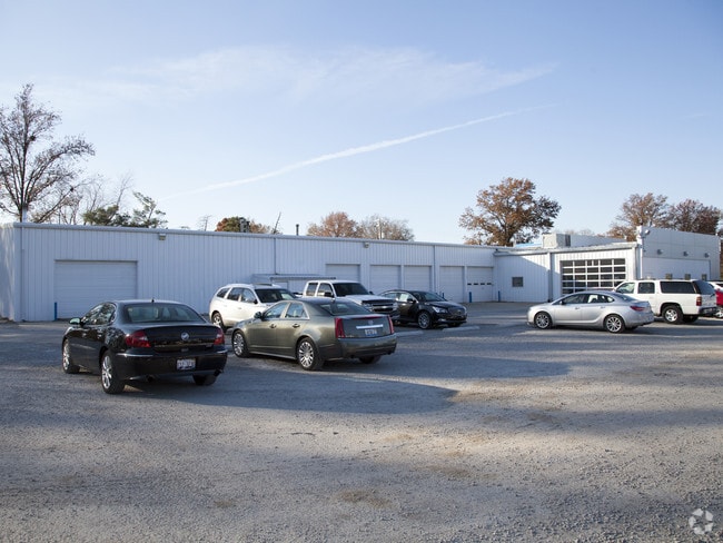
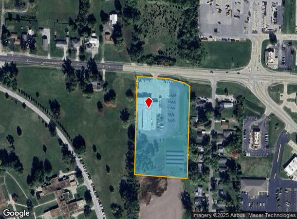
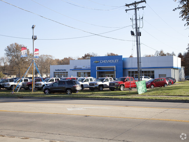
1421 W Mccord St
15-14-13-103-033
SECTION 13 TOWNSHIP 1N RANGE 1W PT NW NW 4.56A
Commercialnec
Clinton
X
Illinois
17121C0270E
4.56 AC
2024
Clinton County
2024
St. Louis
9005002003
St. Louis, MO-IL
15,219 SF
DEMOGRAPHICS near 1421 W Mccord St
1 Mile
3 Mile
5 Mile
2024 Total Population
2,207
15,890
20,013
2029 Population
2,210
15,895
19,918
Pop Growth 2024-2029
+ 0.14%
+ 0.03%
(0.47%)
Average Age
44
41
42
2024 Total Households
827
6,314
7,940
HH Growth 2024-2029
(0.12%)
(0.10%)
(0.59%)
Median Household Inc
$50,641
$40,813
$44,354
Avg Household Size
2.10
2.20
2.20
2024 Avg HH Vehicles
2.00
2.00
2.00
Median Home Value
$74,399
$69,828
$76,749
Median Year Built
1971
1964
1967
Nearby Places
Map Layers
Map Styles
 Street
 Aerial
- Restaurants
- Banks
- Shops
- Fitness
- Groceries
PUBLIC TRANSPORTATION
COMMUTER RAIL
Centralia Amtrak Station (City of New Orleans - Amtrak, Illini - Amtrak, Saluki - Amtrak)
DRIVE
WALK
Distance
Centralia Amtrak Station (City of New Orleans - Amtrak, Illini - Amtrak, Saluki - Amtrak)
4 min
1.6 mi
Freight Ports
Port Milwaukee
DRIVE
WALK
Distance
Port Milwaukee
409 min
355.5 mi
Nearby Properties
Address
Land Use
TOTAL SIZE
Lot Size
Zoning
Address
Land Use
TOTAL SIZE
Lot Size
Zoning
154,605 SF
19.15 AC
51
Address
Land Use
TOTAL SIZE
Lot Size
Zoning
Address
Land Use
TOTAL SIZE
Lot Size
Zoning
33,880 SF
35.67 AC
51
Address
Land Use
TOTAL SIZE
Lot Size
Zoning
57,768 SF
2 AC
31
Address
Land Use
TOTAL SIZE
Lot Size
Zoning
28.96 AC
Address
Land Use
TOTAL SIZE
Lot Size
Zoning
Address
Land Use
TOTAL SIZE
Lot Size
Zoning
9.50 AC
Address
Land Use
TOTAL SIZE
Lot Size
Zoning
Address
Land Use
TOTAL SIZE
Lot Size
Zoning
3.72 AC
Address
Land Use
TOTAL SIZE
Lot Size
Zoning
13.01 AC
Address
Land Use
TOTAL SIZE
Lot Size
Zoning
118,417 SF
8.05 AC
51
Address
Land Use
TOTAL SIZE
Lot Size
Zoning
4.32 AC
Address
Land Use
TOTAL SIZE
Lot Size
Zoning
Address
Land Use
TOTAL SIZE
Lot Size
Zoning
10.50 AC
Address
Land Use
TOTAL SIZE
Lot Size
Zoning
8.20 AC
Address
Land Use
TOTAL SIZE
Lot Size
Zoning
21,350 SF
3 AC
51
Address
Land Use
TOTAL SIZE
Lot Size
Zoning
5.66 AC
Address
Land Use
TOTAL SIZE
Lot Size
Zoning
75,910 SF
9.92 AC
51
Address
Land Use
TOTAL SIZE
Lot Size
Zoning
Address
Land Use
TOTAL SIZE
Lot Size
Zoning
6.21 AC
Address
Land Use
TOTAL SIZE
Lot Size
Zoning
17,382 SF
1.81 AC
51
Address
Land Use
TOTAL SIZE
Lot Size
Zoning
2.32 AC
Address
Land Use
TOTAL SIZE
Lot Size
Zoning
30,624 SF
3.74 AC
51
Address
Land Use
TOTAL SIZE
Lot Size
Zoning
12,936 SF
5.89 AC
12
Address
Land Use
TOTAL SIZE
Lot Size
Zoning
Address
Land Use
TOTAL SIZE
Lot Size
Zoning
3.64 AC
Address
Land Use
TOTAL SIZE
Lot Size
Zoning
1.29 AC
Address
Land Use
TOTAL SIZE
Lot Size
Zoning
4.28 AC
Address
Land Use
TOTAL SIZE
Lot Size
Zoning
1.34 AC
The World's #1 Commercial Real Estate Marketplace
Connect with us
© 2026 CoStar Group
The information above has been obtained from sources believed reliable. While we do not doubt its accuracy we have not verified it and make no guarantee, warranty or representation about it. It is your responsibility to independently confirm its accuracy and completeness. Any projections, opinions, assumptions, or estimates used are for example only and do not represent the current or future performance of the property. The value of this transaction to you depends on tax and other factors which should be evaluated by your tax, financial, and legal advisors. You and your advisors should conduct a careful, independent investigation of the property to determine to your satisfaction the suitability of the property for your needs.