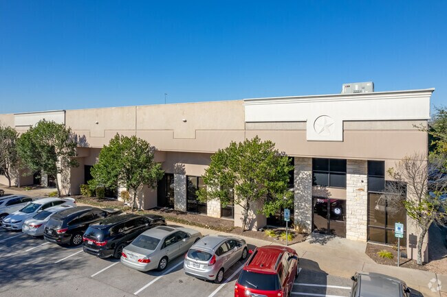
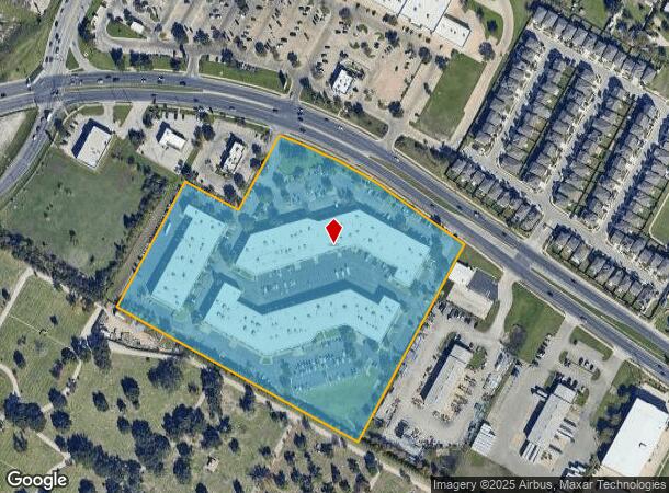
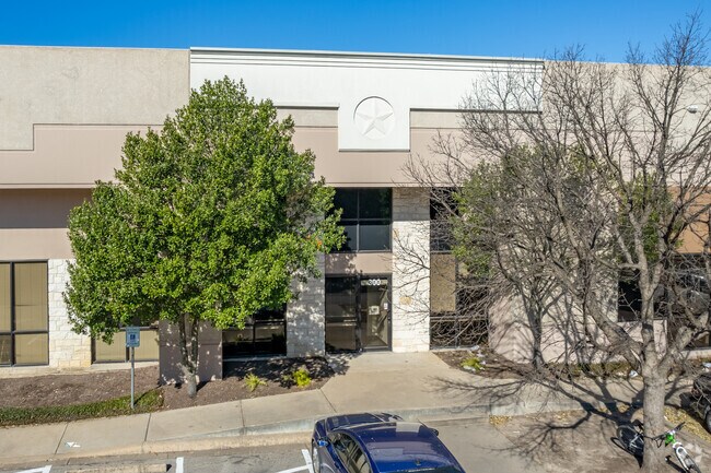
Property Record
1421 W Wells Branch Pky, Pflugerville, TX 78660
NEARBY LISTINGS FOR SALE OR LEASE
Property Detail
1421 W Wells Branch Pky
Austin-Round Rock, TX
Wells Point Commercial Sec 2
462931
LOT 3A-A BLK C WELLS POINT COMMERCIAL SEC 2 AMENDED PLAT OF LOT 2 & THE AMENDED PLAT OF THE AMENDED PLAT OF LOTS 3A,4A&5A
Industrialgeneral
Travis
X
Texas
48491C0635F
3a,2
2024
12.88 AC
2025
Northeast
044200
Austin
161,729 SF
DEMOGRAPHICS near 1421 W Wells Branch Pky
1 Mile
3 Mile
5 Mile
2024 Total Population
17,429
116,784
269,481
2029 Population
18,874
127,911
301,683
Pop Growth 2024-2029
+ 8.29%
+ 9.53%
+ 11.95%
Average Age
35
37
37
2024 Total Households
7,693
47,983
110,780
HH Growth 2024-2029
+ 8.94%
+ 10.38%
+ 12.53%
Median Household Inc
$72,659
$77,009
$79,578
Avg Household Size
2.20
2.40
2.40
2024 Avg HH Vehicles
2.00
2.00
2.00
Median Home Value
$291,718
$297,950
$309,186
Median Year Built
2007
2000
2000
Nearby Places
Map Layers
Map Styles
 Street
 Aerial
- Restaurants
- Banks
- Shops
- Fitness
- Groceries
PUBLIC TRANSPORTATION
AIRPORT
Austin-Bergstrom International
DRIVE
WALK
Distance
Austin-Bergstrom International
36 min
23.9 mi
Freight Ports
Calhoun Port
DRIVE
WALK
Distance
Calhoun Port
202 min
167.4 mi
SALE & LEASE HISTORY
LISTING DATE
SALE/LEASE

Jul 10, 2018
For Lease
Nearby Properties
Address
Land Use
TOTAL SIZE
Lot Size
Zoning
Address
Land Use
TOTAL SIZE
Lot Size
Zoning
368,100 SF
38.07 AC
Address
Land Use
TOTAL SIZE
Lot Size
Zoning
491,412 SF
25.66 AC
Address
Land Use
TOTAL SIZE
Lot Size
Zoning
428,011 SF
25 AC
Address
Land Use
TOTAL SIZE
Lot Size
Zoning
565,886 SF
29.30 AC
Address
Land Use
TOTAL SIZE
Lot Size
Zoning
287,272 SF
17.68 AC
Address
Land Use
TOTAL SIZE
Lot Size
Zoning
466,256 SF
38.33 AC
Address
Land Use
TOTAL SIZE
Lot Size
Zoning
475,034 SF
26.37 AC
Address
Land Use
TOTAL SIZE
Lot Size
Zoning
284,625 SF
11.25 AC
Address
Land Use
TOTAL SIZE
Lot Size
Zoning
426,415 SF
50 AC
Address
Land Use
TOTAL SIZE
Lot Size
Zoning
359,458 SF
18.50 AC
Address
Land Use
TOTAL SIZE
Lot Size
Zoning
349,128 SF
17.89 AC
Address
Land Use
TOTAL SIZE
Lot Size
Zoning
470,992 SF
25.92 AC
Address
Land Use
TOTAL SIZE
Lot Size
Zoning
295,750 SF
21.46 AC
Address
Land Use
TOTAL SIZE
Lot Size
Zoning
709,789 SF
52.90 AC
Address
Land Use
TOTAL SIZE
Lot Size
Zoning
307,036 SF
21.64 AC
Address
Land Use
TOTAL SIZE
Lot Size
Zoning
371,167 SF
13.18 AC
Address
Land Use
TOTAL SIZE
Lot Size
Zoning
290,400 SF
42.71 AC
Address
Land Use
TOTAL SIZE
Lot Size
Zoning
401,976 SF
38.07 AC
Address
Land Use
TOTAL SIZE
Lot Size
Zoning
280,279 SF
10.38 AC
Address
Land Use
TOTAL SIZE
Lot Size
Zoning
311,850 SF
18.09 AC
Address
Land Use
TOTAL SIZE
Lot Size
Zoning
477,454 SF
22.28 AC
Address
Land Use
TOTAL SIZE
Lot Size
Zoning
237,600 SF
14.10 AC
Address
Land Use
TOTAL SIZE
Lot Size
Zoning
313,414 SF
37.71 AC
Address
Land Use
TOTAL SIZE
Lot Size
Zoning
306,387 SF
14.63 AC
Address
Land Use
TOTAL SIZE
Lot Size
Zoning
374,432 SF
14.28 AC
Address
Land Use
TOTAL SIZE
Lot Size
Zoning
341,480 SF
16.35 AC
Address
Land Use
TOTAL SIZE
Lot Size
Zoning
305,148 SF
16.41 AC
Address
Land Use
TOTAL SIZE
Lot Size
Zoning
439,312 SF
30.08 AC
Address
Land Use
TOTAL SIZE
Lot Size
Zoning
335,856 SF
18.55 AC
Address
Land Use
TOTAL SIZE
Lot Size
Zoning
379,953 SF
11.74 AC
PUD
The World's #1 Commercial Real Estate Marketplace
Connect with us
© 2026 CoStar Group
The information above has been obtained from sources believed reliable. While we do not doubt its accuracy we have not verified it and make no guarantee, warranty or representation about it. It is your responsibility to independently confirm its accuracy and completeness. Any projections, opinions, assumptions, or estimates used are for example only and do not represent the current or future performance of the property. The value of this transaction to you depends on tax and other factors which should be evaluated by your tax, financial, and legal advisors. You and your advisors should conduct a careful, independent investigation of the property to determine to your satisfaction the suitability of the property for your needs.