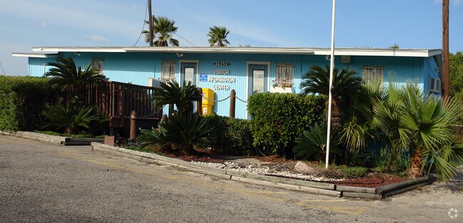
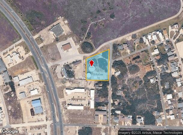
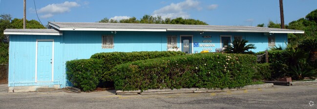
Property Record
14211 Sand Dollar Ave, Corpus Christi, TX 78418
NEARBY LISTINGS FOR SALE OR LEASE
-
-
View all Corpus Christi listings for sale on LoopNet.com
Property Detail
14211 Sand Dollar Ave
Corpus Christi, TX
Padre Island
277836
PADRE ISLAND E POR LT 11 BLK 30
Commercialnec
Nueces
AE
Texas
48355C0565G
11
0
1.82 AC
2025
Flour Bluff/Padre Island
006205
Corpus Christi
1,584 SF
DEMOGRAPHICS near 14211 Sand Dollar Ave
1 Mile
3 Mile
5 Mile
2024 Total Population
2,341
13,142
22,814
2029 Population
2,495
13,778
23,396
Pop Growth 2024-2029
+ 6.58%
+ 4.84%
+ 2.55%
Average Age
46
45
43
2024 Total Households
1,125
5,730
9,474
HH Growth 2024-2029
+ 6.58%
+ 5.08%
+ 2.82%
Median Household Inc
$111,049
$102,048
$85,915
Avg Household Size
2.10
2.20
2.30
2024 Avg HH Vehicles
2.00
2.00
2.00
Median Home Value
$388,635
$365,325
$286,204
Median Year Built
1996
1998
1993
Nearby Places
Map Layers
Map Styles
 Street
 Aerial
- Restaurants
- Banks
- Shops
- Fitness
- Groceries
PUBLIC TRANSPORTATION
AIRPORT
Corpus Christi International
DRIVE
WALK
Distance
Corpus Christi International
31 min
22.4 mi
Freight Ports
Port of Corpus Christi
DRIVE
WALK
Distance
Port of Corpus Christi
26 min
18.2 mi
Nearby Properties
Address
Land Use
TOTAL SIZE
Lot Size
Zoning
Address
Land Use
TOTAL SIZE
Lot Size
Zoning
Address
Land Use
TOTAL SIZE
Lot Size
Zoning
138.88 AC
ATIO
Address
Land Use
TOTAL SIZE
Lot Size
Zoning
210 AC
F-R&AT
Address
Land Use
TOTAL SIZE
Lot Size
Zoning
176.01 AC
Address
Land Use
TOTAL SIZE
Lot Size
Zoning
80,205 SF
2.90 AC
B2IO
Address
Land Use
TOTAL SIZE
Lot Size
Zoning
19.57 AC
B2
Address
Land Use
TOTAL SIZE
Lot Size
Zoning
9,941 SF
195.92 AC
FRIO
Address
Land Use
TOTAL SIZE
Lot Size
Zoning
39.82 AC
ATIO
Address
Land Use
TOTAL SIZE
Lot Size
Zoning
51,256 SF
1.43 AC
AT
Address
Land Use
TOTAL SIZE
Lot Size
Zoning
11,170 SF
16.14 AC
R1B
Address
Land Use
TOTAL SIZE
Lot Size
Zoning
30,068 SF
3.10 AC
B2A
Address
Land Use
TOTAL SIZE
Lot Size
Zoning
Address
Land Use
TOTAL SIZE
Lot Size
Zoning
14,896 SF
1.93 AC
Address
Land Use
TOTAL SIZE
Lot Size
Zoning
35,914 SF
4.91 AC
B2A
Address
Land Use
TOTAL SIZE
Lot Size
Zoning
125,343 SF
28.63 AC
Address
Land Use
TOTAL SIZE
Lot Size
Zoning
5,520 SF
20 AC
FR
Address
Land Use
TOTAL SIZE
Lot Size
Zoning
4,350 SF
7.06 AC
B-2A
Address
Land Use
TOTAL SIZE
Lot Size
Zoning
26.84 AC
R1BIO
Address
Land Use
TOTAL SIZE
Lot Size
Zoning
24,790 SF
2.75 AC
B-2A
Address
Land Use
TOTAL SIZE
Lot Size
Zoning
18,500 SF
2 AC
B2AIO
Address
Land Use
TOTAL SIZE
Lot Size
Zoning
27,381 SF
3.20 AC
R2
Address
Land Use
TOTAL SIZE
Lot Size
Zoning
24,215 SF
2.15 AC
B-2A
Address
Land Use
TOTAL SIZE
Lot Size
Zoning
6.44 AC
B-2
Address
Land Use
TOTAL SIZE
Lot Size
Zoning
14,874 SF
0.36 AC
ATPUD2
Address
Land Use
TOTAL SIZE
Lot Size
Zoning
6.39 AC
B2IO
Address
Land Use
TOTAL SIZE
Lot Size
Zoning
14,874 SF
0.36 AC
ATPUD2
Address
Land Use
TOTAL SIZE
Lot Size
Zoning
6.63 AC
B2
Address
Land Use
TOTAL SIZE
Lot Size
Zoning
17,221 SF
1.88 AC
B2AIO
Address
Land Use
TOTAL SIZE
Lot Size
Zoning
69.11 AC
OCL
Address
Land Use
TOTAL SIZE
Lot Size
Zoning
4.12 AC
B2
The World's #1 Commercial Real Estate Marketplace
Connect with us
© 2026 CoStar Group
The information above has been obtained from sources believed reliable. While we do not doubt its accuracy we have not verified it and make no guarantee, warranty or representation about it. It is your responsibility to independently confirm its accuracy and completeness. Any projections, opinions, assumptions, or estimates used are for example only and do not represent the current or future performance of the property. The value of this transaction to you depends on tax and other factors which should be evaluated by your tax, financial, and legal advisors. You and your advisors should conduct a careful, independent investigation of the property to determine to your satisfaction the suitability of the property for your needs.