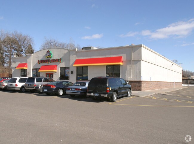
Property Record
1422 Robert St S, Saint Paul, MN 55118

NEARBY LISTINGS FOR SALE OR LEASE
Property Detail
1422 Robert St S
Minneapolis-St. Paul-Bloomington, MN-WI
20 28 22 PT W NE NW COM SW COR NW NE NW S 140 FT E 160.23 FT N 170 FT W 160.23 FT S 30 FT TO BEG EX PT TO CITY SUBJ TO EASE SECTION 20 TWN 28 RANGE 22
42-02000-27-031
Dakota
Commercialnec
Minnesota
X
31
27037C0040E
0.61 AC
2024
West St Paul
2024
Minneapolis/St Paul
060105
DEMOGRAPHICS near 1422 Robert St S
1 Mile
3 Mile
5 Mile
2024 Total Population
13,356
78,123
254,854
2029 Population
13,748
78,882
252,779
Pop Growth 2024-2029
+ 2.94%
+ 0.97%
(0.81%)
Average Age
41
40
38
2024 Total Households
5,939
33,511
103,447
HH Growth 2024-2029
+ 3.13%
+ 1.04%
(0.76%)
Median Household Inc
$58,051
$70,257
$68,009
Avg Household Size
2.20
2.30
2.30
2024 Avg HH Vehicles
2.00
2.00
2.00
Median Home Value
$256,480
$273,446
$285,234
Median Year Built
1970
1968
1963
Nearby Places
Map Layers
Map Styles
 Street
 Aerial
- Restaurants
- Banks
- Shops
- Fitness
- Groceries
PUBLIC TRANSPORTATION
COMMUTER RAIL
St. Paul-Minneapolis (Empire Builder - Amtrak)
DRIVE
WALK
Distance
St. Paul-Minneapolis (Empire Builder - Amtrak)
8 min
3.6 mi
AIRPORT
Minneapolis-St Paul International/Wold-Chamberlain
DRIVE
WALK
Distance
Minneapolis-St Paul International/Wold-Chamberlain
18 min
9.7 mi
Freight Ports
Port Milwaukee
DRIVE
WALK
Distance
Port Milwaukee
369 min
332.4 mi
SALE & LEASE HISTORY
LISTING DATE
SALE/LEASE

Jul 09, 2019
For Sale
Nearby Properties
Address
Land Use
TOTAL SIZE
Lot Size
Zoning
Address
Land Use
TOTAL SIZE
Lot Size
Zoning
63.12 AC
Address
Land Use
TOTAL SIZE
Lot Size
Zoning
Address
Land Use
TOTAL SIZE
Lot Size
Zoning
786,042 SF
2.10 AC
Address
Land Use
TOTAL SIZE
Lot Size
Zoning
146,085 SF
46.83 AC
Address
Land Use
TOTAL SIZE
Lot Size
Zoning
329,070 SF
5.75 AC
Address
Land Use
TOTAL SIZE
Lot Size
Zoning
260,739 SF
3.04 AC
Address
Land Use
TOTAL SIZE
Lot Size
Zoning
445,437 SF
7.80 AC
Address
Land Use
TOTAL SIZE
Lot Size
Zoning
265,736 SF
6.67 AC
Address
Land Use
TOTAL SIZE
Lot Size
Zoning
3.13 AC
Address
Land Use
TOTAL SIZE
Lot Size
Zoning
406,352 SF
1.52 AC
Address
Land Use
TOTAL SIZE
Lot Size
Zoning
32,159 SF
448.26 AC
Address
Land Use
TOTAL SIZE
Lot Size
Zoning
247,470 SF
2.21 AC
Address
Land Use
TOTAL SIZE
Lot Size
Zoning
279,247 SF
1.65 AC
Address
Land Use
TOTAL SIZE
Lot Size
Zoning
217,703 SF
3.51 AC
Address
Land Use
TOTAL SIZE
Lot Size
Zoning
293,970 SF
31.92 AC
Address
Land Use
TOTAL SIZE
Lot Size
Zoning
247,779 SF
1.32 AC
Address
Land Use
TOTAL SIZE
Lot Size
Zoning
278,172 SF
1.97 AC
Address
Land Use
TOTAL SIZE
Lot Size
Zoning
282,178 SF
1.86 AC
Address
Land Use
TOTAL SIZE
Lot Size
Zoning
224,944 SF
3.15 AC
Address
Land Use
TOTAL SIZE
Lot Size
Zoning
37,846 SF
2.86 AC
Address
Land Use
TOTAL SIZE
Lot Size
Zoning
222,299 SF
1.61 AC
Address
Land Use
TOTAL SIZE
Lot Size
Zoning
228,050 SF
0.32 AC
Address
Land Use
TOTAL SIZE
Lot Size
Zoning
243,847 SF
5.24 AC
Address
Land Use
TOTAL SIZE
Lot Size
Zoning
245,570 SF
2.85 AC
Address
Land Use
TOTAL SIZE
Lot Size
Zoning
210,540 SF
5.35 AC
Address
Land Use
TOTAL SIZE
Lot Size
Zoning
218,544 SF
2.01 AC
Address
Land Use
TOTAL SIZE
Lot Size
Zoning
156,636 SF
0.77 AC
Address
Land Use
TOTAL SIZE
Lot Size
Zoning
Address
Land Use
TOTAL SIZE
Lot Size
Zoning
163,985 SF
7.06 AC
Address
Land Use
TOTAL SIZE
Lot Size
Zoning
381,395 SF
15.31 AC
The World's #1 Commercial Real Estate Marketplace
Connect with us
© 2025 CoStar Group
The information above has been obtained from sources believed reliable. While we do not doubt its accuracy we have not verified it and make no guarantee, warranty or representation about it. It is your responsibility to independently confirm its accuracy and completeness. Any projections, opinions, assumptions, or estimates used are for example only and do not represent the current or future performance of the property. The value of this transaction to you depends on tax and other factors which should be evaluated by your tax, financial, and legal advisors. You and your advisors should conduct a careful, independent investigation of the property to determine to your satisfaction the suitability of the property for your needs.