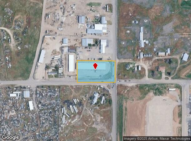
Property Record
1423 E Iona Rd, Idaho Falls, ID 83401

NEARBY LISTINGS FOR SALE OR LEASE
Property Detail
1423 E Iona Rd
Idaho Falls, ID
1.516 A SE COR SE1/4 SE1/4, SEC 5, T 2N, R 38
RP02N38E059528
Bonneville
Publicstorage
Idaho
2025
1.52 AC
2025
Idaho South Area
970405
Other Market Areas
15,960 SF
DEMOGRAPHICS near 1423 E Iona Rd
1 Mile
3 Mile
5 Mile
2024 Total Population
706
49,070
110,759
2029 Population
797
55,315
125,068
Pop Growth 2024-2029
+ 12.89%
+ 12.73%
+ 12.92%
Average Age
37
34
36
2024 Total Households
260
17,526
38,791
HH Growth 2024-2029
+ 12.69%
+ 12.64%
+ 12.82%
Median Household Inc
$49,999
$57,838
$67,525
Avg Household Size
2.50
2.70
2.80
2024 Avg HH Vehicles
2.00
2.00
2.00
Median Home Value
$114,706
$268,382
$321,938
Median Year Built
1981
1976
1984
Nearby Places
Map Layers
Map Styles
 Street
 Aerial
- Restaurants
- Banks
- Shops
- Fitness
- Groceries
PUBLIC TRANSPORTATION
AIRPORT
Idaho Falls Regional
DRIVE
WALK
Distance
Idaho Falls Regional
10 min
4.8 mi
Freight Ports
Port of Portland
DRIVE
WALK
Distance
Port of Portland
744 min
713.6 mi
SALE & LEASE HISTORY
LISTING DATE
SALE/LEASE

Sep 24, 2016
For Sale
Dec 19, 2016
For Sale
Nearby Properties
Address
Land Use
TOTAL SIZE
Lot Size
Zoning
Address
Land Use
TOTAL SIZE
Lot Size
Zoning
136,343 SF
10 AC
Address
Land Use
TOTAL SIZE
Lot Size
Zoning
4,363 SF
13.28 AC
Address
Land Use
TOTAL SIZE
Lot Size
Zoning
253,387 SF
18.33 AC
R2
Address
Land Use
TOTAL SIZE
Lot Size
Zoning
10,324 SF
8.73 AC
Address
Land Use
TOTAL SIZE
Lot Size
Zoning
61,948 SF
4.51 AC
Address
Land Use
TOTAL SIZE
Lot Size
Zoning
273,545 SF
15.89 AC
R2
Address
Land Use
TOTAL SIZE
Lot Size
Zoning
210,995 SF
24.15 AC
R2
Address
Land Use
TOTAL SIZE
Lot Size
Zoning
179,244 SF
16.56 AC
Address
Land Use
TOTAL SIZE
Lot Size
Zoning
1,472 SF
4.38 AC
Address
Land Use
TOTAL SIZE
Lot Size
Zoning
163,776 SF
9.56 AC
R2
Address
Land Use
TOTAL SIZE
Lot Size
Zoning
152,632 SF
7.49 AC
R2
Address
Land Use
TOTAL SIZE
Lot Size
Zoning
91,002 SF
2.70 AC
R2
Address
Land Use
TOTAL SIZE
Lot Size
Zoning
39,458 SF
7.13 AC
Address
Land Use
TOTAL SIZE
Lot Size
Zoning
59,941 SF
11.99 AC
Address
Land Use
TOTAL SIZE
Lot Size
Zoning
216 SF
3.58 AC
Address
Land Use
TOTAL SIZE
Lot Size
Zoning
133,191 SF
12.38 AC
Address
Land Use
TOTAL SIZE
Lot Size
Zoning
33,086 SF
0.30 AC
Address
Land Use
TOTAL SIZE
Lot Size
Zoning
Address
Land Use
TOTAL SIZE
Lot Size
Zoning
76,649 SF
3.96 AC
Address
Land Use
TOTAL SIZE
Lot Size
Zoning
1,573 SF
10.46 AC
Address
Land Use
TOTAL SIZE
Lot Size
Zoning
80,922 SF
10 AC
Address
Land Use
TOTAL SIZE
Lot Size
Zoning
3,219 SF
5.14 AC
R2
Address
Land Use
TOTAL SIZE
Lot Size
Zoning
69,900 SF
7.15 AC
Address
Land Use
TOTAL SIZE
Lot Size
Zoning
91,889 SF
11.68 AC
R2
Address
Land Use
TOTAL SIZE
Lot Size
Zoning
80,772 SF
10.41 AC
R2
Address
Land Use
TOTAL SIZE
Lot Size
Zoning
2,992 SF
4.96 AC
R2
Address
Land Use
TOTAL SIZE
Lot Size
Zoning
67,657 SF
4.08 AC
R2
Address
Land Use
TOTAL SIZE
Lot Size
Zoning
Address
Land Use
TOTAL SIZE
Lot Size
Zoning
44,349 SF
2.05 AC
R2
Address
Land Use
TOTAL SIZE
Lot Size
Zoning
111,308 SF
31.86 AC
R2
The World's #1 Commercial Real Estate Marketplace
Connect with us
© 2025 CoStar Group
The information above has been obtained from sources believed reliable. While we do not doubt its accuracy we have not verified it and make no guarantee, warranty or representation about it. It is your responsibility to independently confirm its accuracy and completeness. Any projections, opinions, assumptions, or estimates used are for example only and do not represent the current or future performance of the property. The value of this transaction to you depends on tax and other factors which should be evaluated by your tax, financial, and legal advisors. You and your advisors should conduct a careful, independent investigation of the property to determine to your satisfaction the suitability of the property for your needs.