Property Record
14235 42Nd St Ne, Saint Michael, MN 55376
NEARBY LISTINGS FOR SALE OR LEASE
Property Detail
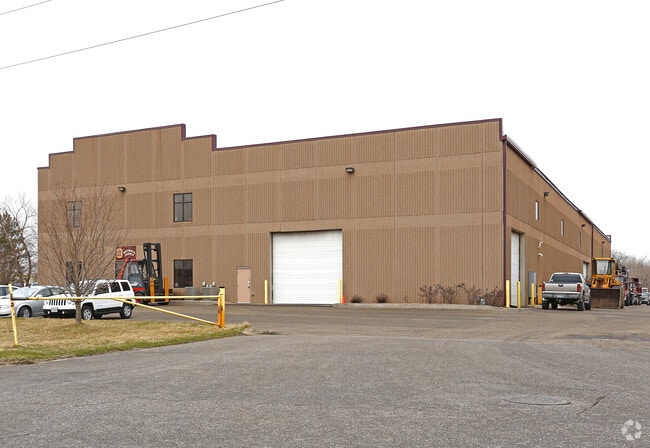
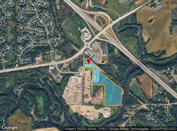
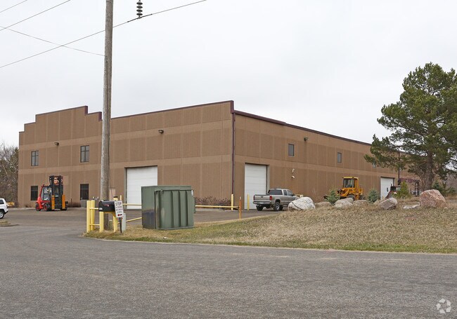
14235 42Nd St Ne
Minneapolis/St Paul
Drywall Supply 1St Addn
Minneapolis-St. Paul-Bloomington, MN-WI
SECT-09 TWP-120 RANGE-023 DRYWALL SUPPLY 1ST ADDN LOT-001 BLOCK-001 OCK-001
114-188-001010
Wright
Lightindustrial
Minnesota
2025
1
2025
24.40 AC
100807
Wright County
27,424 SF
DEMOGRAPHICS near 14235 42Nd St Ne
1 Mile
3 Mile
5 Mile
2024 Total Population
2,432
20,429
63,609
2029 Population
2,610
21,705
69,538
Pop Growth 2024-2029
+ 7.32%
+ 6.25%
+ 9.32%
Average Age
38
37
36
2024 Total Households
801
6,803
21,373
HH Growth 2024-2029
+ 7.49%
+ 6.32%
+ 9.36%
Median Household Inc
$124,851
$120,715
$120,694
Avg Household Size
3.00
3.00
2.90
2024 Avg HH Vehicles
2.00
2.00
2.00
Median Home Value
$355,161
$361,187
$343,777
Median Year Built
2001
2001
2003
Nearby Places
Map Layers
Map Styles
 Street
 Aerial
- Restaurants
- Banks
- Shops
- Fitness
- Groceries
PUBLIC TRANSPORTATION
COMMUTER RAIL
Elk River Station (Northstar Corridor - Northstar Commuter Rail)
DRIVE
WALK
Distance
Elk River Station (Northstar Corridor - Northstar Commuter Rail)
14 min
8.8 mi
AIRPORT
Minneapolis-St Paul International/Wold-Chamberlain
DRIVE
WALK
Distance
Minneapolis-St Paul International/Wold-Chamberlain
52 min
40.2 mi
Freight Ports
Port Milwaukee
DRIVE
WALK
Distance
Port Milwaukee
404 min
365.3 mi
SALE & LEASE HISTORY
LISTING DATE
SALE/LEASE

Sep 25, 2016
For Lease
Sep 23, 2016
For Sale
Nearby Properties
Address
Land Use
TOTAL SIZE
Lot Size
Zoning
Address
Land Use
TOTAL SIZE
Lot Size
Zoning
3.32 AC
Address
Land Use
TOTAL SIZE
Lot Size
Zoning
8.10 AC
Address
Land Use
TOTAL SIZE
Lot Size
Zoning
16.17 AC
Address
Land Use
TOTAL SIZE
Lot Size
Zoning
40,984 SF
34.62 AC
Address
Land Use
TOTAL SIZE
Lot Size
Zoning
Address
Land Use
TOTAL SIZE
Lot Size
Zoning
267,924 SF
13.88 AC
Address
Land Use
TOTAL SIZE
Lot Size
Zoning
19.03 AC
Address
Land Use
TOTAL SIZE
Lot Size
Zoning
58.85 AC
Address
Land Use
TOTAL SIZE
Lot Size
Zoning
Address
Land Use
TOTAL SIZE
Lot Size
Zoning
212,224 SF
12.84 AC
Address
Land Use
TOTAL SIZE
Lot Size
Zoning
31,553 SF
41.63 AC
Address
Land Use
TOTAL SIZE
Lot Size
Zoning
Address
Land Use
TOTAL SIZE
Lot Size
Zoning
14.07 AC
Address
Land Use
TOTAL SIZE
Lot Size
Zoning
Address
Land Use
TOTAL SIZE
Lot Size
Zoning
7,932 SF
13.29 AC
Address
Land Use
TOTAL SIZE
Lot Size
Zoning
21,935 SF
4.15 AC
Address
Land Use
TOTAL SIZE
Lot Size
Zoning
Address
Land Use
TOTAL SIZE
Lot Size
Zoning
Address
Land Use
TOTAL SIZE
Lot Size
Zoning
16.09 AC
Address
Land Use
TOTAL SIZE
Lot Size
Zoning
11.74 AC
Address
Land Use
TOTAL SIZE
Lot Size
Zoning
26,187 SF
2.05 AC
Address
Land Use
TOTAL SIZE
Lot Size
Zoning
154,800 SF
8.74 AC
Address
Land Use
TOTAL SIZE
Lot Size
Zoning
12.34 AC
Address
Land Use
TOTAL SIZE
Lot Size
Zoning
Address
Land Use
TOTAL SIZE
Lot Size
Zoning
16.21 AC
Address
Land Use
TOTAL SIZE
Lot Size
Zoning
Address
Land Use
TOTAL SIZE
Lot Size
Zoning
Address
Land Use
TOTAL SIZE
Lot Size
Zoning
Address
Land Use
TOTAL SIZE
Lot Size
Zoning
12,250 SF
20.65 AC
Address
Land Use
TOTAL SIZE
Lot Size
Zoning
78,708 SF
7.71 AC
The World's #1 Commercial Real Estate Marketplace
Connect with us
© 2025 CoStar Group
The information above has been obtained from sources believed reliable. While we do not doubt its accuracy we have not verified it and make no guarantee, warranty or representation about it. It is your responsibility to independently confirm its accuracy and completeness. Any projections, opinions, assumptions, or estimates used are for example only and do not represent the current or future performance of the property. The value of this transaction to you depends on tax and other factors which should be evaluated by your tax, financial, and legal advisors. You and your advisors should conduct a careful, independent investigation of the property to determine to your satisfaction the suitability of the property for your needs.