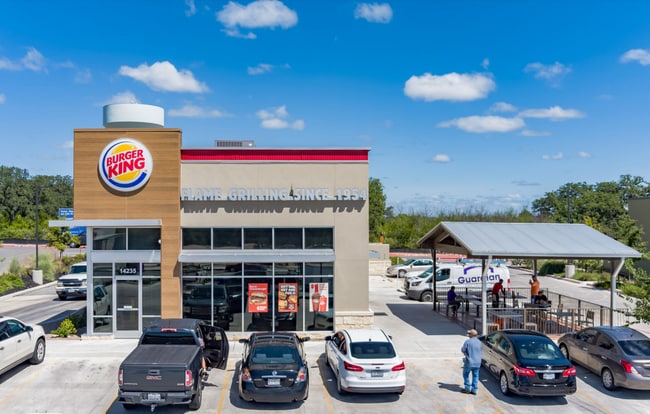
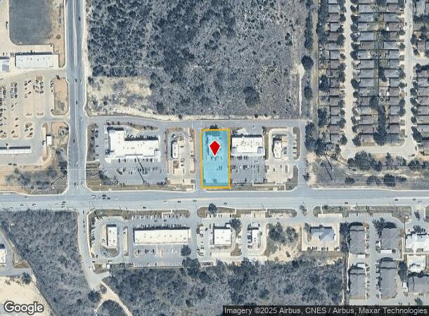
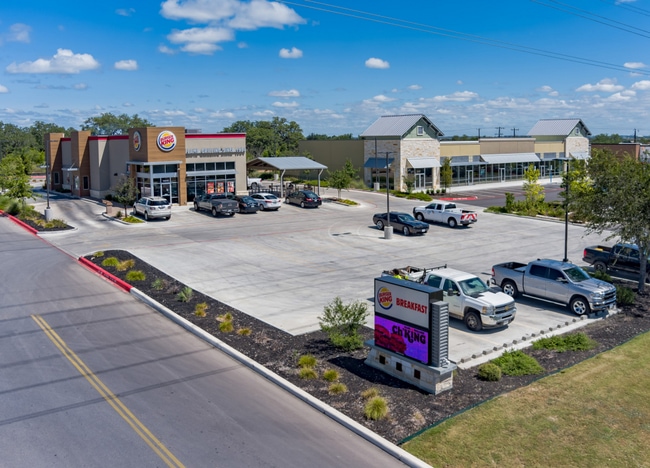
Property Record
14235 Potranco Rd, San Antonio, TX 78253
NEARBY LISTINGS FOR SALE OR LEASE
Property Detail
14235 Potranco Rd
San Antonio-New Braunfels, TX
Cb 4349E (Stevens Ranch Retail)
04349-545-0040
CB 4349E (STEVENS RANCH RETAIL), BLOCK 45 LOT 4 2019 NEW ACCT PER PLAT 20001/326-2 FILED 08/17/2018.
Restaurantdrivein
Bexar
X
Texas
48029C0355G
4
2024
0.88 AC
2025
Far West
172006
San Antonio
3,168 SF
DEMOGRAPHICS near 14235 Potranco Rd
1 Mile
3 Mile
5 Mile
2024 Total Population
7,253
41,371
120,493
2029 Population
8,001
45,829
131,981
Pop Growth 2024-2029
+ 10.31%
+ 10.78%
+ 9.53%
Average Age
33
33
34
2024 Total Households
2,166
12,410
37,554
HH Growth 2024-2029
+ 10.57%
+ 11.10%
+ 9.85%
Median Household Inc
$113,652
$106,722
$101,201
Avg Household Size
3.30
3.30
3.10
2024 Avg HH Vehicles
2.00
2.00
2.00
Median Home Value
$322,050
$284,952
$262,556
Median Year Built
2011
2010
2010
Nearby Places
Map Layers
Map Styles
 Street
 Aerial
- Restaurants
- Banks
- Shops
- Fitness
- Groceries
PUBLIC TRANSPORTATION
AIRPORT
San Antonio International
DRIVE
WALK
Distance
San Antonio International
31 min
20.9 mi
Freight Ports
Port of Corpus Christi
DRIVE
WALK
Distance
Port of Corpus Christi
170 min
162.6 mi
SALE & LEASE HISTORY
LISTING DATE
SALE/LEASE

Oct 04, 2021
For Sale
Nearby Properties
Address
Land Use
TOTAL SIZE
Lot Size
Zoning
Address
Land Use
TOTAL SIZE
Lot Size
Zoning
850,338 SF
93.98 AC
Address
Land Use
TOTAL SIZE
Lot Size
Zoning
333,308 SF
22.04 AC
Address
Land Use
TOTAL SIZE
Lot Size
Zoning
245,000 SF
44.68 AC
Address
Land Use
TOTAL SIZE
Lot Size
Zoning
268,776 SF
10 AC
Address
Land Use
TOTAL SIZE
Lot Size
Zoning
109,685 SF
37.52 AC
Address
Land Use
TOTAL SIZE
Lot Size
Zoning
332,145 SF
17.03 AC
Address
Land Use
TOTAL SIZE
Lot Size
Zoning
238,098 SF
13.93 AC
Address
Land Use
TOTAL SIZE
Lot Size
Zoning
497,319 SF
60 AC
Address
Land Use
TOTAL SIZE
Lot Size
Zoning
209,459 SF
18.25 AC
Address
Land Use
TOTAL SIZE
Lot Size
Zoning
654.58 AC
Address
Land Use
TOTAL SIZE
Lot Size
Zoning
164,025 SF
21.46 AC
Address
Land Use
TOTAL SIZE
Lot Size
Zoning
242.77 AC
Address
Land Use
TOTAL SIZE
Lot Size
Zoning
128,713 SF
15.43 AC
Address
Land Use
TOTAL SIZE
Lot Size
Zoning
409.99 AC
Address
Land Use
TOTAL SIZE
Lot Size
Zoning
442.05 AC
Address
Land Use
TOTAL SIZE
Lot Size
Zoning
324.15 AC
Address
Land Use
TOTAL SIZE
Lot Size
Zoning
152,000 SF
21.83 AC
Address
Land Use
TOTAL SIZE
Lot Size
Zoning
200.84 AC
Address
Land Use
TOTAL SIZE
Lot Size
Zoning
241.16 AC
Address
Land Use
TOTAL SIZE
Lot Size
Zoning
94.43 AC
Address
Land Use
TOTAL SIZE
Lot Size
Zoning
30,800 SF
3.13 AC
Address
Land Use
TOTAL SIZE
Lot Size
Zoning
98,827 SF
3.23 AC
Address
Land Use
TOTAL SIZE
Lot Size
Zoning
92,876 SF
21.64 AC
Address
Land Use
TOTAL SIZE
Lot Size
Zoning
16,486 SF
1.98 AC
Address
Land Use
TOTAL SIZE
Lot Size
Zoning
19,951 SF
2.48 AC
Address
Land Use
TOTAL SIZE
Lot Size
Zoning
112.34 AC
Address
Land Use
TOTAL SIZE
Lot Size
Zoning
97,833 SF
2.69 AC
Address
Land Use
TOTAL SIZE
Lot Size
Zoning
202.74 AC
Address
Land Use
TOTAL SIZE
Lot Size
Zoning
Address
Land Use
TOTAL SIZE
Lot Size
Zoning
45,025 SF
8.87 AC
The World's #1 Commercial Real Estate Marketplace
Connect with us
© 2025 CoStar Group
The information above has been obtained from sources believed reliable. While we do not doubt its accuracy we have not verified it and make no guarantee, warranty or representation about it. It is your responsibility to independently confirm its accuracy and completeness. Any projections, opinions, assumptions, or estimates used are for example only and do not represent the current or future performance of the property. The value of this transaction to you depends on tax and other factors which should be evaluated by your tax, financial, and legal advisors. You and your advisors should conduct a careful, independent investigation of the property to determine to your satisfaction the suitability of the property for your needs.