Property Record
14247 Oconnell Ct, Savage, MN 55378
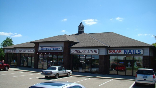


Current Lease Availabilities
Property Detail
14247 Oconnell Ct
Minneapolis-St. Paul-Bloomington, MN-WI
WOODBRIDGE PONDS RETAIL CTR 2ND ADDN LOT 001 BLOCK 001
26-259-001-0
Scott
Commercialnec
Minnesota
B and X Area of moderate flood hazard, usually the area between the limits of the 100-year and 500-year floods.
1
2025
1.52 AC
2026
Burnsville
080206
Minneapolis/St Paul
6,292 SF
NEARBY LISTINGS FOR SALE OR LEASE
DEMOGRAPHICS near 14247 Oconnell Ct
1 mile
3 mile
5 mile
2025 Total Population
11,298
55,619
140,674
2030 Population
11,518
56,806
143,715
Pop Growth 2025-2030
+ 1.95%
+ 2.13%
+ 2.16%
Average Age
39
39
40
2025 Total Households
3,900
19,747
53,123
HH Growth 2025-2030
+ 2.08%
+ 2.25%
+ 2.25%
Median Household Inc
$105,688
$103,819
$98,914
Avg Household Size
2.90
2.80
2.60
2025 Avg HH Vehicles
2.00
2.00
2.00
Median Home Value
$388,331
$395,025
$394,620
Median Year Built
1994
1991
1988
Nearby Places
Map Layers
Map Styles
 Street
 Aerial
Layers
 Traffic
 Biking
Places
Listings with unknown addresses are not visible on the map
- Restaurants
- Banks
- Shops
- Fitness
- Groceries
PUBLIC TRANSPORTATION
AIRPORT
Minneapolis-St Paul International/Wold-Chamberlain
Drive
Walk
Distance
Minneapolis-St Paul International/Wold-Chamberlain
25 min
16.9 mi
Nearby Properties
Address
Land Use
TOTAL SIZE
Lot Size
Zoning
Address
Land Use
TOTAL SIZE
Lot Size
Zoning
378,396 SF
20.25 AC
Address
Land Use
TOTAL SIZE
Lot Size
Zoning
454,738 SF
106.74 AC
Address
Land Use
TOTAL SIZE
Lot Size
Zoning
184,747 SF
8.44 AC
Address
Land Use
TOTAL SIZE
Lot Size
Zoning
8.70 AC
Address
Land Use
TOTAL SIZE
Lot Size
Zoning
394,700 SF
13.23 AC
Address
Land Use
TOTAL SIZE
Lot Size
Zoning
10.57 AC
Address
Land Use
TOTAL SIZE
Lot Size
Zoning
276,290 SF
7.44 AC
Address
Land Use
TOTAL SIZE
Lot Size
Zoning
239,047 SF
9.14 AC
Address
Land Use
TOTAL SIZE
Lot Size
Zoning
324,094 SF
44.01 AC
Address
Land Use
TOTAL SIZE
Lot Size
Zoning
216,700 SF
43.17 AC
Address
Land Use
TOTAL SIZE
Lot Size
Zoning
106,944 SF
13.21 AC
Address
Land Use
TOTAL SIZE
Lot Size
Zoning
136,535 SF
4.99 AC
Address
Land Use
TOTAL SIZE
Lot Size
Zoning
179,761 SF
7.04 AC
Address
Land Use
TOTAL SIZE
Lot Size
Zoning
245,291 SF
12.64 AC
Address
Land Use
TOTAL SIZE
Lot Size
Zoning
369,600 SF
20.22 AC
Address
Land Use
TOTAL SIZE
Lot Size
Zoning
153,369 SF
4.84 AC
Address
Land Use
TOTAL SIZE
Lot Size
Zoning
421,893 SF
21.17 AC
Address
Land Use
TOTAL SIZE
Lot Size
Zoning
75,339 SF
3.99 AC
Address
Land Use
TOTAL SIZE
Lot Size
Zoning
340,588 SF
16.54 AC
Address
Land Use
TOTAL SIZE
Lot Size
Zoning
211,187 SF
5.75 AC
Address
Land Use
TOTAL SIZE
Lot Size
Zoning
97,096 SF
15.34 AC
Address
Land Use
TOTAL SIZE
Lot Size
Zoning
85,602 SF
5.66 AC
Address
Land Use
TOTAL SIZE
Lot Size
Zoning
15.86 AC
Address
Land Use
TOTAL SIZE
Lot Size
Zoning
105,611 SF
14.44 AC
Address
Land Use
TOTAL SIZE
Lot Size
Zoning
150,867 SF
100.29 AC
Address
Land Use
TOTAL SIZE
Lot Size
Zoning
139,852 SF
13.16 AC
Address
Land Use
TOTAL SIZE
Lot Size
Zoning
125,157 SF
5.26 AC
Address
Land Use
TOTAL SIZE
Lot Size
Zoning
89,306 SF
25.06 AC
Address
Land Use
TOTAL SIZE
Lot Size
Zoning
102,797 SF
11.95 AC
Address
Land Use
TOTAL SIZE
Lot Size
Zoning
123,085 SF
10.11 AC
The World's #1 Commercial Real Estate Marketplace
Connect with us
© 2026 CoStar Group
The information above has been obtained from sources believed reliable. While we do not doubt its accuracy we have not verified it and make no guarantee, warranty or representation about it. It is your responsibility to independently confirm its accuracy and completeness. Any projections, opinions, assumptions, or estimates used are for example only and do not represent the current or future performance of the property. The value of this transaction to you depends on tax and other factors which should be evaluated by your tax, financial, and legal advisors. You and your advisors should conduct a careful, independent investigation of the property to determine to your satisfaction the suitability of the property for your needs.