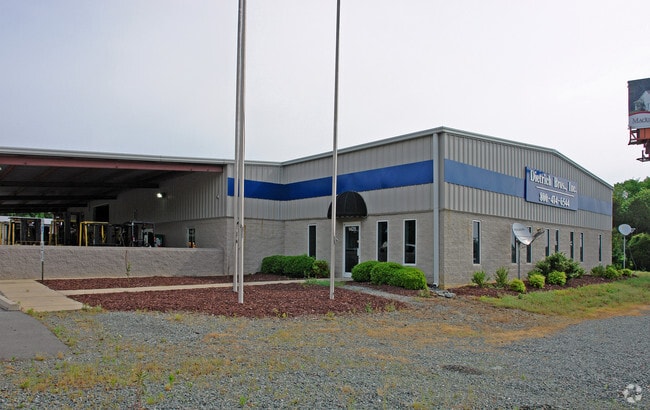
Property Record
1425 Brittney Ln, Burlington, NC 27215


NEARBY LISTINGS FOR SALE OR LEASE
Property Detail
1425 Brittney Ln
Greensboro-High Point, NC
Property Of M & B Land Associates Llc
0103245
SEE DEED
Industrialgeneral
Guilford
X
North Carolina
3710883400K
12
2024
7.83 AC
2025
SE Guilford County
015202
Greensboro/Winston-Salem
9,740 SF
DEMOGRAPHICS near 1425 Brittney Ln
1 Mile
3 Mile
5 Mile
2024 Total Population
5,403
28,297
58,055
2029 Population
5,710
30,009
61,353
Pop Growth 2024-2029
+ 5.68%
+ 6.05%
+ 5.68%
Average Age
36
41
40
2024 Total Households
2,014
11,776
22,887
HH Growth 2024-2029
+ 5.86%
+ 6.28%
+ 5.82%
Median Household Inc
$83,092
$74,841
$73,609
Avg Household Size
2.70
2.30
2.30
2024 Avg HH Vehicles
2.00
2.00
2.00
Median Home Value
$246,865
$252,636
$243,068
Median Year Built
2010
2004
1997
Nearby Places
Map Layers
Map Styles
 Street
 Aerial
- Restaurants
- Banks
- Shops
- Fitness
- Groceries
PUBLIC TRANSPORTATION
COMMUTER RAIL
Burlington Station (Piedmont - North Carolina by Train (NC Train))
DRIVE
WALK
Distance
Burlington Station (Piedmont - North Carolina by Train (NC Train))
16 min
9.6 mi
AIRPORT
Piedmont Triad International
DRIVE
WALK
Distance
Piedmont Triad International
41 min
29.3 mi
Nearby Properties
Address
Land Use
TOTAL SIZE
Lot Size
Zoning
Address
Land Use
TOTAL SIZE
Lot Size
Zoning
350,000 SF
64.18 AC
O I
Address
Land Use
TOTAL SIZE
Lot Size
Zoning
81,153 SF
62.10 AC
X 1
Address
Land Use
TOTAL SIZE
Lot Size
Zoning
26,280 SF
14.34 AC
R 15
Address
Land Use
TOTAL SIZE
Lot Size
Zoning
531,300 SF
29.40 AC
LI
Address
Land Use
TOTAL SIZE
Lot Size
Zoning
297,670 SF
37.41 AC
LI
Address
Land Use
TOTAL SIZE
Lot Size
Zoning
41,892 SF
21.63 AC
CR
Address
Land Use
TOTAL SIZE
Lot Size
Zoning
26,280 SF
11.24 AC
CR
Address
Land Use
TOTAL SIZE
Lot Size
Zoning
51,381 SF
34.69 AC
CB
Address
Land Use
TOTAL SIZE
Lot Size
Zoning
475,200 SF
46.54 AC
LI
Address
Land Use
TOTAL SIZE
Lot Size
Zoning
10,368 SF
13.60 AC
MFA
Address
Land Use
TOTAL SIZE
Lot Size
Zoning
27,803 SF
8.80 AC
CR
Address
Land Use
TOTAL SIZE
Lot Size
Zoning
47,520 SF
6.10 AC
B 2
Address
Land Use
TOTAL SIZE
Lot Size
Zoning
23,265 SF
20.45 AC
MF A
Address
Land Use
TOTAL SIZE
Lot Size
Zoning
399,195 SF
24.84 AC
RM-12
Address
Land Use
TOTAL SIZE
Lot Size
Zoning
135,186 SF
15.60 AC
CR
Address
Land Use
TOTAL SIZE
Lot Size
Zoning
28,812 SF
15.63 AC
MFA
Address
Land Use
TOTAL SIZE
Lot Size
Zoning
84,783 SF
32.88 AC
CB
Address
Land Use
TOTAL SIZE
Lot Size
Zoning
29,120 SF
56.82 AC
X 1
Address
Land Use
TOTAL SIZE
Lot Size
Zoning
298,682 SF
21.54 AC
CR
Address
Land Use
TOTAL SIZE
Lot Size
Zoning
300,464 SF
19.67 AC
LI
Address
Land Use
TOTAL SIZE
Lot Size
Zoning
257,796 SF
17.91 AC
CU-HI
Address
Land Use
TOTAL SIZE
Lot Size
Zoning
246,317 SF
18.72 AC
PD-R
Address
Land Use
TOTAL SIZE
Lot Size
Zoning
203,832 SF
36.10 AC
B 2
Address
Land Use
TOTAL SIZE
Lot Size
Zoning
14,760 SF
13.07 AC
MFA
Address
Land Use
TOTAL SIZE
Lot Size
Zoning
240,155 SF
21.72 AC
LI
Address
Land Use
TOTAL SIZE
Lot Size
Zoning
10,604 SF
24.43 AC
R 9
Address
Land Use
TOTAL SIZE
Lot Size
Zoning
53,012 SF
18.58 AC
B 2
Address
Land Use
TOTAL SIZE
Lot Size
Zoning
81,726 SF
18.01 AC
R 15
Address
Land Use
TOTAL SIZE
Lot Size
Zoning
162,161 SF
19.18 AC
RM-8
Address
Land Use
TOTAL SIZE
Lot Size
Zoning
90,083 SF
2.33 AC
CB
The World's #1 Commercial Real Estate Marketplace
Connect with us
© 2025 CoStar Group
The information above has been obtained from sources believed reliable. While we do not doubt its accuracy we have not verified it and make no guarantee, warranty or representation about it. It is your responsibility to independently confirm its accuracy and completeness. Any projections, opinions, assumptions, or estimates used are for example only and do not represent the current or future performance of the property. The value of this transaction to you depends on tax and other factors which should be evaluated by your tax, financial, and legal advisors. You and your advisors should conduct a careful, independent investigation of the property to determine to your satisfaction the suitability of the property for your needs.