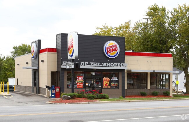
Property Record
1425 E New York St, Aurora, IL 60505

NEARBY LISTINGS FOR SALE OR LEASE
Property Detail
1425 E New York St
Chicago-Naperville-Elgin, IL-IN-WI
Fast Foods
15-24-351-010
OGDEN GARDENS PT LOT 361 : & PT LOT 362 & N 1/2 VAC : ALLEY S & ADJ LOT DIMENSIONS: 1 IRREG APPROX LOT SQ FT 1 SUBDIVISION: FAST FOODS RANGE CODE: 001
Commercialnec
Kane
X
Illinois
17089C0343H
361-3
2024
0.12 AC
2024
Western East/West Corr
853402
Chicago
2,948 SF
DEMOGRAPHICS near 1425 E New York St
1 Mile
3 Mile
5 Mile
2024 Total Population
16,524
125,503
261,771
2029 Population
16,292
124,859
263,175
Pop Growth 2024-2029
(1.40%)
(0.51%)
+ 0.54%
Average Age
35
36
37
2024 Total Households
4,645
40,972
89,824
HH Growth 2024-2029
(1.44%)
(0.48%)
+ 0.54%
Median Household Inc
$60,903
$75,362
$85,697
Avg Household Size
3.40
2.90
2.80
2024 Avg HH Vehicles
2.00
2.00
2.00
Median Home Value
$149,600
$211,640
$247,018
Median Year Built
1955
1979
1989
Nearby Places
Map Layers
Map Styles
 Street
 Aerial
- Restaurants
- Banks
- Shops
- Fitness
- Groceries
PUBLIC TRANSPORTATION
COMMUTER RAIL
Aurora Station (Burlington Northern-Santa Fe Railway Line - Northeast Illinois Regional Commuter Railroad (Metra))
DRIVE
WALK
Distance
Aurora Station (Burlington Northern-Santa Fe Railway Line - Northeast Illinois Regional Commuter Railroad (Metra))
4 min
2.0 mi
Route 59 Station (Burlington Northern-Santa Fe Railway Line - Northeast Illinois Regional Commuter Railroad (Metra))
DRIVE
WALK
Distance
Route 59 Station (Burlington Northern-Santa Fe Railway Line - Northeast Illinois Regional Commuter Railroad (Metra))
10 min
5.5 mi
AIRPORT
Chicago Midway International
DRIVE
WALK
Distance
Chicago Midway International
50 min
31.0 mi
Chicago O'Hare International
DRIVE
WALK
Distance
Chicago O'Hare International
52 min
36.0 mi
Freight Ports
Port Milwaukee
DRIVE
WALK
Distance
Port Milwaukee
133 min
107.8 mi
Nearby Properties
Address
Land Use
TOTAL SIZE
Lot Size
Zoning
Address
Land Use
TOTAL SIZE
Lot Size
Zoning
28.52 AC
R
Address
Land Use
TOTAL SIZE
Lot Size
Zoning
272,948 SF
16.10 AC
Address
Land Use
TOTAL SIZE
Lot Size
Zoning
283,844 SF
16.06 AC
M
Address
Land Use
TOTAL SIZE
Lot Size
Zoning
17.84 AC
M
Address
Land Use
TOTAL SIZE
Lot Size
Zoning
11.02 AC
M
Address
Land Use
TOTAL SIZE
Lot Size
Zoning
9.83 AC
C
Address
Land Use
TOTAL SIZE
Lot Size
Zoning
173,303 SF
19.53 AC
Address
Land Use
TOTAL SIZE
Lot Size
Zoning
521,922 SF
19.87 AC
Address
Land Use
TOTAL SIZE
Lot Size
Zoning
244,494 SF
16.08 AC
Address
Land Use
TOTAL SIZE
Lot Size
Zoning
320,874 SF
1.49 AC
Address
Land Use
TOTAL SIZE
Lot Size
Zoning
17.42 AC
Address
Land Use
TOTAL SIZE
Lot Size
Zoning
116,621 SF
8.50 AC
O
Address
Land Use
TOTAL SIZE
Lot Size
Zoning
233,437 SF
13.11 AC
Address
Land Use
TOTAL SIZE
Lot Size
Zoning
317,815 SF
21.29 AC
Address
Land Use
TOTAL SIZE
Lot Size
Zoning
100,340 SF
1.80 AC
Address
Land Use
TOTAL SIZE
Lot Size
Zoning
73,880 SF
0.75 AC
Address
Land Use
TOTAL SIZE
Lot Size
Zoning
8.87 AC
Address
Land Use
TOTAL SIZE
Lot Size
Zoning
224,199 SF
16.46 AC
I
Address
Land Use
TOTAL SIZE
Lot Size
Zoning
250,712 SF
10.60 AC
I
Address
Land Use
TOTAL SIZE
Lot Size
Zoning
6.31 AC
M
Address
Land Use
TOTAL SIZE
Lot Size
Zoning
Address
Land Use
TOTAL SIZE
Lot Size
Zoning
93,771 SF
10.33 AC
C
Address
Land Use
TOTAL SIZE
Lot Size
Zoning
85,440 SF
0.58 AC
Address
Land Use
TOTAL SIZE
Lot Size
Zoning
144,164 SF
7.95 AC
Address
Land Use
TOTAL SIZE
Lot Size
Zoning
2.73 AC
Address
Land Use
TOTAL SIZE
Lot Size
Zoning
89,188 SF
3.70 AC
Address
Land Use
TOTAL SIZE
Lot Size
Zoning
140,761 SF
8.20 AC
I
Address
Land Use
TOTAL SIZE
Lot Size
Zoning
183,429 SF
12 AC
I
Address
Land Use
TOTAL SIZE
Lot Size
Zoning
82,150 SF
23.67 AC
Address
Land Use
TOTAL SIZE
Lot Size
Zoning
178,576 SF
7.91 AC
I
The World's #1 Commercial Real Estate Marketplace
Connect with us
© 2025 CoStar Group
The information above has been obtained from sources believed reliable. While we do not doubt its accuracy we have not verified it and make no guarantee, warranty or representation about it. It is your responsibility to independently confirm its accuracy and completeness. Any projections, opinions, assumptions, or estimates used are for example only and do not represent the current or future performance of the property. The value of this transaction to you depends on tax and other factors which should be evaluated by your tax, financial, and legal advisors. You and your advisors should conduct a careful, independent investigation of the property to determine to your satisfaction the suitability of the property for your needs.