Property Record
1425 Gold Star Hwy, Groton, CT 06340


NEARBY LISTINGS FOR SALE OR LEASE
-
-
View all Groton listings for lease on LoopNet.com
Property Detail
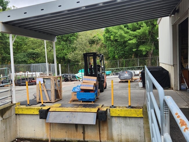
1425 Gold Star Hwy
Officebuilding
New London
X
Connecticut
09011C0369G
6.54 AC
2025
New London
2025
Hartford
702100
Norwich-New London-Willimantic, CT
35,212 SF
GROT-001790-002090-009873
DEMOGRAPHICS near 1425 Gold Star Hwy
1 Mile
3 Mile
5 Mile
2024 Total Population
1,065
22,683
69,375
2029 Population
1,058
22,741
69,378
Pop Growth 2024-2029
(0.66%)
+ 0.26%
0.00%
Average Age
43
40
41
2024 Total Households
441
9,400
28,374
HH Growth 2024-2029
(0.91%)
+ 0.21%
+ 0.05%
Median Household Inc
$114,436
$76,211
$74,599
Avg Household Size
2.40
2.30
2.20
2024 Avg HH Vehicles
2.00
2.00
2.00
Median Home Value
$292,399
$267,110
$286,107
Median Year Built
1972
1978
1970
Nearby Places
Map Layers
Map Styles
 Street
 Aerial
- Restaurants
- Banks
- Shops
- Fitness
- Groceries
PUBLIC TRANSPORTATION
COMMUTER RAIL
DRIVE
WALK
Distance
12 min
6.0 mi
New London (Shore Line East - Shore Line East)
DRIVE
WALK
Distance
New London (Shore Line East - Shore Line East)
11 min
6.2 mi
SALE & LEASE HISTORY
LISTING DATE
SALE/LEASE

Mar 29, 2024
For Lease
Feb 25, 2019
For Lease
Nearby Properties
Address
Land Use
TOTAL SIZE
Lot Size
Zoning
Address
Land Use
TOTAL SIZE
Lot Size
Zoning
8,712 SF
RU-20
Address
Land Use
TOTAL SIZE
Lot Size
Zoning
42,688 SF
19.22 AC
RM
Address
Land Use
TOTAL SIZE
Lot Size
Zoning
276.72 AC
GC
Address
Land Use
TOTAL SIZE
Lot Size
Zoning
8,820 SF
66.22 AC
R-12
Address
Land Use
TOTAL SIZE
Lot Size
Zoning
268,573 SF
74.66 AC
RS-20
Address
Land Use
TOTAL SIZE
Lot Size
Zoning
287.66 AC
RU-20
Address
Land Use
TOTAL SIZE
Lot Size
Zoning
11,880 SF
35.66 AC
RM
Address
Land Use
TOTAL SIZE
Lot Size
Zoning
13.68 AC
CR
Address
Land Use
TOTAL SIZE
Lot Size
Zoning
162,521 SF
44.19 AC
RS-20
Address
Land Use
TOTAL SIZE
Lot Size
Zoning
60.63 AC
RU-20
Address
Land Use
TOTAL SIZE
Lot Size
Zoning
104,052 SF
27.36 AC
RM
Address
Land Use
TOTAL SIZE
Lot Size
Zoning
74,433 SF
47.37 AC
RS-20
Address
Land Use
TOTAL SIZE
Lot Size
Zoning
66.87 AC
RU-20
Address
Land Use
TOTAL SIZE
Lot Size
Zoning
231,514 SF
9.33 AC
IM
Address
Land Use
TOTAL SIZE
Lot Size
Zoning
125,275 SF
10 AC
RM
Address
Land Use
TOTAL SIZE
Lot Size
Zoning
204,329 SF
17.92 AC
CR
Address
Land Use
TOTAL SIZE
Lot Size
Zoning
33.50 AC
R-12
Address
Land Use
TOTAL SIZE
Lot Size
Zoning
133,106 SF
17.25 AC
MTC
Address
Land Use
TOTAL SIZE
Lot Size
Zoning
33,404 SF
10.15 AC
MVC
Address
Land Use
TOTAL SIZE
Lot Size
Zoning
52,065 SF
12.40 AC
CN
Address
Land Use
TOTAL SIZE
Lot Size
Zoning
125,755 SF
14.63 AC
MVC
Address
Land Use
TOTAL SIZE
Lot Size
Zoning
60,592 SF
12.95 AC
MTC
Address
Land Use
TOTAL SIZE
Lot Size
Zoning
520 SF
36.40 AC
RS-20
Address
Land Use
TOTAL SIZE
Lot Size
Zoning
83,470 SF
14.67 AC
CR
Address
Land Use
TOTAL SIZE
Lot Size
Zoning
37,434 SF
10.75 AC
MVC
Address
Land Use
TOTAL SIZE
Lot Size
Zoning
58,739 SF
21.85 AC
RU-40
Address
Land Use
TOTAL SIZE
Lot Size
Zoning
37,448 SF
3.86 AC
MTC
Address
Land Use
TOTAL SIZE
Lot Size
Zoning
87,440 SF
9.30 AC
MTC
Address
Land Use
TOTAL SIZE
Lot Size
Zoning
90,170 SF
5.03 AC
CR
Address
Land Use
TOTAL SIZE
Lot Size
Zoning
2,980 SF
RU-20
The World's #1 Commercial Real Estate Marketplace
Connect with us
© 2026 CoStar Group
The information above has been obtained from sources believed reliable. While we do not doubt its accuracy we have not verified it and make no guarantee, warranty or representation about it. It is your responsibility to independently confirm its accuracy and completeness. Any projections, opinions, assumptions, or estimates used are for example only and do not represent the current or future performance of the property. The value of this transaction to you depends on tax and other factors which should be evaluated by your tax, financial, and legal advisors. You and your advisors should conduct a careful, independent investigation of the property to determine to your satisfaction the suitability of the property for your needs.