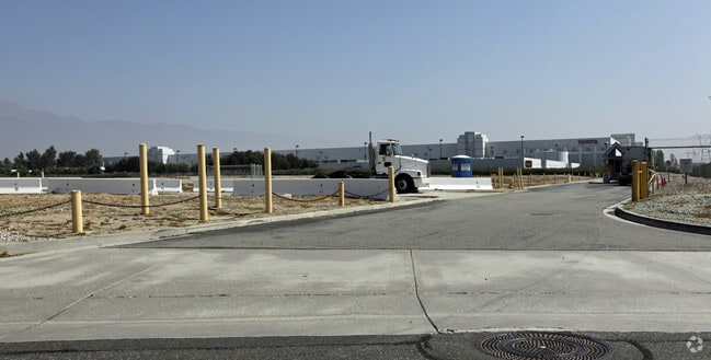
Property Record
1425 Toyota Way, Ontario, CA 91761


NEARBY LISTINGS FOR SALE OR LEASE
-
-
-
-
-
-
-
-
-
-
-
-
-
-
-
-
10513-10567 San Sevaine Way
Jurupa Valley, CA 91752
$3,222,139 - $3,427,861
10,212 - 10,864 SF
Industrial
-
-
View all Ontario listings for sale on LoopNet.com
Property Detail
1425 Toyota Way
0238-121-75
PARCEL MAP 13414 PAR 1 AND PORTION PARCEL MAP 13172 PAR 1 AND TR 2244 N 500 FT W 500 FT LOT 1 BLK 31 EX PORTION OF SEC 31 TP 1S R 6W COM NE COR TH N 89 DEG 32 MIN W ALG C/L JURUPA ST 4555.54 FT TO TRUE POB TH S 0 DEG 24 MIN W 135 FT TH N 89 DEG 32 MI
Warehouse
San Bernardino
X
California
06071C8641J
1
2024
93.45 AC
2025
Airport Area
012700
Inland Empire (California)
817,493 SF
Riverside-San Bernardino-Ontario, CA
DEMOGRAPHICS near 1425 Toyota Way
1 Mile
3 Mile
5 Mile
2024 Total Population
3
34,564
213,388
2029 Population
3
35,500
219,201
Pop Growth 2024-2029
0.00%
+ 2.71%
+ 2.72%
Average Age
0
37
36
2024 Total Households
1
12,096
63,719
HH Growth 2024-2029
0.00%
+ 2.92%
+ 2.66%
Median Household Inc
$0
$82,988
$88,816
Avg Household Size
.00
2.70
3.20
2024 Avg HH Vehicles
.00
2.00
2.00
Median Home Value
$0
$497,049
$516,432
Median Year Built
1984
1990
1988
Nearby Places
Map Layers
Map Styles
 Street
 Aerial
- Restaurants
- Banks
- Shops
- Fitness
- Groceries
PUBLIC TRANSPORTATION
COMMUTER RAIL
East Ontario (Riverside Line - Southern California Regional Rail Authority (Metrolink))
DRIVE
WALK
Distance
East Ontario (Riverside Line - Southern California Regional Rail Authority (Metrolink))
8 min
2.8 mi
Rancho Cucamonga (San Bernardino Line - Southern California Regional Rail Authority (Metrolink))
DRIVE
WALK
Distance
Rancho Cucamonga (San Bernardino Line - Southern California Regional Rail Authority (Metrolink))
9 min
4.0 mi
AIRPORT
Ontario International
DRIVE
WALK
Distance
Ontario International
10 min
4.6 mi
Freight Ports
Port of Long Beach
DRIVE
WALK
Distance
Port of Long Beach
69 min
53.1 mi
Nearby Properties
Address
Land Use
TOTAL SIZE
Lot Size
Zoning
Address
Land Use
TOTAL SIZE
Lot Size
Zoning
1,459,702 SF
96.41 AC
Address
Land Use
TOTAL SIZE
Lot Size
Zoning
1,003,458 SF
52.98 AC
Address
Land Use
TOTAL SIZE
Lot Size
Zoning
1,422,524 SF
44.96 AC
Address
Land Use
TOTAL SIZE
Lot Size
Zoning
1,379,287 SF
62.56 AC
Address
Land Use
TOTAL SIZE
Lot Size
Zoning
1,613,290 SF
59.42 AC
Address
Land Use
TOTAL SIZE
Lot Size
Zoning
707,551 SF
20.36 AC
Address
Land Use
TOTAL SIZE
Lot Size
Zoning
759,260 SF
42.77 AC
Address
Land Use
TOTAL SIZE
Lot Size
Zoning
817,750 SF
35.82 AC
Address
Land Use
TOTAL SIZE
Lot Size
Zoning
760,915 SF
30.34 AC
Address
Land Use
TOTAL SIZE
Lot Size
Zoning
752,497 SF
24.89 AC
Address
Land Use
TOTAL SIZE
Lot Size
Zoning
1,385,866 SF
69.84 AC
Address
Land Use
TOTAL SIZE
Lot Size
Zoning
336,640 SF
20.87 AC
Address
Land Use
TOTAL SIZE
Lot Size
Zoning
336,640 SF
20.44 AC
R2
Address
Land Use
TOTAL SIZE
Lot Size
Zoning
459,431 SF
23.10 AC
Address
Land Use
TOTAL SIZE
Lot Size
Zoning
34.80 AC
Address
Land Use
TOTAL SIZE
Lot Size
Zoning
329,831 SF
15.51 AC
MSC
Address
Land Use
TOTAL SIZE
Lot Size
Zoning
489,989 SF
24.49 AC
Address
Land Use
TOTAL SIZE
Lot Size
Zoning
545,161 SF
11.10 AC
Address
Land Use
TOTAL SIZE
Lot Size
Zoning
453,960 SF
18.54 AC
Address
Land Use
TOTAL SIZE
Lot Size
Zoning
23.37 AC
Address
Land Use
TOTAL SIZE
Lot Size
Zoning
560,025 SF
25.85 AC
Address
Land Use
TOTAL SIZE
Lot Size
Zoning
591,495 SF
18.29 AC
Address
Land Use
TOTAL SIZE
Lot Size
Zoning
210,615 SF
9.42 AC
MM
Address
Land Use
TOTAL SIZE
Lot Size
Zoning
286,732 SF
9.58 AC
Address
Land Use
TOTAL SIZE
Lot Size
Zoning
901,662 SF
33.87 AC
IP
Address
Land Use
TOTAL SIZE
Lot Size
Zoning
261,357 SF
10.03 AC
Address
Land Use
TOTAL SIZE
Lot Size
Zoning
440,209 SF
10.34 AC
Address
Land Use
TOTAL SIZE
Lot Size
Zoning
830,300 SF
39.99 AC
Address
Land Use
TOTAL SIZE
Lot Size
Zoning
235,781 SF
10.80 AC
Address
Land Use
TOTAL SIZE
Lot Size
Zoning
317,070 SF
14.26 AC
The World's #1 Commercial Real Estate Marketplace
Connect with us
© 2026 CoStar Group
The information above has been obtained from sources believed reliable. While we do not doubt its accuracy we have not verified it and make no guarantee, warranty or representation about it. It is your responsibility to independently confirm its accuracy and completeness. Any projections, opinions, assumptions, or estimates used are for example only and do not represent the current or future performance of the property. The value of this transaction to you depends on tax and other factors which should be evaluated by your tax, financial, and legal advisors. You and your advisors should conduct a careful, independent investigation of the property to determine to your satisfaction the suitability of the property for your needs.