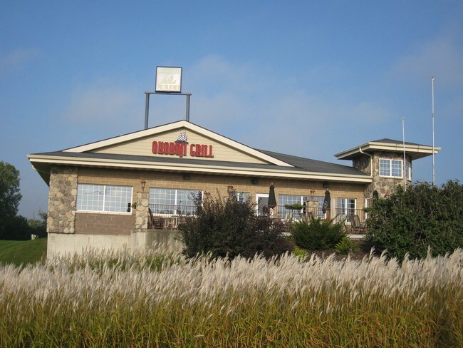
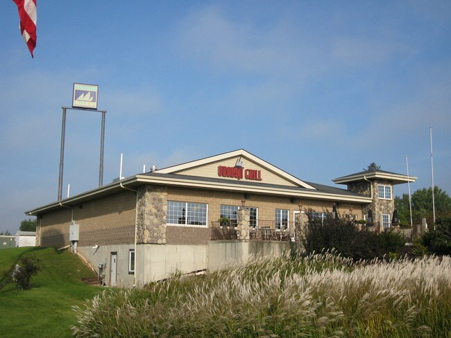
Property Record
1425 W 19Th St S, Newton, IA 50208
NEARBY LISTINGS FOR SALE OR LEASE
Property Detail
1425 W 19Th St S
13-05-226-015
PARCEL K IN NE NE & PT NE NE BEG 358.2' W & 352' S OF NE COR SEC 5; SW 140'-SW 60' -SW 15'-NW 25'-SW 75' -SE 50'-NE 75'-NW
Restaurantbuilding
Jasper
X
Iowa
19099C0187D
0.83 AC
2025
Iowa Southeast Area
2025
Other Market Areas
040300
Des Moines-West Des Moines, IA
5,145 SF
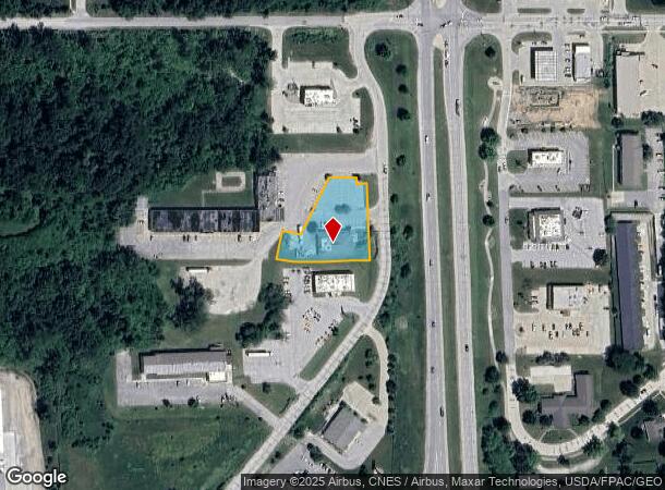
DEMOGRAPHICS near 1425 W 19Th St S
1 Mile
3 Mile
5 Mile
2024 Total Population
2,554
17,204
19,620
2029 Population
2,570
17,510
19,947
Pop Growth 2024-2029
+ 0.63%
+ 1.78%
+ 1.67%
Average Age
42
42
42
2024 Total Households
1,041
7,359
8,328
HH Growth 2024-2029
+ 0.58%
+ 1.79%
+ 1.68%
Median Household Inc
$69,121
$53,032
$54,458
Avg Household Size
2.40
2.20
2.30
2024 Avg HH Vehicles
2.00
2.00
2.00
Median Home Value
$198,472
$138,883
$143,365
Median Year Built
1967
1964
1966
Nearby Places
Map Layers
Map Styles
 Street
 Aerial
- Restaurants
- Banks
- Shops
- Fitness
- Groceries
SALE & LEASE HISTORY
LISTING DATE
SALE/LEASE

Nov 21, 2019
For Sale
Apr 20, 2022
For Sale
Nearby Properties
Address
Land Use
TOTAL SIZE
Lot Size
Zoning
Address
Land Use
TOTAL SIZE
Lot Size
Zoning
5,200 SF
29.50 AC
Address
Land Use
TOTAL SIZE
Lot Size
Zoning
45,504 SF
83.15 AC
Address
Land Use
TOTAL SIZE
Lot Size
Zoning
220,239 SF
9.59 AC
Address
Land Use
TOTAL SIZE
Lot Size
Zoning
21,476 SF
10.85 AC
Address
Land Use
TOTAL SIZE
Lot Size
Zoning
20,314 SF
0.79 AC
Address
Land Use
TOTAL SIZE
Lot Size
Zoning
161,016 SF
3.23 AC
Address
Land Use
TOTAL SIZE
Lot Size
Zoning
Address
Land Use
TOTAL SIZE
Lot Size
Zoning
800 SF
27.84 AC
Address
Land Use
TOTAL SIZE
Lot Size
Zoning
26,256 SF
3.90 AC
Address
Land Use
TOTAL SIZE
Lot Size
Zoning
2,321 SF
0.93 AC
Address
Land Use
TOTAL SIZE
Lot Size
Zoning
63,208 SF
12.35 AC
Address
Land Use
TOTAL SIZE
Lot Size
Zoning
43,474 SF
7.16 AC
Address
Land Use
TOTAL SIZE
Lot Size
Zoning
66,500 SF
14.22 AC
Address
Land Use
TOTAL SIZE
Lot Size
Zoning
39,360 SF
1.88 AC
Address
Land Use
TOTAL SIZE
Lot Size
Zoning
432 SF
19.58 AC
Address
Land Use
TOTAL SIZE
Lot Size
Zoning
400 SF
12.59 AC
Address
Land Use
TOTAL SIZE
Lot Size
Zoning
1,040 SF
7.33 AC
Address
Land Use
TOTAL SIZE
Lot Size
Zoning
5,736 SF
17.30 AC
Address
Land Use
TOTAL SIZE
Lot Size
Zoning
40,383 SF
0.96 AC
Address
Land Use
TOTAL SIZE
Lot Size
Zoning
400 SF
18.34 AC
Address
Land Use
TOTAL SIZE
Lot Size
Zoning
19,592 SF
1.80 AC
Address
Land Use
TOTAL SIZE
Lot Size
Zoning
Address
Land Use
TOTAL SIZE
Lot Size
Zoning
20,335 SF
1.43 AC
Address
Land Use
TOTAL SIZE
Lot Size
Zoning
2,888 SF
3.55 AC
Address
Land Use
TOTAL SIZE
Lot Size
Zoning
6.48 AC
Address
Land Use
TOTAL SIZE
Lot Size
Zoning
87,120 SF
0.40 AC
Address
Land Use
TOTAL SIZE
Lot Size
Zoning
1.79 AC
Address
Land Use
TOTAL SIZE
Lot Size
Zoning
7,094 SF
1.64 AC
Address
Land Use
TOTAL SIZE
Lot Size
Zoning
15,200 SF
39.45 AC
Address
Land Use
TOTAL SIZE
Lot Size
Zoning
77,880 SF
5.27 AC
The World's #1 Commercial Real Estate Marketplace
Connect with us
© 2026 CoStar Group
The information above has been obtained from sources believed reliable. While we do not doubt its accuracy we have not verified it and make no guarantee, warranty or representation about it. It is your responsibility to independently confirm its accuracy and completeness. Any projections, opinions, assumptions, or estimates used are for example only and do not represent the current or future performance of the property. The value of this transaction to you depends on tax and other factors which should be evaluated by your tax, financial, and legal advisors. You and your advisors should conduct a careful, independent investigation of the property to determine to your satisfaction the suitability of the property for your needs.