No Photo
Property Record
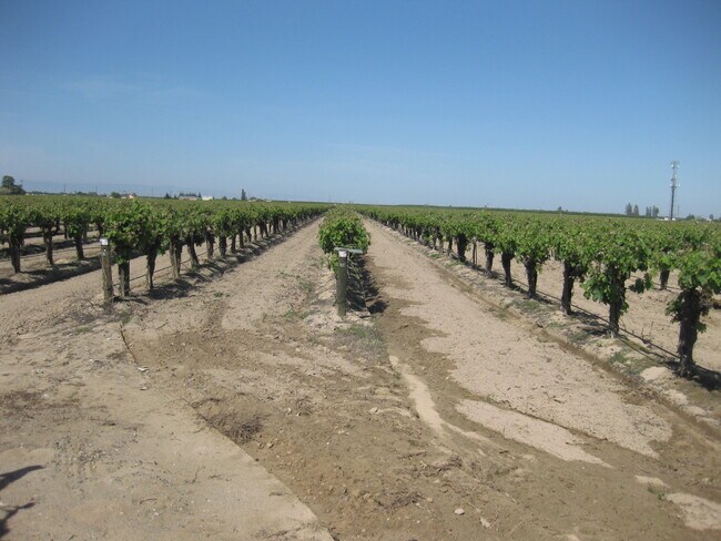
14259 S Marks Ave, Caruthers, CA 93609


NEARBY LISTINGS FOR SALE OR LEASE
-
-
View all Caruthers listings for sale on LoopNet.com
Property Detail
14259 S Marks Ave
Fresno, CA
Westmoreland
041-192-12S
SUR RT 60.09 AC LOTS 14-16 WESTMORELAND TR
Vineyard
Fresno
X
California
06019C2625H
15
2025
60.07 AC
2025
W Outlying Fresno County
007500
Fresno
DEMOGRAPHICS near 14259 S Marks Ave
1 Mile
3 Mile
5 Mile
2024 Total Population
1,065
3,497
5,329
2029 Population
1,043
3,367
5,132
Pop Growth 2024-2029
(2.07%)
(3.72%)
(3.70%)
Average Age
34
34
35
2024 Total Households
280
923
1,429
HH Growth 2024-2029
(2.14%)
(3.79%)
(3.71%)
Median Household Inc
$62,000
$59,118
$58,008
Avg Household Size
3.60
3.50
3.50
2024 Avg HH Vehicles
3.00
2.00
2.00
Median Home Value
$251,874
$264,871
$277,015
Median Year Built
1973
1968
1969
Nearby Places
Map Layers
Map Styles
 Street
 Aerial
- Restaurants
- Banks
- Shops
- Fitness
- Groceries
PUBLIC TRANSPORTATION
AIRPORT
Fresno Yosemite International
DRIVE
WALK
Distance
Fresno Yosemite International
35 min
23.4 mi
Freight Ports
Port of Stockton
DRIVE
WALK
Distance
Port of Stockton
175 min
144.7 mi
SALE & LEASE HISTORY
LISTING DATE
SALE/LEASE

Apr 23, 2020
For Sale
Nearby Properties
Address
Land Use
TOTAL SIZE
Lot Size
Zoning
Address
Land Use
TOTAL SIZE
Lot Size
Zoning
1,804 SF
80 AC
AE20
Address
Land Use
TOTAL SIZE
Lot Size
Zoning
1,438 SF
19.32 AC
AE20
Address
Land Use
TOTAL SIZE
Lot Size
Zoning
78.80 AC
AE20
Address
Land Use
TOTAL SIZE
Lot Size
Zoning
3,011 SF
75 AC
AE20
Address
Land Use
TOTAL SIZE
Lot Size
Zoning
34,921 SF
3.07 AC
R2A
Address
Land Use
TOTAL SIZE
Lot Size
Zoning
26.22 AC
Address
Land Use
TOTAL SIZE
Lot Size
Zoning
819 SF
20 AC
AE20
Address
Land Use
TOTAL SIZE
Lot Size
Zoning
21,700 SF
37.62 AC
M2
Address
Land Use
TOTAL SIZE
Lot Size
Zoning
1,216 SF
318.18 AC
AE20
Address
Land Use
TOTAL SIZE
Lot Size
Zoning
9,100 SF
2.07 AC
MI
Address
Land Use
TOTAL SIZE
Lot Size
Zoning
6,902 SF
37 AC
AE20
Address
Land Use
TOTAL SIZE
Lot Size
Zoning
3,164 SF
60.09 AC
AE20
Address
Land Use
TOTAL SIZE
Lot Size
Zoning
57.96 AC
AE20
Address
Land Use
TOTAL SIZE
Lot Size
Zoning
1,417 SF
40 AC
AE20
Address
Land Use
TOTAL SIZE
Lot Size
Zoning
2,070 SF
38.80 AC
AE20
Address
Land Use
TOTAL SIZE
Lot Size
Zoning
1,000 SF
20 AC
AE20
Address
Land Use
TOTAL SIZE
Lot Size
Zoning
7,844 SF
3.05 AC
R1
Address
Land Use
TOTAL SIZE
Lot Size
Zoning
1,904 SF
47.20 AC
AE20
Address
Land Use
TOTAL SIZE
Lot Size
Zoning
13,322 SF
1.55 AC
C4
Address
Land Use
TOTAL SIZE
Lot Size
Zoning
1,847 SF
52.50 AC
AE20
Address
Land Use
TOTAL SIZE
Lot Size
Zoning
1,685 SF
41.90 AC
AE20
Address
Land Use
TOTAL SIZE
Lot Size
Zoning
14.41 AC
R1
Address
Land Use
TOTAL SIZE
Lot Size
Zoning
1,866 SF
39.40 AC
AE20
Address
Land Use
TOTAL SIZE
Lot Size
Zoning
72.88 AC
Address
Land Use
TOTAL SIZE
Lot Size
Zoning
158.18 AC
AE20
Address
Land Use
TOTAL SIZE
Lot Size
Zoning
19.44 AC
AE20
Address
Land Use
TOTAL SIZE
Lot Size
Zoning
864 SF
318.18 AC
AE20
Address
Land Use
TOTAL SIZE
Lot Size
Zoning
40 AC
AE20
Address
Land Use
TOTAL SIZE
Lot Size
Zoning
3,499 SF
104.45 AC
AE20
The World's #1 Commercial Real Estate Marketplace
Connect with us
© 2026 CoStar Group
The information above has been obtained from sources believed reliable. While we do not doubt its accuracy we have not verified it and make no guarantee, warranty or representation about it. It is your responsibility to independently confirm its accuracy and completeness. Any projections, opinions, assumptions, or estimates used are for example only and do not represent the current or future performance of the property. The value of this transaction to you depends on tax and other factors which should be evaluated by your tax, financial, and legal advisors. You and your advisors should conduct a careful, independent investigation of the property to determine to your satisfaction the suitability of the property for your needs.