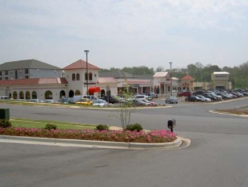
Property Record
1420 Paramount Dr, Huntsville, AL 35806


NEARBY LISTINGS FOR SALE OR LEASE
Property Detail
1420 Paramount Dr
Huntsville, AL
Main Line Subdivision
15-07-26-1-000-001.001
LOT 2 MAIN LINE SUBDIVISION PH 4 PB # 2018-28238
Stripcommercialcenter
Madison
AE
Alabama
01089C0164E
2
2025
4.81 AC
2025
North Huntsville
010627
Huntsville
19,980 SF
DEMOGRAPHICS near 1420 Paramount Dr
1 Mile
3 Mile
5 Mile
2024 Total Population
6,503
39,099
120,418
2029 Population
7,325
43,548
133,661
Pop Growth 2024-2029
+ 12.64%
+ 11.38%
+ 11.00%
Average Age
39
39
38
2024 Total Households
3,530
17,474
49,419
HH Growth 2024-2029
+ 13.20%
+ 12.06%
+ 11.64%
Median Household Inc
$86,495
$85,662
$81,920
Avg Household Size
1.80
2.10
2.30
2024 Avg HH Vehicles
2.00
2.00
2.00
Median Home Value
$319,608
$298,418
$264,242
Median Year Built
2009
2001
1994
Nearby Places
Map Layers
Map Styles
 Street
 Aerial
- Restaurants
- Banks
- Shops
- Fitness
- Groceries
PUBLIC TRANSPORTATION
AIRPORT
Huntsville International-Carl T Jones Field
DRIVE
WALK
Distance
Huntsville International-Carl T Jones Field
21 min
13.2 mi
SALE & LEASE HISTORY
LISTING DATE
SALE/LEASE

Sep 26, 2023
For Lease
Sep 25, 2016
For Lease
Oct 07, 2016
For Lease
Apr 26, 2017
For Lease
Apr 09, 2019
For Lease
Nearby Properties
Address
Land Use
TOTAL SIZE
Lot Size
Zoning
Address
Land Use
TOTAL SIZE
Lot Size
Zoning
61,684 SF
52 AC
Address
Land Use
TOTAL SIZE
Lot Size
Zoning
34,373 SF
20.08 AC
Address
Land Use
TOTAL SIZE
Lot Size
Zoning
9,056 SF
39.70 AC
Address
Land Use
TOTAL SIZE
Lot Size
Zoning
61,245 SF
3.39 AC
Address
Land Use
TOTAL SIZE
Lot Size
Zoning
15,182 SF
20 AC
Address
Land Use
TOTAL SIZE
Lot Size
Zoning
18,232 SF
19 AC
Address
Land Use
TOTAL SIZE
Lot Size
Zoning
13,345 SF
18 AC
Address
Land Use
TOTAL SIZE
Lot Size
Zoning
14,008 SF
19 AC
Address
Land Use
TOTAL SIZE
Lot Size
Zoning
4,367 SF
27 AC
Address
Land Use
TOTAL SIZE
Lot Size
Zoning
79,332 SF
4.03 AC
Address
Land Use
TOTAL SIZE
Lot Size
Zoning
59,317 SF
3.38 AC
Address
Land Use
TOTAL SIZE
Lot Size
Zoning
4,470 SF
20 AC
Address
Land Use
TOTAL SIZE
Lot Size
Zoning
4,681 SF
8.36 AC
Address
Land Use
TOTAL SIZE
Lot Size
Zoning
14,665 SF
7.40 AC
Address
Land Use
TOTAL SIZE
Lot Size
Zoning
3,363 SF
26.88 AC
Address
Land Use
TOTAL SIZE
Lot Size
Zoning
7,384 SF
11.50 AC
Address
Land Use
TOTAL SIZE
Lot Size
Zoning
195,300 SF
Address
Land Use
TOTAL SIZE
Lot Size
Zoning
10,399 SF
31.50 AC
Address
Land Use
TOTAL SIZE
Lot Size
Zoning
343,176 SF
23 AC
Address
Land Use
TOTAL SIZE
Lot Size
Zoning
6,258 SF
14 AC
Address
Land Use
TOTAL SIZE
Lot Size
Zoning
1,454 SF
14.22 AC
Address
Land Use
TOTAL SIZE
Lot Size
Zoning
3,644 SF
25.74 AC
Address
Land Use
TOTAL SIZE
Lot Size
Zoning
60,647 SF
4.90 AC
Address
Land Use
TOTAL SIZE
Lot Size
Zoning
3,257 SF
25.84 AC
Address
Land Use
TOTAL SIZE
Lot Size
Zoning
61,745 SF
7.51 AC
Address
Land Use
TOTAL SIZE
Lot Size
Zoning
28,890 SF
3.15 AC
Address
Land Use
TOTAL SIZE
Lot Size
Zoning
19,078 SF
10 AC
Address
Land Use
TOTAL SIZE
Lot Size
Zoning
7,529 SF
16 AC
Address
Land Use
TOTAL SIZE
Lot Size
Zoning
4,324 SF
38 AC
Address
Land Use
TOTAL SIZE
Lot Size
Zoning
76,644 SF
14 AC
The World's #1 Commercial Real Estate Marketplace
Connect with us
© 2026 CoStar Group
The information above has been obtained from sources believed reliable. While we do not doubt its accuracy we have not verified it and make no guarantee, warranty or representation about it. It is your responsibility to independently confirm its accuracy and completeness. Any projections, opinions, assumptions, or estimates used are for example only and do not represent the current or future performance of the property. The value of this transaction to you depends on tax and other factors which should be evaluated by your tax, financial, and legal advisors. You and your advisors should conduct a careful, independent investigation of the property to determine to your satisfaction the suitability of the property for your needs.