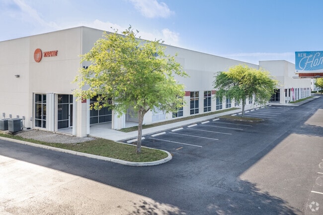
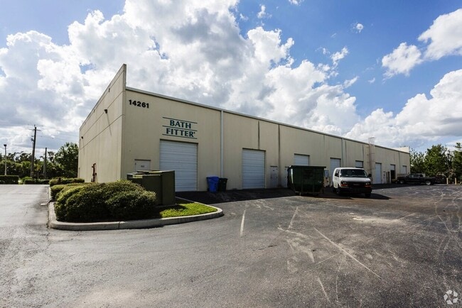
Property Record
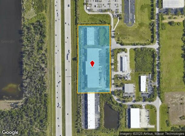
14241/261 Jetport Loop W, Fort Myers, FL 33913

Current Lease Availabilities
NEARBY LISTINGS FOR SALE OR LEASE
Property Detail
14241/261 Jetport Loop W
Cape Coral-Fort Myers, FL
E. Daniels Rd / Airport
27-45-25-01-00000.0280
JETPORT-INTERSTATE COMMERCE PK PB 43 PG 98 LOTS 28 + 29
Warehouse
Lee
X
Florida
12071C0445F
28,29
2024
6.71 AC
2025
S Ft Myers/San Carlos
980000
Southwest Florida
84,206 SF
DEMOGRAPHICS near 14241/261 Jetport Loop W
1 Mile
3 Mile
5 Mile
2024 Total Population
1,347
20,900
88,358
2029 Population
1,617
25,079
105,355
Pop Growth 2024-2029
+ 20.04%
+ 20.00%
+ 19.24%
Average Age
64
55
48
2024 Total Households
667
9,785
38,697
HH Growth 2024-2029
+ 19.64%
+ 19.82%
+ 19.05%
Median Household Inc
$93,088
$90,943
$81,168
Avg Household Size
1.90
2.10
2.20
2024 Avg HH Vehicles
2.00
2.00
2.00
Median Home Value
$363,749
$360,181
$321,788
Median Year Built
1995
2003
2001
Nearby Places
- Restaurants
- Banks
- Shops
- Fitness
- Groceries
PUBLIC TRANSPORTATION
AIRPORT
Southwest Florida International
DRIVE
WALK
Distance
Southwest Florida International
12 min
4.1 mi
Punta Gorda
DRIVE
WALK
Distance
Punta Gorda
43 min
33.0 mi
Nearby Properties
Address
Land Use
TOTAL SIZE
Lot Size
Zoning
Address
Land Use
TOTAL SIZE
Lot Size
Zoning
545,043 SF
16.29 AC
C-1
Address
Land Use
TOTAL SIZE
Lot Size
Zoning
21.08 AC
MDP-3
Address
Land Use
TOTAL SIZE
Lot Size
Zoning
311,796 SF
32.56 AC
IL
Address
Land Use
TOTAL SIZE
Lot Size
Zoning
15.08 AC
Address
Land Use
TOTAL SIZE
Lot Size
Zoning
246,785 SF
18.54 AC
AOPD
Address
Land Use
TOTAL SIZE
Lot Size
Zoning
14.15 AC
CPD
Address
Land Use
TOTAL SIZE
Lot Size
Zoning
24,552 SF
71.20 AC
IPD
Address
Land Use
TOTAL SIZE
Lot Size
Zoning
34.63 AC
AG-2
Address
Land Use
TOTAL SIZE
Lot Size
Zoning
158,775 SF
13.72 AC
MPD
Address
Land Use
TOTAL SIZE
Lot Size
Zoning
315,233 SF
75.18 AC
CPD
Address
Land Use
TOTAL SIZE
Lot Size
Zoning
270,752 SF
45.08 AC
IPD
Address
Land Use
TOTAL SIZE
Lot Size
Zoning
33.21 AC
AG-2
Address
Land Use
TOTAL SIZE
Lot Size
Zoning
204,456 SF
5.21 AC
C-1
Address
Land Use
TOTAL SIZE
Lot Size
Zoning
213,556 SF
18.17 AC
CPD
Address
Land Use
TOTAL SIZE
Lot Size
Zoning
10.16 AC
MDP-3
Address
Land Use
TOTAL SIZE
Lot Size
Zoning
10.50 AC
AG-2
Address
Land Use
TOTAL SIZE
Lot Size
Zoning
263,160 SF
19.96 AC
IPD
Address
Land Use
TOTAL SIZE
Lot Size
Zoning
198,225 SF
28.77 AC
IPD
Address
Land Use
TOTAL SIZE
Lot Size
Zoning
Address
Land Use
TOTAL SIZE
Lot Size
Zoning
16.84 AC
IPD
Address
Land Use
TOTAL SIZE
Lot Size
Zoning
159,937 SF
11.82 AC
MPD
Address
Land Use
TOTAL SIZE
Lot Size
Zoning
201,426 SF
15 AC
MPD
Address
Land Use
TOTAL SIZE
Lot Size
Zoning
94,930 SF
0.51 AC
MPD
Address
Land Use
TOTAL SIZE
Lot Size
Zoning
66,686 SF
8.35 AC
MPD
Address
Land Use
TOTAL SIZE
Lot Size
Zoning
180,386 SF
10.11 AC
IPD
Address
Land Use
TOTAL SIZE
Lot Size
Zoning
96,408 SF
5.75 AC
PUD
Address
Land Use
TOTAL SIZE
Lot Size
Zoning
68,185 SF
29.25 AC
CFPD
Address
Land Use
TOTAL SIZE
Lot Size
Zoning
221,486 SF
74.60 AC
PUD
Address
Land Use
TOTAL SIZE
Lot Size
Zoning
108,087 SF
3.53 AC
CPD
Address
Land Use
TOTAL SIZE
Lot Size
Zoning
100,413 SF
0.67 AC
MPD
The World's #1 Commercial Real Estate Marketplace
Connect with us
© 2025 CoStar Group
The information above has been obtained from sources believed reliable. While we do not doubt its accuracy we have not verified it and make no guarantee, warranty or representation about it. It is your responsibility to independently confirm its accuracy and completeness. Any projections, opinions, assumptions, or estimates used are for example only and do not represent the current or future performance of the property. The value of this transaction to you depends on tax and other factors which should be evaluated by your tax, financial, and legal advisors. You and your advisors should conduct a careful, independent investigation of the property to determine to your satisfaction the suitability of the property for your needs.