Property Record
1427 Lower Dallas Highway Hwy, Gastonia, NC 28056


NEARBY LISTINGS FOR SALE OR LEASE
Property Detail
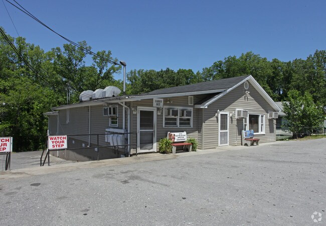
1427 Lower Dallas Highway Hwy
300856
WILLIAM H GANTT BLK A LOTS 1-27 & ADD'L PLAT BOOK 010 PAGE 057
Restaurantbuilding
Gaston
X
North Carolina
3710354600J
1-27
2025
8.01 AC
2025
Gaston County
033303
Charlotte
6,878 SF
Charlotte-Concord-Gastonia, NC-SC
DEMOGRAPHICS near 1427 Lower Dallas Highway Hwy
1 Mile
3 Mile
5 Mile
2024 Total Population
5,705
29,216
80,270
2029 Population
6,041
31,087
85,550
Pop Growth 2024-2029
+ 5.89%
+ 6.40%
+ 6.58%
Average Age
37
38
39
2024 Total Households
2,158
11,241
32,123
HH Growth 2024-2029
+ 6.07%
+ 6.59%
+ 6.73%
Median Household Inc
$52,339
$45,627
$47,145
Avg Household Size
2.60
2.50
2.40
2024 Avg HH Vehicles
2.00
2.00
2.00
Median Home Value
$175,611
$168,203
$179,503
Median Year Built
1980
1975
1973
Nearby Places
Map Layers
Map Styles
 Street
 Aerial
- Restaurants
- Banks
- Shops
- Fitness
- Groceries
PUBLIC TRANSPORTATION
COMMUTER RAIL
DRIVE
WALK
Distance
7 min
3.4 mi
AIRPORT
Charlotte/Douglas International
DRIVE
WALK
Distance
Charlotte/Douglas International
32 min
17.5 mi
Concord-Padgett Regional
DRIVE
WALK
Distance
Concord-Padgett Regional
45 min
33.9 mi
SALE & LEASE HISTORY
LISTING DATE
SALE/LEASE

Sep 23, 2016
For Sale
May 09, 2017
For Sale
Feb 16, 2018
For Sale
Nearby Properties
Address
Land Use
TOTAL SIZE
Lot Size
Zoning
Address
Land Use
TOTAL SIZE
Lot Size
Zoning
56,000 SF
23.22 AC
GOV01
Address
Land Use
TOTAL SIZE
Lot Size
Zoning
11,696 SF
159.68 AC
Address
Land Use
TOTAL SIZE
Lot Size
Zoning
159,263 SF
9.83 AC
GOV01
Address
Land Use
TOTAL SIZE
Lot Size
Zoning
192,315 SF
44.12 AC
INDS1
Address
Land Use
TOTAL SIZE
Lot Size
Zoning
103,890 SF
8.81 AC
OFF04
Address
Land Use
TOTAL SIZE
Lot Size
Zoning
2,688 SF
22.48 AC
OFF01
Address
Land Use
TOTAL SIZE
Lot Size
Zoning
1,680 SF
19.08 AC
OFF01
Address
Land Use
TOTAL SIZE
Lot Size
Zoning
Address
Land Use
TOTAL SIZE
Lot Size
Zoning
123,948 SF
6.94 AC
GOV05
Address
Land Use
TOTAL SIZE
Lot Size
Zoning
135,840 SF
11.21 AC
Address
Land Use
TOTAL SIZE
Lot Size
Zoning
411,076 SF
67.01 AC
INDS2
Address
Land Use
TOTAL SIZE
Lot Size
Zoning
53,260 SF
2.18 AC
HOTL1
Address
Land Use
TOTAL SIZE
Lot Size
Zoning
176,657 SF
16.19 AC
Address
Land Use
TOTAL SIZE
Lot Size
Zoning
154,681 SF
63.07 AC
INDS1
Address
Land Use
TOTAL SIZE
Lot Size
Zoning
83,664 SF
2.23 AC
HOTL1
Address
Land Use
TOTAL SIZE
Lot Size
Zoning
163,100 SF
41.60 AC
INDS1
Address
Land Use
TOTAL SIZE
Lot Size
Zoning
16,776 SF
49.87 AC
PUB01
Address
Land Use
TOTAL SIZE
Lot Size
Zoning
50,661 SF
2.32 AC
R1
Address
Land Use
TOTAL SIZE
Lot Size
Zoning
148,300 SF
12.59 AC
INDS2
Address
Land Use
TOTAL SIZE
Lot Size
Zoning
1,914 SF
15.78 AC
MRKT1
Address
Land Use
TOTAL SIZE
Lot Size
Zoning
63,900 SF
2.41 AC
HOTL1
Address
Land Use
TOTAL SIZE
Lot Size
Zoning
49,316 SF
1.70 AC
HOTL1
Address
Land Use
TOTAL SIZE
Lot Size
Zoning
13,017 SF
10.75 AC
REST1
Address
Land Use
TOTAL SIZE
Lot Size
Zoning
46,807 SF
4.36 AC
Address
Land Use
TOTAL SIZE
Lot Size
Zoning
3,328 SF
10.16 AC
APT02
Address
Land Use
TOTAL SIZE
Lot Size
Zoning
20,160 SF
18.47 AC
PUB01
Address
Land Use
TOTAL SIZE
Lot Size
Zoning
44,224 SF
3.32 AC
Address
Land Use
TOTAL SIZE
Lot Size
Zoning
1,522 SF
15.71 AC
APT01
Address
Land Use
TOTAL SIZE
Lot Size
Zoning
19,609 SF
5.34 AC
OFF01
Address
Land Use
TOTAL SIZE
Lot Size
Zoning
4,228 SF
11.39 AC
APT02
The World's #1 Commercial Real Estate Marketplace
Connect with us
© 2026 CoStar Group
The information above has been obtained from sources believed reliable. While we do not doubt its accuracy we have not verified it and make no guarantee, warranty or representation about it. It is your responsibility to independently confirm its accuracy and completeness. Any projections, opinions, assumptions, or estimates used are for example only and do not represent the current or future performance of the property. The value of this transaction to you depends on tax and other factors which should be evaluated by your tax, financial, and legal advisors. You and your advisors should conduct a careful, independent investigation of the property to determine to your satisfaction the suitability of the property for your needs.