Property Record
14275 Interstate 10 E, Schertz, TX 78154
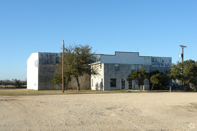

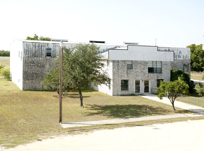

Property Detail
14275 Interstate 10 E
San Antonio-New Braunfels, TX
CB 5193B BLK 200 LOT 5 & 6
05193-200-0051
BEXAR
Warehouse
Texas
B and X Area of moderate flood hazard, usually the area between the limits of the 100-year and 500-year floods.
51
2024
2.01 AC
2025
Northeast
131601
San Antonio
7,500 SF
NEARBY LISTINGS FOR SALE OR LEASE
DEMOGRAPHICS near 14275 Interstate 10 E
1 mile
3 mile
5 mile
2025 Total Population
203
6,647
18,775
2030 Population
222
7,511
20,962
Pop Growth 2025-2030
+ 9.36%
+ 13.00%
+ 11.65%
Average Age
42
39
39
2025 Total Households
73
2,322
6,535
HH Growth 2025-2030
+ 10.96%
+ 13.14%
+ 12.09%
Median Household Inc
$96,428
$98,686
$96,307
Avg Household Size
2.70
2.90
2.90
2025 Avg HH Vehicles
3.00
2.00
2.00
Median Home Value
$353,124
$351,105
$372,136
Median Year Built
1995
2010
2010
Nearby Places
Map Layers
Map Styles
 Street
 Aerial
Transit
 Traffic
 Biking
Places
Listings with unknown addresses are not visible on the map
- Restaurants
- Banks
- Shops
- Fitness
- Groceries
PUBLIC TRANSPORTATION
AIRPORT
San Antonio International
Drive
Walk
Distance
San Antonio International
32 min
24.6 mi
Nearby Properties
Address
Land Use
TOTAL SIZE
Lot Size
Zoning
Address
Land Use
TOTAL SIZE
Lot Size
Zoning
398,442 SF
14.62 AC
Address
Land Use
TOTAL SIZE
Lot Size
Zoning
191,300 SF
5 AC
Address
Land Use
TOTAL SIZE
Lot Size
Zoning
74,210 SF
34.98 AC
Address
Land Use
TOTAL SIZE
Lot Size
Zoning
1,036 SF
165.64 AC
Address
Land Use
TOTAL SIZE
Lot Size
Zoning
167.75 AC
Address
Land Use
TOTAL SIZE
Lot Size
Zoning
74.97 AC
Address
Land Use
TOTAL SIZE
Lot Size
Zoning
65,138 SF
13.69 AC
Address
Land Use
TOTAL SIZE
Lot Size
Zoning
47,601 SF
5.76 AC
Address
Land Use
TOTAL SIZE
Lot Size
Zoning
63.79 AC
Address
Land Use
TOTAL SIZE
Lot Size
Zoning
65,556 SF
4.78 AC
Address
Land Use
TOTAL SIZE
Lot Size
Zoning
1,246 SF
218.03 AC
Address
Land Use
TOTAL SIZE
Lot Size
Zoning
1,292 SF
112.47 AC
Address
Land Use
TOTAL SIZE
Lot Size
Zoning
4,120 SF
83.68 AC
Address
Land Use
TOTAL SIZE
Lot Size
Zoning
142,016 SF
16.35 AC
Address
Land Use
TOTAL SIZE
Lot Size
Zoning
1,440 SF
275 AC
Address
Land Use
TOTAL SIZE
Lot Size
Zoning
189.56 AC
Address
Land Use
TOTAL SIZE
Lot Size
Zoning
101.94 AC
Address
Land Use
TOTAL SIZE
Lot Size
Zoning
1,302 SF
83.98 AC
Address
Land Use
TOTAL SIZE
Lot Size
Zoning
95.46 AC
Address
Land Use
TOTAL SIZE
Lot Size
Zoning
95,900 SF
3.23 AC
Address
Land Use
TOTAL SIZE
Lot Size
Zoning
119.15 AC
Address
Land Use
TOTAL SIZE
Lot Size
Zoning
59,989 SF
5.07 AC
Address
Land Use
TOTAL SIZE
Lot Size
Zoning
78.15 AC
Address
Land Use
TOTAL SIZE
Lot Size
Zoning
76.77 AC
Address
Land Use
TOTAL SIZE
Lot Size
Zoning
4,778 SF
101.35 AC
Address
Land Use
TOTAL SIZE
Lot Size
Zoning
90.54 AC
Address
Land Use
TOTAL SIZE
Lot Size
Zoning
1,084 SF
69.15 AC
Address
Land Use
TOTAL SIZE
Lot Size
Zoning
14,502 SF
27.01 AC
Address
Land Use
TOTAL SIZE
Lot Size
Zoning
1,152 SF
150.90 AC
Address
Land Use
TOTAL SIZE
Lot Size
Zoning
The World's #1 Commercial Real Estate Marketplace
Connect with us
© 2026 CoStar Group
The information above has been obtained from sources believed reliable. While we do not doubt its accuracy we have not verified it and make no guarantee, warranty or representation about it. It is your responsibility to independently confirm its accuracy and completeness. Any projections, opinions, assumptions, or estimates used are for example only and do not represent the current or future performance of the property. The value of this transaction to you depends on tax and other factors which should be evaluated by your tax, financial, and legal advisors. You and your advisors should conduct a careful, independent investigation of the property to determine to your satisfaction the suitability of the property for your needs.