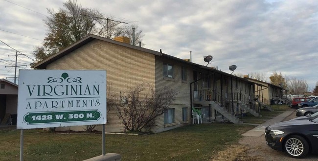
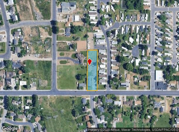
Property Record
1428 W 300 N, Clearfield, UT 84015
NEARBY LISTINGS FOR SALE OR LEASE
Property Detail
1428 W 300 N
Ogden, UT
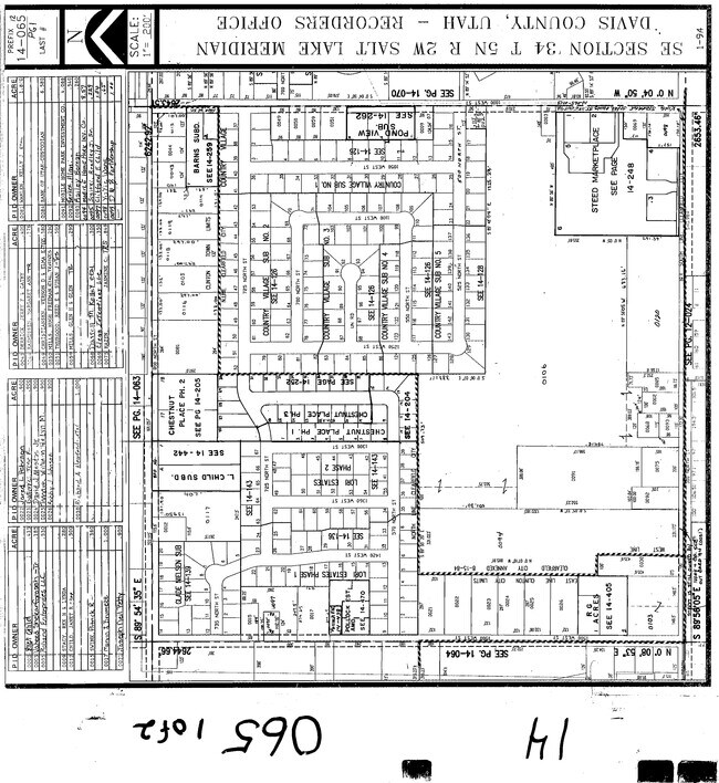
BEG 330 FT E OF THE SW COR OF THE SE 1/4 OF SEC 34-T5N-R2W, SLB&M; & RUN TH E 100 FT; TH N 435.6 FT; TH W 100 FT; TH S 435.6 FT TO BEG. LESS & EXCEPT THAT PORTION OF LAND LYING WITHIN THE COUNTY RO
14-065-0126
Davis
Multifamilydwelling
Utah
2025
0.92 AC
2025
Clinton
125501
Salt Lake City
5,562 SF
DEMOGRAPHICS near 1428 W 300 N
1 Mile
3 Mile
5 Mile
2024 Total Population
12,753
97,043
195,464
2029 Population
13,447
103,238
208,722
Pop Growth 2024-2029
+ 5.44%
+ 6.38%
+ 6.78%
Average Age
34
33
34
2024 Total Households
3,764
28,777
60,471
HH Growth 2024-2029
+ 5.50%
+ 6.51%
+ 6.92%
Median Household Inc
$89,055
$88,901
$83,916
Avg Household Size
3.30
3.30
3.20
2024 Avg HH Vehicles
2.00
2.00
2.00
Median Home Value
$365,435
$383,292
$373,100
Median Year Built
1992
1995
1995
Nearby Places
Map Layers
Map Styles
 Street
 Aerial
- Restaurants
- Banks
- Shops
- Fitness
- Groceries
PUBLIC TRANSPORTATION
COMMUTER RAIL
Clearfield (FrontRunner North - Utah Transit Authority (UTA))
DRIVE
WALK
Distance
Clearfield (FrontRunner North - Utah Transit Authority (UTA))
8 min
3.7 mi
Roy (FrontRunner North - Utah Transit Authority (UTA))
DRIVE
WALK
Distance
Roy (FrontRunner North - Utah Transit Authority (UTA))
13 min
6.9 mi
AIRPORT
Salt Lake City International
DRIVE
WALK
Distance
Salt Lake City International
41 min
32.9 mi
Freight Ports
Port of Stockton
DRIVE
WALK
Distance
Port of Stockton
741 min
723.3 mi
SALE & LEASE HISTORY
LISTING DATE
SALE/LEASE

May 23, 2018
For Sale
Nearby Properties
Address
Land Use
TOTAL SIZE
Lot Size
Zoning
Address
Land Use
TOTAL SIZE
Lot Size
Zoning
399,630 SF
31.55 AC
I
Address
Land Use
TOTAL SIZE
Lot Size
Zoning
664,440 SF
37.07 AC
Address
Land Use
TOTAL SIZE
Lot Size
Zoning
151,064 SF
48.81 AC
Address
Land Use
TOTAL SIZE
Lot Size
Zoning
86,213 SF
12.27 AC
Address
Land Use
TOTAL SIZE
Lot Size
Zoning
123,824 SF
41.89 AC
M1
Address
Land Use
TOTAL SIZE
Lot Size
Zoning
125,164 SF
7.12 AC
Address
Land Use
TOTAL SIZE
Lot Size
Zoning
121,332 SF
44.40 AC
Address
Land Use
TOTAL SIZE
Lot Size
Zoning
123,445 SF
27.94 AC
M1
Address
Land Use
TOTAL SIZE
Lot Size
Zoning
27,763 SF
11.41 AC
Address
Land Use
TOTAL SIZE
Lot Size
Zoning
638,065 SF
33.77 AC
M1
Address
Land Use
TOTAL SIZE
Lot Size
Zoning
91,750 SF
6.76 AC
C2
Address
Land Use
TOTAL SIZE
Lot Size
Zoning
63,828 SF
5.30 AC
PF
Address
Land Use
TOTAL SIZE
Lot Size
Zoning
1,540 SF
11.52 AC
Address
Land Use
TOTAL SIZE
Lot Size
Zoning
453,129 SF
24.72 AC
M1
Address
Land Use
TOTAL SIZE
Lot Size
Zoning
76,778 SF
5.51 AC
Address
Land Use
TOTAL SIZE
Lot Size
Zoning
26,058 SF
5.86 AC
Address
Land Use
TOTAL SIZE
Lot Size
Zoning
5,481 SF
15.54 AC
Address
Land Use
TOTAL SIZE
Lot Size
Zoning
74,995 SF
6.07 AC
Address
Land Use
TOTAL SIZE
Lot Size
Zoning
223,079 SF
22.55 AC
Address
Land Use
TOTAL SIZE
Lot Size
Zoning
503,599 SF
47.71 AC
M1
Address
Land Use
TOTAL SIZE
Lot Size
Zoning
199,214 SF
19.59 AC
C1
Address
Land Use
TOTAL SIZE
Lot Size
Zoning
232,057 SF
35.90 AC
R19
Address
Land Use
TOTAL SIZE
Lot Size
Zoning
2,177 SF
14.40 AC
R3
The World's #1 Commercial Real Estate Marketplace
Connect with us
© 2026 CoStar Group
The information above has been obtained from sources believed reliable. While we do not doubt its accuracy we have not verified it and make no guarantee, warranty or representation about it. It is your responsibility to independently confirm its accuracy and completeness. Any projections, opinions, assumptions, or estimates used are for example only and do not represent the current or future performance of the property. The value of this transaction to you depends on tax and other factors which should be evaluated by your tax, financial, and legal advisors. You and your advisors should conduct a careful, independent investigation of the property to determine to your satisfaction the suitability of the property for your needs.