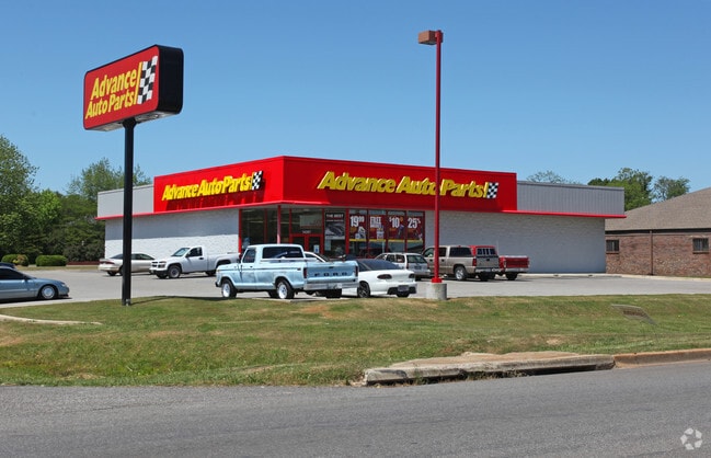
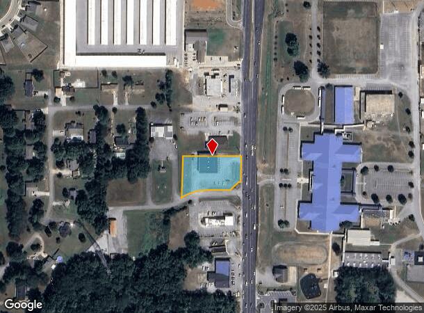
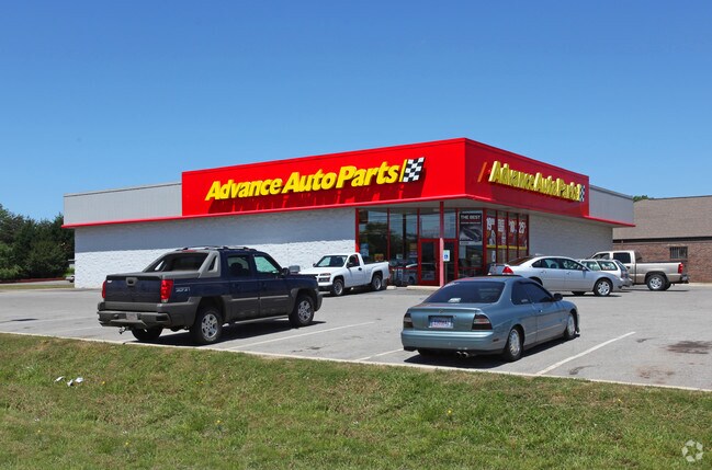
Property Record
14287 Highway 231 431 N, Hazel Green, AL 35750
NEARBY LISTINGS FOR SALE OR LEASE
Property Detail
14287 Highway 231 431 N
04-06-24-4-000-061.003
SEC 24 T1S R1W PART OF THE SE 1/4 OF SEC 24 DESC AS COM AT THE SE COR OF SD SE 1/4 TH N 25 FT TH W 676.20 FT TH N 01 DEG W 11
Storesoffices
Madison
X
Alabama
47103C0425E
0.98 AC
2025
North Madison County
2025
Huntsville
010304
Huntsville, AL
6,944 SF
DEMOGRAPHICS near 14287 Highway 231 431 N
1 Mile
3 Mile
5 Mile
2024 Total Population
1,879
8,780
23,197
2029 Population
2,111
9,850
26,046
Pop Growth 2024-2029
+ 12.35%
+ 12.19%
+ 12.28%
Average Age
40
40
40
2024 Total Households
729
3,364
8,845
HH Growth 2024-2029
+ 12.76%
+ 12.57%
+ 12.70%
Median Household Inc
$72,906
$77,905
$83,190
Avg Household Size
2.50
2.60
2.60
2024 Avg HH Vehicles
2.00
2.00
2.00
Median Home Value
$160,031
$179,757
$217,346
Median Year Built
1991
1994
1998
Nearby Places
Map Layers
Map Styles
 Street
 Aerial
- Restaurants
- Banks
- Shops
- Fitness
- Groceries
PUBLIC TRANSPORTATION
AIRPORT
Huntsville International-Carl T Jones Field
DRIVE
WALK
Distance
Huntsville International-Carl T Jones Field
37 min
27.9 mi
Freight Ports
Port of Mobile
DRIVE
WALK
Distance
Port of Mobile
405 min
369.1 mi
Nearby Properties
Address
Land Use
TOTAL SIZE
Lot Size
Zoning
Address
Land Use
TOTAL SIZE
Lot Size
Zoning
156,342 SF
16.36 AC
Address
Land Use
TOTAL SIZE
Lot Size
Zoning
1,650 SF
8.56 AC
Address
Land Use
TOTAL SIZE
Lot Size
Zoning
4,870 SF
41 AC
Address
Land Use
TOTAL SIZE
Lot Size
Zoning
4,136 SF
2.94 AC
Address
Land Use
TOTAL SIZE
Lot Size
Zoning
30,440 SF
4.52 AC
Address
Land Use
TOTAL SIZE
Lot Size
Zoning
6,306 SF
1.37 AC
Address
Land Use
TOTAL SIZE
Lot Size
Zoning
17,134 SF
4.90 AC
Address
Land Use
TOTAL SIZE
Lot Size
Zoning
570 SF
1.37 AC
Address
Land Use
TOTAL SIZE
Lot Size
Zoning
4,528 SF
2.06 AC
Address
Land Use
TOTAL SIZE
Lot Size
Zoning
9,234 SF
1.48 AC
Address
Land Use
TOTAL SIZE
Lot Size
Zoning
4,890 SF
3.47 AC
Address
Land Use
TOTAL SIZE
Lot Size
Zoning
12,400 SF
1.66 AC
Address
Land Use
TOTAL SIZE
Lot Size
Zoning
5,244 SF
3.49 AC
Address
Land Use
TOTAL SIZE
Lot Size
Zoning
3,630 SF
1.20 AC
Address
Land Use
TOTAL SIZE
Lot Size
Zoning
6,881 SF
3.60 AC
Address
Land Use
TOTAL SIZE
Lot Size
Zoning
3.03 AC
Address
Land Use
TOTAL SIZE
Lot Size
Zoning
13,960 SF
2.90 AC
Address
Land Use
TOTAL SIZE
Lot Size
Zoning
6,150 SF
0.98 AC
Address
Land Use
TOTAL SIZE
Lot Size
Zoning
16,400 SF
7.35 AC
Address
Land Use
TOTAL SIZE
Lot Size
Zoning
Address
Land Use
TOTAL SIZE
Lot Size
Zoning
5,070 SF
1.02 AC
Address
Land Use
TOTAL SIZE
Lot Size
Zoning
4,245 SF
1 AC
Address
Land Use
TOTAL SIZE
Lot Size
Zoning
3,250 SF
0.96 AC
Address
Land Use
TOTAL SIZE
Lot Size
Zoning
6,300 SF
0.89 AC
Address
Land Use
TOTAL SIZE
Lot Size
Zoning
3,700 SF
0.96 AC
Address
Land Use
TOTAL SIZE
Lot Size
Zoning
7,076 SF
1.28 AC
Address
Land Use
TOTAL SIZE
Lot Size
Zoning
9,982 SF
2.07 AC
Address
Land Use
TOTAL SIZE
Lot Size
Zoning
2,242 SF
0.86 AC
Address
Land Use
TOTAL SIZE
Lot Size
Zoning
3,115 SF
0.97 AC
Address
Land Use
TOTAL SIZE
Lot Size
Zoning
171.28 AC
The World's #1 Commercial Real Estate Marketplace
Connect with us
© 2025 CoStar Group
The information above has been obtained from sources believed reliable. While we do not doubt its accuracy we have not verified it and make no guarantee, warranty or representation about it. It is your responsibility to independently confirm its accuracy and completeness. Any projections, opinions, assumptions, or estimates used are for example only and do not represent the current or future performance of the property. The value of this transaction to you depends on tax and other factors which should be evaluated by your tax, financial, and legal advisors. You and your advisors should conduct a careful, independent investigation of the property to determine to your satisfaction the suitability of the property for your needs.