Property Record
143 3Rd St, Newport, RI 02840
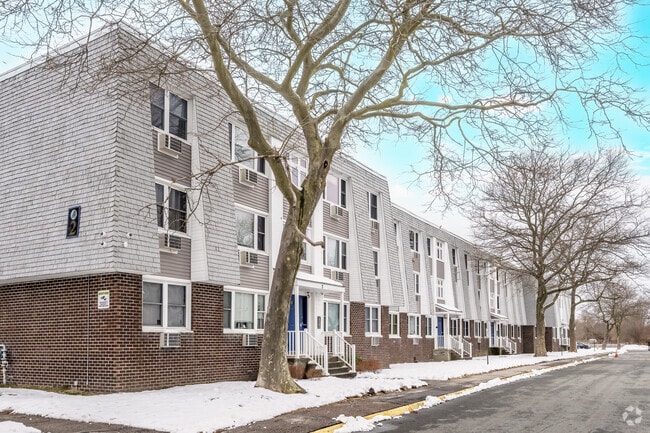

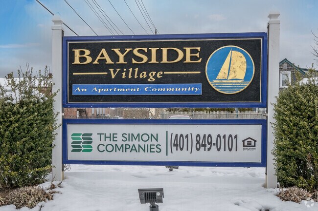
Property Detail
143 3Rd St
Apartment
Newport
R10
Rhode Island
AE The base floodplain where base flood elevations are provided. AE Zones are now used on new format FIRMs instead of A1-A30 Zones.
5.20 AC
2025
Newport
2025
Providence
041100
Providence-Warwick, RI-MA
114,608 SF
NEWP-000009-000000-000410
NEARBY LISTINGS FOR SALE OR LEASE
DEMOGRAPHICS near 143 3Rd St
1 mile
3 mile
5 mile
2025 Total Population
9,497
40,559
51,299
2030 Population
9,016
40,281
50,603
Pop Growth 2025-2030
(5.06%)
(0.69%)
(1.36%)
Average Age
43
43
44
2025 Total Households
4,329
17,504
21,873
HH Growth 2025-2030
(4.34%)
(1.98%)
(2.17%)
Median Household Inc
$84,816
$92,584
$99,378
Avg Household Size
2.00
2.10
2.20
2025 Avg HH Vehicles
1.00
2.00
2.00
Median Home Value
$756,316
$722,292
$743,720
Median Year Built
1946
1958
1963
Nearby Places
Map Layers
Map Styles
 Street
 Aerial
Transit
 Traffic
 Biking
Places
Listings with unknown addresses are not visible on the map
- Restaurants
- Banks
- Shops
- Fitness
- Groceries
PUBLIC TRANSPORTATION
AIRPORT
Rhode Island Tf Green International
Drive
Walk
Distance
Rhode Island Tf Green International
44 min
28.1 mi
Freight Ports
Port of Davisville, RI
Drive
Walk
Distance
Port of Davisville, RI
30 min
16.8 mi
Nearby Properties
Address
Land Use
TOTAL SIZE
Lot Size
Zoning
Address
Land Use
TOTAL SIZE
Lot Size
Zoning
60.03 AC
R40
Address
Land Use
TOTAL SIZE
Lot Size
Zoning
264,032 SF
3.73 AC
GB
Address
Land Use
TOTAL SIZE
Lot Size
Zoning
237,976 SF
8.99 AC
WB
Address
Land Use
TOTAL SIZE
Lot Size
Zoning
141,371 SF
12.59 AC
R60
Address
Land Use
TOTAL SIZE
Lot Size
Zoning
143,311 SF
2.94 AC
GB
Address
Land Use
TOTAL SIZE
Lot Size
Zoning
63,510 SF
13.17 AC
R60
Address
Land Use
TOTAL SIZE
Lot Size
Zoning
249,902 SF
27.88 AC
UV
Address
Land Use
TOTAL SIZE
Lot Size
Zoning
118,890 SF
35.60 AC
R40
Address
Land Use
TOTAL SIZE
Lot Size
Zoning
104,307 SF
3.58 AC
R60
Address
Land Use
TOTAL SIZE
Lot Size
Zoning
45,074 SF
5.65 AC
R60
Address
Land Use
TOTAL SIZE
Lot Size
Zoning
76,534 SF
5.29 AC
WB
Address
Land Use
TOTAL SIZE
Lot Size
Zoning
86,091 SF
6.50 AC
CI
Address
Land Use
TOTAL SIZE
Lot Size
Zoning
81,080 SF
5.35 AC
R60
Address
Land Use
TOTAL SIZE
Lot Size
Zoning
74,403 SF
8.56 AC
R60
Address
Land Use
TOTAL SIZE
Lot Size
Zoning
158,333 SF
1.81 AC
R10
Address
Land Use
TOTAL SIZE
Lot Size
Zoning
82.64 AC
Address
Land Use
TOTAL SIZE
Lot Size
Zoning
217,212 SF
10.46 AC
R10
Address
Land Use
TOTAL SIZE
Lot Size
Zoning
33 AC
PA
Address
Land Use
TOTAL SIZE
Lot Size
Zoning
172,320 SF
10.14 AC
R10
Address
Land Use
TOTAL SIZE
Lot Size
Zoning
16,051 SF
9 AC
R60
Address
Land Use
TOTAL SIZE
Lot Size
Zoning
37,484 SF
10.45 AC
R60
Address
Land Use
TOTAL SIZE
Lot Size
Zoning
17.92 AC
RMA
Address
Land Use
TOTAL SIZE
Lot Size
Zoning
108,365 SF
5.15 AC
R10
Address
Land Use
TOTAL SIZE
Lot Size
Zoning
41,145 SF
9.33 AC
R120
Address
Land Use
TOTAL SIZE
Lot Size
Zoning
36,984 SF
10 AC
R10
Address
Land Use
TOTAL SIZE
Lot Size
Zoning
26,975 SF
8.85 AC
R60
Address
Land Use
TOTAL SIZE
Lot Size
Zoning
Address
Land Use
TOTAL SIZE
Lot Size
Zoning
151,202 SF
15.98 AC
PA
Address
Land Use
TOTAL SIZE
Lot Size
Zoning
24,868 SF
4.36 AC
R60
Address
Land Use
TOTAL SIZE
Lot Size
Zoning
50,220 SF
8.83 AC
TM
The World's #1 Commercial Real Estate Marketplace
Connect with us
© 2026 CoStar Group
The information above has been obtained from sources believed reliable. While we do not doubt its accuracy we have not verified it and make no guarantee, warranty or representation about it. It is your responsibility to independently confirm its accuracy and completeness. Any projections, opinions, assumptions, or estimates used are for example only and do not represent the current or future performance of the property. The value of this transaction to you depends on tax and other factors which should be evaluated by your tax, financial, and legal advisors. You and your advisors should conduct a careful, independent investigation of the property to determine to your satisfaction the suitability of the property for your needs.