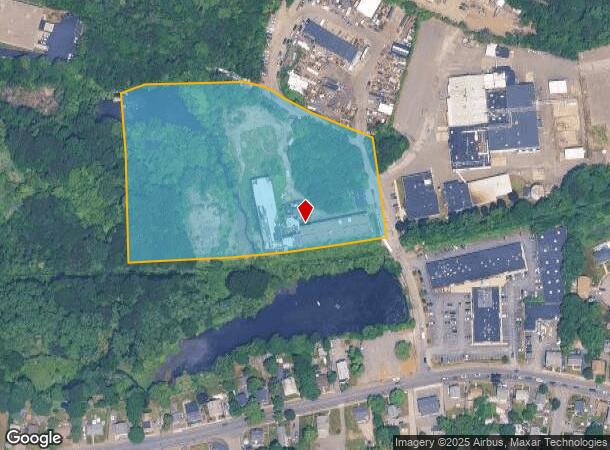
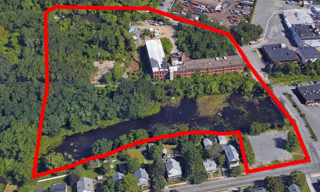
Property Record
143 Lynnfield St, Peabody, MA 01960

NEARBY LISTINGS FOR SALE OR LEASE
Property Detail
143 Lynnfield St
PEAB-000101-000000-000220
Essex
Industrialgeneral
Massachusetts
AE
6.95 AC
25009C0414G
Peabody/Salem
2020
Boston
2025
Boston-Cambridge-Newton, MA-NH
210402
DEMOGRAPHICS near 143 Lynnfield St
1 Mile
3 Mile
5 Mile
2024 Total Population
8,282
94,596
299,472
2029 Population
8,325
93,858
296,641
Pop Growth 2024-2029
+ 0.52%
(0.78%)
(0.95%)
Average Age
43
43
41
2024 Total Households
2,980
37,831
116,538
HH Growth 2024-2029
+ 0.37%
(0.86%)
(1.00%)
Median Household Inc
$98,082
$84,518
$82,391
Avg Household Size
2.70
2.40
2.50
2024 Avg HH Vehicles
2.00
2.00
2.00
Median Home Value
$530,067
$473,379
$512,042
Median Year Built
1964
1961
1956
Nearby Places
Map Layers
Map Styles
 Street
 Aerial
- Restaurants
- Banks
- Shops
- Fitness
- Groceries
PUBLIC TRANSPORTATION
COMMUTER RAIL
Salem (Newburyport/Rockport Line - Massachusetts Bay Transportation Authority Commuter Rail (Purple Line))
DRIVE
WALK
Distance
Salem (Newburyport/Rockport Line - Massachusetts Bay Transportation Authority Commuter Rail (Purple Line))
10 min
4.1 mi
Swampscott (Newburyport/Rockport Line - Massachusetts Bay Transportation Authority Commuter Rail (Purple Line))
DRIVE
WALK
Distance
Swampscott (Newburyport/Rockport Line - Massachusetts Bay Transportation Authority Commuter Rail (Purple Line))
12 min
5.3 mi
AIRPORT
General Edward Lawrence Logan International
DRIVE
WALK
Distance
General Edward Lawrence Logan International
26 min
13.7 mi
Freight Ports
Port of Boston
DRIVE
WALK
Distance
Port of Boston
30 min
18.5 mi
SALE & LEASE HISTORY
LISTING DATE
SALE/LEASE

May 11, 2017
For Sale
May 10, 2017
For Sale
Jun 02, 2022
For Sale
Jul 20, 2019
For Sale
Apr 20, 2021
For Sale
Nearby Properties
Address
Land Use
TOTAL SIZE
Lot Size
Zoning
Address
Land Use
TOTAL SIZE
Lot Size
Zoning
10,368 SF
33.83 AC
R3
Address
Land Use
TOTAL SIZE
Lot Size
Zoning
17 AC
R4
Address
Land Use
TOTAL SIZE
Lot Size
Zoning
9,860 SF
17.80 AC
R1
Address
Land Use
TOTAL SIZE
Lot Size
Zoning
49 AC
I2
Address
Land Use
TOTAL SIZE
Lot Size
Zoning
17.60 AC
R1A
Address
Land Use
TOTAL SIZE
Lot Size
Zoning
9.71 AC
BR
Address
Land Use
TOTAL SIZE
Lot Size
Zoning
49.85 AC
R1B
Address
Land Use
TOTAL SIZE
Lot Size
Zoning
151.89 AC
PC
Address
Land Use
TOTAL SIZE
Lot Size
Zoning
38,440 SF
8.95 AC
I
Address
Land Use
TOTAL SIZE
Lot Size
Zoning
249,477 SF
13.98 AC
RA
Address
Land Use
TOTAL SIZE
Lot Size
Zoning
206.65 AC
R1B
Address
Land Use
TOTAL SIZE
Lot Size
Zoning
18.72 AC
R1
Address
Land Use
TOTAL SIZE
Lot Size
Zoning
11.08 AC
R4
Address
Land Use
TOTAL SIZE
Lot Size
Zoning
223,689 SF
11.60 AC
R1
Address
Land Use
TOTAL SIZE
Lot Size
Zoning
249,587 SF
5.79 AC
DDD
Address
Land Use
TOTAL SIZE
Lot Size
Zoning
59.99 AC
IP
Address
Land Use
TOTAL SIZE
Lot Size
Zoning
25.72 AC
IP
Address
Land Use
TOTAL SIZE
Lot Size
Zoning
408,207 SF
37.12 AC
C3
Address
Land Use
TOTAL SIZE
Lot Size
Zoning
98,516 SF
5.01 AC
R1
Address
Land Use
TOTAL SIZE
Lot Size
Zoning
4.14 AC
NRCC
Address
Land Use
TOTAL SIZE
Lot Size
Zoning
28.30 AC
IP
Address
Land Use
TOTAL SIZE
Lot Size
Zoning
9.58 AC
R3
Address
Land Use
TOTAL SIZE
Lot Size
Zoning
125,862 SF
5.30 AC
R1
Address
Land Use
TOTAL SIZE
Lot Size
Zoning
5 AC
B2
Address
Land Use
TOTAL SIZE
Lot Size
Zoning
24.37 AC
C3
Address
Land Use
TOTAL SIZE
Lot Size
Zoning
20.78 AC
C3
Address
Land Use
TOTAL SIZE
Lot Size
Zoning
19.10 AC
R114
Address
Land Use
TOTAL SIZE
Lot Size
Zoning
15.16 AC
I2
Address
Land Use
TOTAL SIZE
Lot Size
Zoning
19.52 AC
R3
Address
Land Use
TOTAL SIZE
Lot Size
Zoning
158,572 SF
10 AC
I2
The World's #1 Commercial Real Estate Marketplace
Connect with us
© 2025 CoStar Group
The information above has been obtained from sources believed reliable. While we do not doubt its accuracy we have not verified it and make no guarantee, warranty or representation about it. It is your responsibility to independently confirm its accuracy and completeness. Any projections, opinions, assumptions, or estimates used are for example only and do not represent the current or future performance of the property. The value of this transaction to you depends on tax and other factors which should be evaluated by your tax, financial, and legal advisors. You and your advisors should conduct a careful, independent investigation of the property to determine to your satisfaction the suitability of the property for your needs.