Property Record
143 Patsy St, Benson, NC 27504
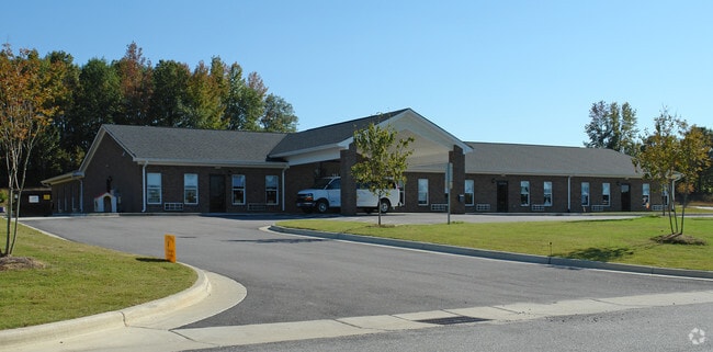

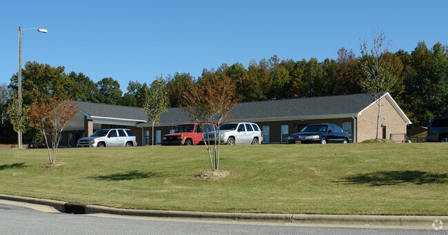

Property Detail
143 Patsy St
Raleigh-Cary, NC
As Said Lot Is Shown On Map
13E04042M
LOT 19A 69/154
Daycare
Johnston
X
North Carolina
3720163400K
19a
2025
1.29 AC
2025
Johnston County
041504
Raleigh/Durham
7,280 SF
NEARBY LISTINGS FOR SALE OR LEASE
-
-
View all Benson listings for sale on LoopNet.com
DEMOGRAPHICS near 143 Patsy St
1 mile
3 mile
5 mile
2024 Total Population
2,165
13,296
41,561
2029 Population
2,670
16,262
50,541
Pop Growth 2024-2029
+ 23.33%
+ 22.31%
+ 21.61%
Average Age
37
38
38
2024 Total Households
769
4,751
14,654
HH Growth 2024-2029
+ 23.54%
+ 22.46%
+ 21.76%
Median Household Inc
$69,011
$74,970
$86,117
Avg Household Size
2.80
2.70
2.80
2024 Avg HH Vehicles
2.00
2.00
2.00
Median Home Value
$209,438
$258,967
$280,481
Median Year Built
2005
2002
2003
Nearby Places
Map Layers
Map Styles
 Street
 Aerial
Transit
 Traffic
 Biking
Places
Listings with unknown addresses are not visible on the map
- Restaurants
- Banks
- Shops
- Fitness
- Groceries
PUBLIC TRANSPORTATION
AIRPORT
Raleigh-Durham International
Drive
Walk
Distance
Raleigh-Durham International
46 min
36.9 mi
Freight Ports
Port of Wilmington
Drive
Walk
Distance
Port of Wilmington
129 min
111.9 mi
Nearby Properties
Address
Land Use
TOTAL SIZE
Lot Size
Zoning
Address
Land Use
TOTAL SIZE
Lot Size
Zoning
31,796 SF
87.86 AC
RAG
Address
Land Use
TOTAL SIZE
Lot Size
Zoning
16,151 SF
51.85 AC
RAG
Address
Land Use
TOTAL SIZE
Lot Size
Zoning
16,236 SF
38.57 AC
RES
Address
Land Use
TOTAL SIZE
Lot Size
Zoning
93,981 SF
3.23 AC
IND
Address
Land Use
TOTAL SIZE
Lot Size
Zoning
64,632 SF
16.35 AC
COM
Address
Land Use
TOTAL SIZE
Lot Size
Zoning
1,681 SF
4.89 AC
COM
Address
Land Use
TOTAL SIZE
Lot Size
Zoning
8,982 SF
9.42 AC
RAG
Address
Land Use
TOTAL SIZE
Lot Size
Zoning
6,900 SF
2.26 AC
COP
Address
Land Use
TOTAL SIZE
Lot Size
Zoning
15,582 SF
2.87 AC
COM
Address
Land Use
TOTAL SIZE
Lot Size
Zoning
293.36 AC
RAG
Address
Land Use
TOTAL SIZE
Lot Size
Zoning
9,000 SF
3.34 AC
COM
Address
Land Use
TOTAL SIZE
Lot Size
Zoning
39.67 AC
COM
Address
Land Use
TOTAL SIZE
Lot Size
Zoning
2,850 SF
197.63 AC
RAG
Address
Land Use
TOTAL SIZE
Lot Size
Zoning
6,577 SF
2.64 AC
COM
Address
Land Use
TOTAL SIZE
Lot Size
Zoning
8,464 SF
1.33 AC
COM
Address
Land Use
TOTAL SIZE
Lot Size
Zoning
3,925 SF
1.55 AC
COM
Address
Land Use
TOTAL SIZE
Lot Size
Zoning
69.49 AC
RAG
Address
Land Use
TOTAL SIZE
Lot Size
Zoning
209.23 AC
RAG
Address
Land Use
TOTAL SIZE
Lot Size
Zoning
3,914 SF
2.30 AC
IND
Address
Land Use
TOTAL SIZE
Lot Size
Zoning
3,000 SF
3.33 AC
COM
Address
Land Use
TOTAL SIZE
Lot Size
Zoning
10,446 SF
1.50 AC
COM
Address
Land Use
TOTAL SIZE
Lot Size
Zoning
4,064 SF
1.08 AC
COM
Address
Land Use
TOTAL SIZE
Lot Size
Zoning
3,320 SF
1.59 AC
COM
Address
Land Use
TOTAL SIZE
Lot Size
Zoning
7,192 SF
7.90 AC
RAG
Address
Land Use
TOTAL SIZE
Lot Size
Zoning
5,520 SF
6.83 AC
RAG
Address
Land Use
TOTAL SIZE
Lot Size
Zoning
6,591 SF
4.03 AC
IND
Address
Land Use
TOTAL SIZE
Lot Size
Zoning
5,000 SF
4.61 AC
COP
Address
Land Use
TOTAL SIZE
Lot Size
Zoning
1,864 SF
85.80 AC
COM
Address
Land Use
TOTAL SIZE
Lot Size
Zoning
3,300 SF
1.56 AC
COM
The World's #1 Commercial Real Estate Marketplace
Connect with us
© 2026 CoStar Group
The information above has been obtained from sources believed reliable. While we do not doubt its accuracy we have not verified it and make no guarantee, warranty or representation about it. It is your responsibility to independently confirm its accuracy and completeness. Any projections, opinions, assumptions, or estimates used are for example only and do not represent the current or future performance of the property. The value of this transaction to you depends on tax and other factors which should be evaluated by your tax, financial, and legal advisors. You and your advisors should conduct a careful, independent investigation of the property to determine to your satisfaction the suitability of the property for your needs.