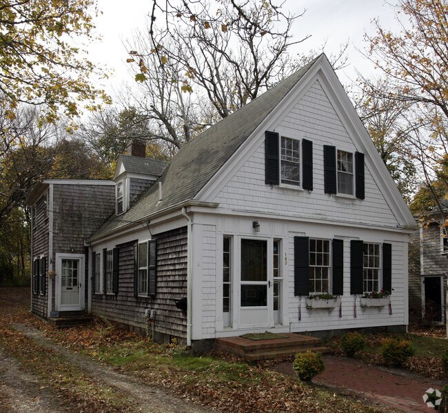
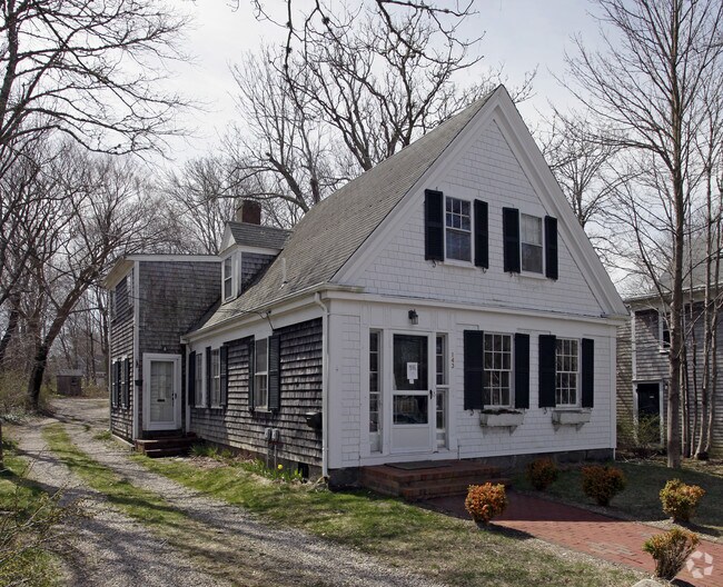
Property Record
143 Route 6A, Yarmouth Port, MA 02675
NEARBY LISTINGS FOR SALE OR LEASE
Property Detail
143 Route 6A
Commercialofficeresidentialmixeduse
Barnstable
X
Massachusetts
25001C0559J
0.31 AC
2025
Cape Cod
2025
Other Market Areas
011802
Barnstable Town, MA
1,884 SF
YARM-000122-000128
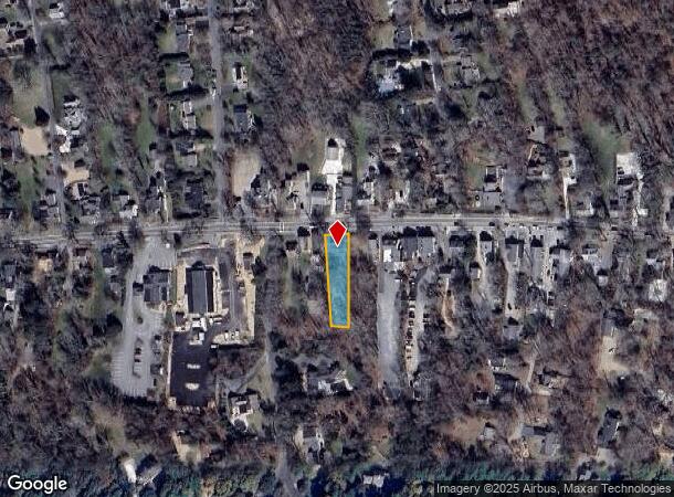
DEMOGRAPHICS near 143 Route 6A
1 Mile
3 Mile
5 Mile
2024 Total Population
1,217
13,390
53,792
2029 Population
1,224
13,589
55,464
Pop Growth 2024-2029
+ 0.58%
+ 1.49%
+ 3.11%
Average Age
53
50
48
2024 Total Households
546
5,996
24,117
HH Growth 2024-2029
+ 0.18%
+ 1.22%
+ 3.08%
Median Household Inc
$113,095
$91,238
$73,096
Avg Household Size
2.20
2.20
2.10
2024 Avg HH Vehicles
2.00
2.00
2.00
Median Home Value
$580,169
$455,845
$451,106
Median Year Built
1976
1977
1973
Nearby Places
Map Layers
Map Styles
 Street
 Aerial
- Restaurants
- Banks
- Shops
- Fitness
- Groceries
PUBLIC TRANSPORTATION
COMMUTER RAIL
DRIVE
WALK
Distance
7 min
3.6 mi
AIRPORT
Martha's Vineyard
DRIVE
WALK
Distance
Martha's Vineyard
111 min
42.3 mi
Freight Ports
Port of New Bedford Harbor
DRIVE
WALK
Distance
Port of New Bedford Harbor
70 min
50.1 mi
Nearby Properties
Address
Land Use
TOTAL SIZE
Lot Size
Zoning
Address
Land Use
TOTAL SIZE
Lot Size
Zoning
298,272 SF
9.34 AC
IN
Address
Land Use
TOTAL SIZE
Lot Size
Zoning
17.95 AC
VB-A;R
Address
Land Use
TOTAL SIZE
Lot Size
Zoning
11,698 SF
34.50 AC
Address
Land Use
TOTAL SIZE
Lot Size
Zoning
110,415 SF
70 AC
Address
Land Use
TOTAL SIZE
Lot Size
Zoning
43.50 AC
IN
Address
Land Use
TOTAL SIZE
Lot Size
Zoning
177,385 SF
39.53 AC
Address
Land Use
TOTAL SIZE
Lot Size
Zoning
32.95 AC
IN
Address
Land Use
TOTAL SIZE
Lot Size
Zoning
167,800 SF
9.73 AC
IN
Address
Land Use
TOTAL SIZE
Lot Size
Zoning
4,800 SF
414.61 AC
Address
Land Use
TOTAL SIZE
Lot Size
Zoning
8.09 AC
Address
Land Use
TOTAL SIZE
Lot Size
Zoning
16.63 AC
IN
Address
Land Use
TOTAL SIZE
Lot Size
Zoning
2,084 SF
20.03 AC
Address
Land Use
TOTAL SIZE
Lot Size
Zoning
2,560 SF
100.38 AC
Address
Land Use
TOTAL SIZE
Lot Size
Zoning
110.62 AC
RF-1;R
Address
Land Use
TOTAL SIZE
Lot Size
Zoning
10.21 AC
IN
Address
Land Use
TOTAL SIZE
Lot Size
Zoning
4.11 AC
Address
Land Use
TOTAL SIZE
Lot Size
Zoning
Address
Land Use
TOTAL SIZE
Lot Size
Zoning
40,332 SF
2.26 AC
IND;IN
Address
Land Use
TOTAL SIZE
Lot Size
Zoning
800 SF
7.30 AC
MB
Address
Land Use
TOTAL SIZE
Lot Size
Zoning
58,848 SF
6.20 AC
IN
Address
Land Use
TOTAL SIZE
Lot Size
Zoning
59,756 SF
9.56 AC
Address
Land Use
TOTAL SIZE
Lot Size
Zoning
37,182 SF
5.13 AC
Address
Land Use
TOTAL SIZE
Lot Size
Zoning
1,712 SF
6.31 AC
IN
Address
Land Use
TOTAL SIZE
Lot Size
Zoning
32,717 SF
7.08 AC
IN
Address
Land Use
TOTAL SIZE
Lot Size
Zoning
6,912 SF
0.20 AC
Address
Land Use
TOTAL SIZE
Lot Size
Zoning
57,516 SF
4.13 AC
INDLTD
Address
Land Use
TOTAL SIZE
Lot Size
Zoning
Address
Land Use
TOTAL SIZE
Lot Size
Zoning
40,161 SF
2.43 AC
IN
Address
Land Use
TOTAL SIZE
Lot Size
Zoning
21,010 SF
7 AC
IN
Address
Land Use
TOTAL SIZE
Lot Size
Zoning
21,758 SF
6.75 AC
The World's #1 Commercial Real Estate Marketplace
Connect with us
© 2025 CoStar Group
The information above has been obtained from sources believed reliable. While we do not doubt its accuracy we have not verified it and make no guarantee, warranty or representation about it. It is your responsibility to independently confirm its accuracy and completeness. Any projections, opinions, assumptions, or estimates used are for example only and do not represent the current or future performance of the property. The value of this transaction to you depends on tax and other factors which should be evaluated by your tax, financial, and legal advisors. You and your advisors should conduct a careful, independent investigation of the property to determine to your satisfaction the suitability of the property for your needs.