Property Record
143 Upper County Rd, Dennis Port, MA 02639
NEARBY LISTINGS FOR SALE OR LEASE
Property Detail
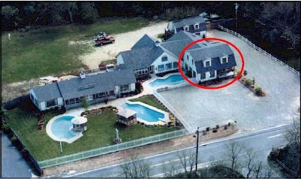
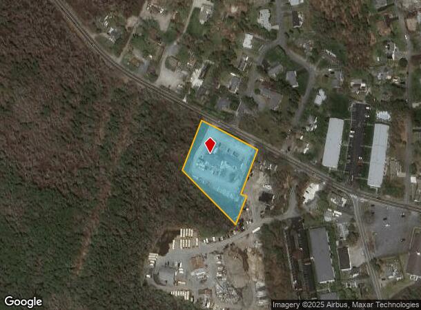
143 Upper County Rd
Commercialofficeresidentialmixeduse
Barnstable
AE
Massachusetts
25001C0592J
1.73 AC
2025
Cape Cod
2025
Other Market Areas
011600
Barnstable Town, MA
6,704 SF
DENN-000089-000000-000040
DEMOGRAPHICS near 143 Upper County Rd
1 mile
3 mile
5 mile
2024 Total Population
3,971
16,940
42,317
2029 Population
4,132
17,853
44,177
Pop Growth 2024-2029
+ 4.05%
+ 5.39%
+ 4.40%
Average Age
49
53
51
2024 Total Households
2,023
8,340
20,112
HH Growth 2024-2029
+ 3.95%
+ 5.43%
+ 4.40%
Median Household Inc
$54,763
$67,996
$73,829
Avg Household Size
1.90
1.90
2.00
2024 Avg HH Vehicles
2.00
2.00
2.00
Median Home Value
$407,477
$470,111
$470,054
Median Year Built
1966
1968
1972
Nearby Places
Map Layers
Map Styles
 Street
 Aerial
Transit
 Traffic
 Biking
Places
Listings with unknown addresses are not visible on the map
- Restaurants
- Banks
- Shops
- Fitness
- Groceries
PUBLIC TRANSPORTATION
COMMUTER RAIL
Hyannis (CapeFLYER - Cape Cod Regional Transit Authority)
Drive
Walk
Distance
Hyannis (CapeFLYER - Cape Cod Regional Transit Authority)
16 min
9.0 mi
AIRPORT
Nantucket Memorial
Drive
Walk
Distance
Nantucket Memorial
166 min
42.5 mi
Freight Ports
Port of New Bedford Harbor
Drive
Walk
Distance
Port of New Bedford Harbor
80 min
57.0 mi
Nearby Properties
Address
Land Use
TOTAL SIZE
Lot Size
Zoning
Address
Land Use
TOTAL SIZE
Lot Size
Zoning
13.34 AC
E
Address
Land Use
TOTAL SIZE
Lot Size
Zoning
138,804 SF
15.94 AC
Address
Land Use
TOTAL SIZE
Lot Size
Zoning
222,477 SF
41.60 AC
Address
Land Use
TOTAL SIZE
Lot Size
Zoning
Address
Land Use
TOTAL SIZE
Lot Size
Zoning
3.42 AC
Address
Land Use
TOTAL SIZE
Lot Size
Zoning
10.34 AC
Address
Land Use
TOTAL SIZE
Lot Size
Zoning
Address
Land Use
TOTAL SIZE
Lot Size
Zoning
Address
Land Use
TOTAL SIZE
Lot Size
Zoning
14,844 SF
0.50 AC
Address
Land Use
TOTAL SIZE
Lot Size
Zoning
Address
Land Use
TOTAL SIZE
Lot Size
Zoning
Address
Land Use
TOTAL SIZE
Lot Size
Zoning
4.88 AC
E
Address
Land Use
TOTAL SIZE
Lot Size
Zoning
59,054 SF
9.53 AC
R
Address
Land Use
TOTAL SIZE
Lot Size
Zoning
12,228 SF
0.66 AC
Address
Land Use
TOTAL SIZE
Lot Size
Zoning
0.78 AC
R
Address
Land Use
TOTAL SIZE
Lot Size
Zoning
Address
Land Use
TOTAL SIZE
Lot Size
Zoning
6,276 SF
0.80 AC
R
Address
Land Use
TOTAL SIZE
Lot Size
Zoning
Address
Land Use
TOTAL SIZE
Lot Size
Zoning
0.80 AC
R
Address
Land Use
TOTAL SIZE
Lot Size
Zoning
9.77 AC
Address
Land Use
TOTAL SIZE
Lot Size
Zoning
5,470 SF
0.83 AC
R
Address
Land Use
TOTAL SIZE
Lot Size
Zoning
6,251 SF
1.03 AC
R
Address
Land Use
TOTAL SIZE
Lot Size
Zoning
8,406 SF
0.88 AC
R
Address
Land Use
TOTAL SIZE
Lot Size
Zoning
5,649 SF
0.50 AC
R
Address
Land Use
TOTAL SIZE
Lot Size
Zoning
7,610 SF
0.65 AC
R
Address
Land Use
TOTAL SIZE
Lot Size
Zoning
2,942 SF
130.52 AC
Address
Land Use
TOTAL SIZE
Lot Size
Zoning
4,867 SF
0.87 AC
R
Address
Land Use
TOTAL SIZE
Lot Size
Zoning
5,552 SF
0.80 AC
R
Address
Land Use
TOTAL SIZE
Lot Size
Zoning
14.54 AC
Address
Land Use
TOTAL SIZE
Lot Size
Zoning
45.75 AC
R
The World's #1 Commercial Real Estate Marketplace
Connect with us
© 2026 CoStar Group
The information above has been obtained from sources believed reliable. While we do not doubt its accuracy we have not verified it and make no guarantee, warranty or representation about it. It is your responsibility to independently confirm its accuracy and completeness. Any projections, opinions, assumptions, or estimates used are for example only and do not represent the current or future performance of the property. The value of this transaction to you depends on tax and other factors which should be evaluated by your tax, financial, and legal advisors. You and your advisors should conduct a careful, independent investigation of the property to determine to your satisfaction the suitability of the property for your needs.