Property Record
1430 Prudential Dr, Jacksonville, FL 32207
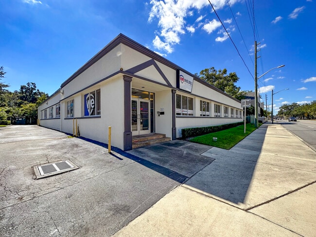
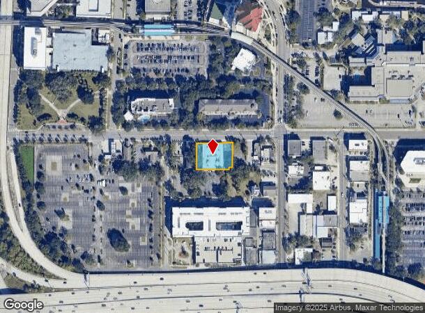
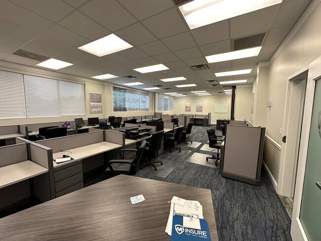
Property Detail
1430 Prudential Dr
Jacksonville, FL
Davis S/D Blk 45 Oklahoma
080992-0010
2-8 44-2S-26E .55 HENDRICKS SUBDIVISION HOMESTEAD TRACT LOT4, 2-41 DAVIS SUBDIVISION LOTS 1,2 BLK 1, PT CL R/WS RECD O/R 21060-1739, ORD FF-140
Storebuilding
Duval
X
Florida
12031C0359J
1,2
2025
0.54 AC
2026
Downtown Southbank
000800
Jacksonville (Florida)
12,024 SF
NEARBY LISTINGS FOR SALE OR LEASE
DEMOGRAPHICS near 1430 Prudential Dr
1 mile
3 mile
5 mile
2024 Total Population
8,334
81,515
221,630
2029 Population
9,017
87,042
234,228
Pop Growth 2024-2029
+ 8.20%
+ 6.78%
+ 5.68%
Average Age
43
39
39
2024 Total Households
4,488
35,583
92,690
HH Growth 2024-2029
+ 8.67%
+ 7.17%
+ 5.92%
Median Household Inc
$49,374
$40,183
$43,004
Avg Household Size
1.70
2.10
2.20
2024 Avg HH Vehicles
1.00
1.00
1.00
Median Home Value
$342,241
$252,228
$191,872
Median Year Built
1977
1959
1960
Nearby Places
Map Layers
Map Styles
 Street
 Aerial
Transit
 Traffic
 Biking
Places
Listings with unknown addresses are not visible on the map
- Restaurants
- Banks
- Shops
- Fitness
- Groceries
PUBLIC TRANSPORTATION
TRANSIT/SUBWAY
Riverplace (Skyway - Jacksonville Transit Authority Skyway (The Skyway))
Drive
Walk
Distance
Riverplace (Skyway - Jacksonville Transit Authority Skyway (The Skyway))
2 min
5 min
0.2 mi
Kings Avenue (Skyway - Jacksonville Transit Authority Skyway (The Skyway))
Drive
Walk
Distance
Kings Avenue (Skyway - Jacksonville Transit Authority Skyway (The Skyway))
2 min
10 min
0.3 mi
San Marco (Skyway - Jacksonville Transit Authority Skyway (The Skyway))
Drive
Walk
Distance
San Marco (Skyway - Jacksonville Transit Authority Skyway (The Skyway))
6 min
8 min
0.4 mi
COMMUTER RAIL
Drive
Walk
Distance
15 min
7.6 mi
AIRPORT
Jacksonville International
Drive
Walk
Distance
Jacksonville International
27 min
16.1 mi
Freight Ports
Jacksonville Port
Drive
Walk
Distance
Jacksonville Port
13 min
5.5 mi
SALE & LEASE HISTORY
LISTING DATE
SALE/LEASE

Oct 30, 2023
For Sale
Aug 06, 2020
For Sale
Nearby Properties
Address
Land Use
TOTAL SIZE
Lot Size
Zoning
Address
Land Use
TOTAL SIZE
Lot Size
Zoning
1,086,885 SF
16.34 AC
CCBD
Address
Land Use
TOTAL SIZE
Lot Size
Zoning
543,383 SF
7.87 AC
CCBD
Address
Land Use
TOTAL SIZE
Lot Size
Zoning
1,150,143 SF
43.90 AC
CCBD
Address
Land Use
TOTAL SIZE
Lot Size
Zoning
629,459 SF
10.33 AC
PUD
Address
Land Use
TOTAL SIZE
Lot Size
Zoning
705,940 SF
25.12 AC
PBF-1
Address
Land Use
TOTAL SIZE
Lot Size
Zoning
442,972 SF
5.33 AC
PUD
Address
Land Use
TOTAL SIZE
Lot Size
Zoning
165,408 SF
2.45 AC
CCBD
Address
Land Use
TOTAL SIZE
Lot Size
Zoning
407,122 SF
4.50 AC
CCBD
Address
Land Use
TOTAL SIZE
Lot Size
Zoning
521,850 SF
10.06 AC
CCBD
Address
Land Use
TOTAL SIZE
Lot Size
Zoning
831,560 SF
1.16 AC
PUD
Address
Land Use
TOTAL SIZE
Lot Size
Zoning
187,278 SF
1.71 AC
CCBD
Address
Land Use
TOTAL SIZE
Lot Size
Zoning
257,667 SF
3.91 AC
CCBD
Address
Land Use
TOTAL SIZE
Lot Size
Zoning
127,732 SF
1.44 AC
CCBD
Address
Land Use
TOTAL SIZE
Lot Size
Zoning
224,600 SF
3.41 AC
PUD
Address
Land Use
TOTAL SIZE
Lot Size
Zoning
313,472 SF
35.44 AC
CCBD
Address
Land Use
TOTAL SIZE
Lot Size
Zoning
355,967 SF
8.98 AC
PUD
Address
Land Use
TOTAL SIZE
Lot Size
Zoning
700,443 SF
8 AC
CCBD
Address
Land Use
TOTAL SIZE
Lot Size
Zoning
264,277 SF
2.07 AC
CCBD
Address
Land Use
TOTAL SIZE
Lot Size
Zoning
503,858 SF
1.32 AC
CCBD
Address
Land Use
TOTAL SIZE
Lot Size
Zoning
369,638 SF
6.30 AC
CCBD
Address
Land Use
TOTAL SIZE
Lot Size
Zoning
448,709 SF
2.97 AC
CCBD
Address
Land Use
TOTAL SIZE
Lot Size
Zoning
326,485 SF
1.56 AC
CCBD
Address
Land Use
TOTAL SIZE
Lot Size
Zoning
453,728 SF
8.20 AC
CCBD
Address
Land Use
TOTAL SIZE
Lot Size
Zoning
194,877 SF
11.64 AC
CCBD
Address
Land Use
TOTAL SIZE
Lot Size
Zoning
299,055 SF
18.93 AC
CCBD
Address
Land Use
TOTAL SIZE
Lot Size
Zoning
336,623 SF
2.06 AC
CCBD
Address
Land Use
TOTAL SIZE
Lot Size
Zoning
290,975 SF
4.49 AC
PUD
Address
Land Use
TOTAL SIZE
Lot Size
Zoning
253,858 SF
4.93 AC
PUD
Address
Land Use
TOTAL SIZE
Lot Size
Zoning
212,152 SF
8.17 AC
CCBD
Address
Land Use
TOTAL SIZE
Lot Size
Zoning
146,636 SF
2.88 AC
CCBD
The World's #1 Commercial Real Estate Marketplace
Connect with us
© 2026 CoStar Group
The information above has been obtained from sources believed reliable. While we do not doubt its accuracy we have not verified it and make no guarantee, warranty or representation about it. It is your responsibility to independently confirm its accuracy and completeness. Any projections, opinions, assumptions, or estimates used are for example only and do not represent the current or future performance of the property. The value of this transaction to you depends on tax and other factors which should be evaluated by your tax, financial, and legal advisors. You and your advisors should conduct a careful, independent investigation of the property to determine to your satisfaction the suitability of the property for your needs.