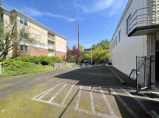
Property Record
1430 Sw Clay St, Portland, OR 97201
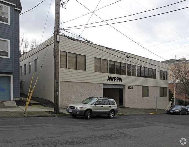
This Property Is For Sale
Current Lease Availabilities
Property Detail
1430 Sw Clay St
R246922
PORTLAND, BLOCK SE 1/4, INC PT VAC ST W 10 OF LOT 7&8
Commercialnec
Multnomah
RHD
Oregon
B and X Area of moderate flood hazard, usually the area between the limits of the 100-year and 500-year floods.
7,8
2025
0.20 AC
2025
SW Close-In
005602
Portland
6,000 SF
Portland-Vancouver-Hillsboro, OR-WA
NEARBY LISTINGS FOR SALE OR LEASE
DEMOGRAPHICS near 1430 Sw Clay St
1 mile
3 mile
5 mile
2025 Total Population
41,510
171,500
426,331
2030 Population
41,877
171,908
424,051
Pop Growth 2025-2030
+ 0.88%
+ 0.24%
(0.53%)
Average Age
41
41
41
2025 Total Households
25,471
91,771
198,263
HH Growth 2025-2030
+ 0.69%
+ 0.17%
(0.60%)
Median Household Inc
$61,591
$84,168
$99,250
Avg Household Size
1.50
1.80
2.00
2025 Avg HH Vehicles
1.00
1.00
1.00
Median Home Value
$718,808
$761,317
$729,026
Median Year Built
1977
1976
1964
Nearby Places
Map Layers
Map Styles
 Street
 Aerial
Transit
 Traffic
 Biking
Places
Listings with unknown addresses are not visible on the map
- Restaurants
- Banks
- Shops
- Fitness
- Groceries
Nearby Properties
Address
Land Use
TOTAL SIZE
Lot Size
Zoning
Address
Land Use
TOTAL SIZE
Lot Size
Zoning
395,815 SF
2.66 AC
IRD
Address
Land Use
TOTAL SIZE
Lot Size
Zoning
27.58 AC
EX
Address
Land Use
TOTAL SIZE
Lot Size
Zoning
627,500 SF
16.60 AC
CX
Address
Land Use
TOTAL SIZE
Lot Size
Zoning
57,314 SF
60.69 AC
OS
Address
Land Use
TOTAL SIZE
Lot Size
Zoning
560,000 SF
0.15 AC
CX
Address
Land Use
TOTAL SIZE
Lot Size
Zoning
20.71 AC
OS
Address
Land Use
TOTAL SIZE
Lot Size
Zoning
409,260 SF
7.41 AC
EX
Address
Land Use
TOTAL SIZE
Lot Size
Zoning
1.09 AC
EX
Address
Land Use
TOTAL SIZE
Lot Size
Zoning
2.24 AC
CX
Address
Land Use
TOTAL SIZE
Lot Size
Zoning
326,547 SF
2.42 AC
RH
Address
Land Use
TOTAL SIZE
Lot Size
Zoning
304,836 SF
10.85 AC
CX
Address
Land Use
TOTAL SIZE
Lot Size
Zoning
417,324 SF
0.68 AC
CX
Address
Land Use
TOTAL SIZE
Lot Size
Zoning
598,328 SF
12.32 AC
CX
Address
Land Use
TOTAL SIZE
Lot Size
Zoning
257,700 SF
2.89 AC
EX
Address
Land Use
TOTAL SIZE
Lot Size
Zoning
128,500 SF
6.95 AC
OS
Address
Land Use
TOTAL SIZE
Lot Size
Zoning
460,000 SF
0.92 AC
CX
Address
Land Use
TOTAL SIZE
Lot Size
Zoning
689,840 SF
0.92 AC
CX
Address
Land Use
TOTAL SIZE
Lot Size
Zoning
125,217 SF
0.23 AC
CX
Address
Land Use
TOTAL SIZE
Lot Size
Zoning
97,465 SF
107.18 AC
OS
Address
Land Use
TOTAL SIZE
Lot Size
Zoning
7.78 AC
EX
Address
Land Use
TOTAL SIZE
Lot Size
Zoning
426,742 SF
0.53 AC
RXD
Address
Land Use
TOTAL SIZE
Lot Size
Zoning
243,371 SF
0.67 AC
CI2
Address
Land Use
TOTAL SIZE
Lot Size
Zoning
584,483 SF
0.90 AC
CX
Address
Land Use
TOTAL SIZE
Lot Size
Zoning
247,520 SF
7.74 AC
CX
Address
Land Use
TOTAL SIZE
Lot Size
Zoning
306,000 SF
1.21 AC
NULL
Address
Land Use
TOTAL SIZE
Lot Size
Zoning
251,293 SF
14.15 AC
IR
Address
Land Use
TOTAL SIZE
Lot Size
Zoning
596,161 SF
0.92 AC
CX
Address
Land Use
TOTAL SIZE
Lot Size
Zoning
456,760 SF
0.53 AC
EX
Address
Land Use
TOTAL SIZE
Lot Size
Zoning
193,898 SF
2.50 AC
IRD
Address
Land Use
TOTAL SIZE
Lot Size
Zoning
134,398 SF
3.17 AC
CG
The World's #1 Commercial Real Estate Marketplace
Connect with us
© 2026 CoStar Group
The information above has been obtained from sources believed reliable. While we do not doubt its accuracy we have not verified it and make no guarantee, warranty or representation about it. It is your responsibility to independently confirm its accuracy and completeness. Any projections, opinions, assumptions, or estimates used are for example only and do not represent the current or future performance of the property. The value of this transaction to you depends on tax and other factors which should be evaluated by your tax, financial, and legal advisors. You and your advisors should conduct a careful, independent investigation of the property to determine to your satisfaction the suitability of the property for your needs.