Property Record
14301 Vint Hill Rd, Nokesville, VA 20181
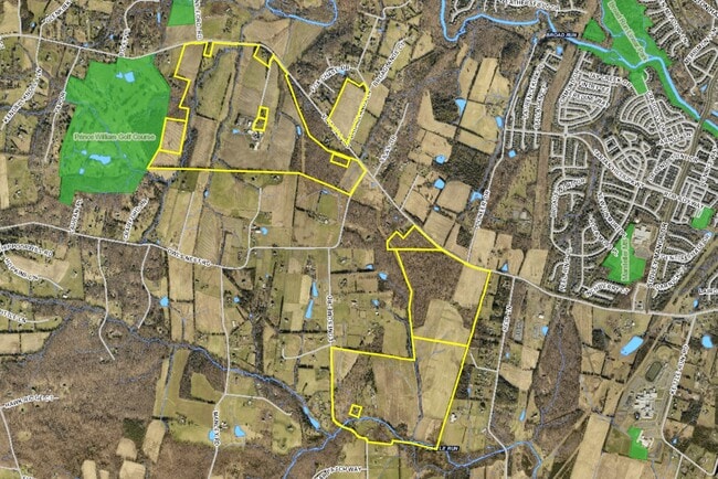
This Property Is For Sale
NEARBY LISTINGS FOR SALE OR LEASE
-
-
View all Nokesville listings for sale on LoopNet.com
Property Detail
14301 Vint Hill Rd
7395-45-9158
GREENWICH 10705 LONESOME RD
Agriculturalland
Prince William
A
Virginia
51061C0375D
6498
2024
265.21 AC
2025
Route 29/I-66 Corridor
901417
Washington, DC
3,338 SF
Washington-Arlington-Alexandria, DC-VA-MD-WV
DEMOGRAPHICS near 14301 Vint Hill Rd
1 Mile
3 Mile
5 Mile
2024 Total Population
1,929
38,252
69,335
2029 Population
1,967
39,140
71,205
Pop Growth 2024-2029
+ 1.97%
+ 2.32%
+ 2.70%
Average Age
38
36
37
2024 Total Households
583
11,031
21,554
HH Growth 2024-2029
+ 2.06%
+ 2.33%
+ 2.80%
Median Household Inc
$144,860
$153,586
$143,942
Avg Household Size
3.30
3.40
3.10
2024 Avg HH Vehicles
2.00
2.00
2.00
Median Home Value
$617,897
$586,204
$586,471
Median Year Built
2004
2003
2003
Nearby Places
Map Layers
Map Styles
 Street
 Aerial
- Restaurants
- Banks
- Shops
- Fitness
- Groceries
PUBLIC TRANSPORTATION
COMMUTER RAIL
Lead (Manassas Line - Virginia Railway Express)
DRIVE
WALK
Distance
Lead (Manassas Line - Virginia Railway Express)
16 min
7.5 mi
Broad Run/Airport (Manassas Line - Virginia Railway Express)
DRIVE
WALK
Distance
Broad Run/Airport (Manassas Line - Virginia Railway Express)
16 min
7.5 mi
AIRPORT
Washington Dulles International
DRIVE
WALK
Distance
Washington Dulles International
44 min
26.2 mi
Freight Ports
Port of Baltimore
DRIVE
WALK
Distance
Port of Baltimore
103 min
76.6 mi
Nearby Properties
Address
Land Use
TOTAL SIZE
Lot Size
Zoning
Address
Land Use
TOTAL SIZE
Lot Size
Zoning
866,820 SF
253.92 AC
M2
Address
Land Use
TOTAL SIZE
Lot Size
Zoning
112.48 AC
M2
Address
Land Use
TOTAL SIZE
Lot Size
Zoning
350,906 SF
83.51 AC
M1
Address
Land Use
TOTAL SIZE
Lot Size
Zoning
67.20 AC
M2
Address
Land Use
TOTAL SIZE
Lot Size
Zoning
227,465 SF
31.91 AC
M1
Address
Land Use
TOTAL SIZE
Lot Size
Zoning
446,663 SF
92.79 AC
A1
Address
Land Use
TOTAL SIZE
Lot Size
Zoning
119.30 AC
M2
Address
Land Use
TOTAL SIZE
Lot Size
Zoning
49.76 AC
PBD
Address
Land Use
TOTAL SIZE
Lot Size
Zoning
85.01 AC
M2
Address
Land Use
TOTAL SIZE
Lot Size
Zoning
147,877 SF
39.51 AC
MIXED
Address
Land Use
TOTAL SIZE
Lot Size
Zoning
65.55 AC
M2
Address
Land Use
TOTAL SIZE
Lot Size
Zoning
138,407 SF
9.63 AC
RPC
Address
Land Use
TOTAL SIZE
Lot Size
Zoning
16.01 AC
M2
Address
Land Use
TOTAL SIZE
Lot Size
Zoning
104,765 SF
20.97 AC
A1
Address
Land Use
TOTAL SIZE
Lot Size
Zoning
88,741 SF
21.13 AC
A1
Address
Land Use
TOTAL SIZE
Lot Size
Zoning
85,000 SF
30 AC
AGRICULTUR
Address
Land Use
TOTAL SIZE
Lot Size
Zoning
140,337 SF
36.42 AC
RPC
Address
Land Use
TOTAL SIZE
Lot Size
Zoning
97,707 SF
13.52 AC
RPC
Address
Land Use
TOTAL SIZE
Lot Size
Zoning
85,852 SF
15.48 AC
RPC
Address
Land Use
TOTAL SIZE
Lot Size
Zoning
65,405 SF
7.37 AC
RPC
Address
Land Use
TOTAL SIZE
Lot Size
Zoning
38,896 SF
20.35 AC
OM
Address
Land Use
TOTAL SIZE
Lot Size
Zoning
81,015 SF
15.57 AC
PMR
Address
Land Use
TOTAL SIZE
Lot Size
Zoning
45,242 SF
165.94 AC
RPC
Address
Land Use
TOTAL SIZE
Lot Size
Zoning
58,961 SF
2.35 AC
B1
Address
Land Use
TOTAL SIZE
Lot Size
Zoning
54,964 SF
11.99 AC
RPC
Address
Land Use
TOTAL SIZE
Lot Size
Zoning
114,080 SF
68.61 AC
MIXED
Address
Land Use
TOTAL SIZE
Lot Size
Zoning
25,668 SF
6.89 AC
OM
Address
Land Use
TOTAL SIZE
Lot Size
Zoning
10,590 SF
165 AC
A1
Address
Land Use
TOTAL SIZE
Lot Size
Zoning
13.46 AC
M2
Address
Land Use
TOTAL SIZE
Lot Size
Zoning
22.69 AC
RPC
The World's #1 Commercial Real Estate Marketplace
Connect with us
© 2025 CoStar Group
The information above has been obtained from sources believed reliable. While we do not doubt its accuracy we have not verified it and make no guarantee, warranty or representation about it. It is your responsibility to independently confirm its accuracy and completeness. Any projections, opinions, assumptions, or estimates used are for example only and do not represent the current or future performance of the property. The value of this transaction to you depends on tax and other factors which should be evaluated by your tax, financial, and legal advisors. You and your advisors should conduct a careful, independent investigation of the property to determine to your satisfaction the suitability of the property for your needs.