Property Record
1431 N Main, Blanchard, OK 73010


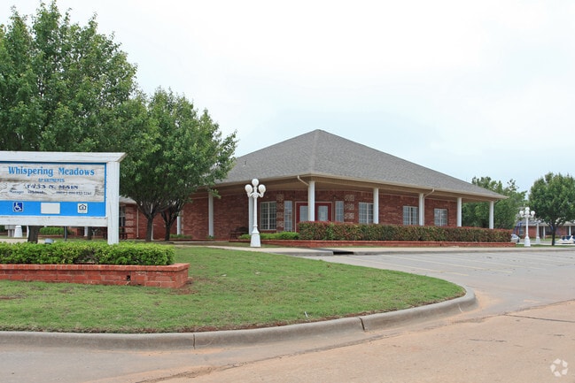
Property Detail
1431 N Main
Oklahoma City, OK
BLK 4 LOT 11 & 12 CHEROKEE HILL
0CH100004011000000
Grady
Officebuilding
Oklahoma
B and X Area of moderate flood hazard, usually the area between the limits of the 100-year and 500-year floods.
11,12
2025
2.89 AC
2025
McClain County
400104
Oklahoma City
1,724 SF
NEARBY LISTINGS FOR SALE OR LEASE
-
-
View all Blanchard listings for sale on LoopNet.com
DEMOGRAPHICS near 1431 N Main
1 mile
3 mile
5 mile
2025 Total Population
3,701
9,548
14,972
2030 Population
4,216
10,700
16,671
Pop Growth 2025-2030
+ 13.92%
+ 12.07%
+ 11.35%
Average Age
39
39
39
2025 Total Households
1,443
3,542
5,457
HH Growth 2025-2030
+ 14.07%
+ 12.25%
+ 11.51%
Median Household Inc
$67,309
$83,488
$88,005
Avg Household Size
2.50
2.70
2.70
2025 Avg HH Vehicles
2.00
2.00
2.00
Median Home Value
$233,175
$263,028
$271,576
Median Year Built
2000
2001
2002
Nearby Places
Map Layers
Map Styles
 Street
 Aerial
Layers
 Traffic
 Biking
Places
Listings with unknown addresses are not visible on the map
- Restaurants
- Banks
- Shops
- Fitness
- Groceries
PUBLIC TRANSPORTATION
AIRPORT
Will Rogers World
Drive
Walk
Distance
Will Rogers World
37 min
23.5 mi
Freight Ports
Tulsa Port Of Catoosa
Drive
Walk
Distance
Tulsa Port Of Catoosa
170 min
151.5 mi
Nearby Properties
Address
Land Use
TOTAL SIZE
Lot Size
Zoning
Address
Land Use
TOTAL SIZE
Lot Size
Zoning
7,564 SF
2.33 AC
Address
Land Use
TOTAL SIZE
Lot Size
Zoning
15,096 SF
1.81 AC
Address
Land Use
TOTAL SIZE
Lot Size
Zoning
5,125 SF
6 AC
Address
Land Use
TOTAL SIZE
Lot Size
Zoning
1,920 SF
20.82 AC
Address
Land Use
TOTAL SIZE
Lot Size
Zoning
8,584 SF
1.95 AC
Address
Land Use
TOTAL SIZE
Lot Size
Zoning
4,456 SF
0.24 AC
Address
Land Use
TOTAL SIZE
Lot Size
Zoning
6,240 SF
2.87 AC
Address
Land Use
TOTAL SIZE
Lot Size
Zoning
5,000 SF
80 AC
TM
Address
Land Use
TOTAL SIZE
Lot Size
Zoning
10,156 SF
1.13 AC
Address
Land Use
TOTAL SIZE
Lot Size
Zoning
5,765 SF
2.40 AC
Address
Land Use
TOTAL SIZE
Lot Size
Zoning
24,613 SF
1.99 AC
Address
Land Use
TOTAL SIZE
Lot Size
Zoning
1,080 SF
7.47 AC
Address
Land Use
TOTAL SIZE
Lot Size
Zoning
1,980 SF
6.40 AC
Address
Land Use
TOTAL SIZE
Lot Size
Zoning
10,880 SF
3.94 AC
Address
Land Use
TOTAL SIZE
Lot Size
Zoning
14,796 SF
0.40 AC
Address
Land Use
TOTAL SIZE
Lot Size
Zoning
3,420 SF
0.08 AC
Address
Land Use
TOTAL SIZE
Lot Size
Zoning
5,700 SF
9.40 AC
Address
Land Use
TOTAL SIZE
Lot Size
Zoning
6,900 SF
2.48 AC
Address
Land Use
TOTAL SIZE
Lot Size
Zoning
15,725 SF
9.45 AC
Address
Land Use
TOTAL SIZE
Lot Size
Zoning
14,908 SF
1.33 AC
Address
Land Use
TOTAL SIZE
Lot Size
Zoning
2,000 SF
1.16 AC
Address
Land Use
TOTAL SIZE
Lot Size
Zoning
800 SF
3.05 AC
The World's #1 Commercial Real Estate Marketplace
Connect with us
© 2026 CoStar Group
The information above has been obtained from sources believed reliable. While we do not doubt its accuracy we have not verified it and make no guarantee, warranty or representation about it. It is your responsibility to independently confirm its accuracy and completeness. Any projections, opinions, assumptions, or estimates used are for example only and do not represent the current or future performance of the property. The value of this transaction to you depends on tax and other factors which should be evaluated by your tax, financial, and legal advisors. You and your advisors should conduct a careful, independent investigation of the property to determine to your satisfaction the suitability of the property for your needs.