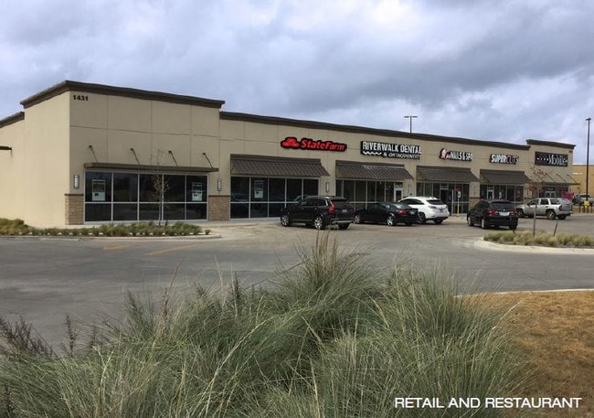
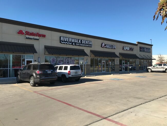
Property Record
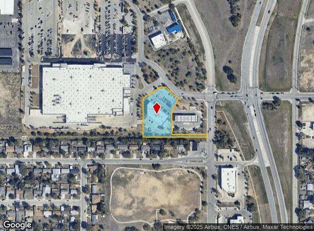
1431 Palo Alto Rd, San Antonio, TX 78211
NEARBY LISTINGS FOR SALE OR LEASE
Property Detail
1431 Palo Alto Rd
San Antonio-New Braunfels, TX
Ncb 12685 (Provident Centre Ph 1)
12685-032-0170
NCB 12685 (PROVIDENT CENTRE PH 1), BLOCK 32 LOT 17 2013) SPLIT/MERGE PER PLAT 9647/220 FILED 10-26-2012
Regionalshoppingcenterormallwithanchorstore
Bexar
X
Texas
48029C0560F
17
2024
1.53 AC
2025
South
161100
San Antonio
12,015 SF
DEMOGRAPHICS near 1431 Palo Alto Rd
1 Mile
3 Mile
5 Mile
2024 Total Population
11,707
64,575
187,868
2029 Population
12,203
68,565
199,555
Pop Growth 2024-2029
+ 4.24%
+ 6.18%
+ 6.22%
Average Age
37
36
36
2024 Total Households
3,586
19,836
57,651
HH Growth 2024-2029
+ 4.49%
+ 6.32%
+ 6.51%
Median Household Inc
$50,437
$45,210
$43,187
Avg Household Size
3.20
3.20
3.00
2024 Avg HH Vehicles
2.00
2.00
2.00
Median Home Value
$125,874
$111,057
$116,898
Median Year Built
1978
1973
1968
Nearby Places
Map Layers
Map Styles
 Street
 Aerial
- Restaurants
- Banks
- Shops
- Fitness
- Groceries
PUBLIC TRANSPORTATION
COMMUTER RAIL
DRIVE
WALK
Distance
15 min
9.0 mi
AIRPORT
San Antonio International
DRIVE
WALK
Distance
San Antonio International
23 min
15.4 mi
SALE & LEASE HISTORY
LISTING DATE
SALE/LEASE

Jan 31, 2022
For Lease
Jan 28, 2025
For Lease
Jan 27, 2017
For Lease
Nearby Properties
Address
Land Use
TOTAL SIZE
Lot Size
Zoning
Address
Land Use
TOTAL SIZE
Lot Size
Zoning
180,980 SF
1,373.90 AC
Address
Land Use
TOTAL SIZE
Lot Size
Zoning
548,048 SF
27.53 AC
Address
Land Use
TOTAL SIZE
Lot Size
Zoning
324,153 SF
17.31 AC
Address
Land Use
TOTAL SIZE
Lot Size
Zoning
504,337 SF
45.55 AC
Address
Land Use
TOTAL SIZE
Lot Size
Zoning
447,169 SF
46.74 AC
Address
Land Use
TOTAL SIZE
Lot Size
Zoning
71,607 SF
10.46 AC
Address
Land Use
TOTAL SIZE
Lot Size
Zoning
218,003 SF
12.33 AC
Address
Land Use
TOTAL SIZE
Lot Size
Zoning
Address
Land Use
TOTAL SIZE
Lot Size
Zoning
11,553 SF
67.15 AC
Address
Land Use
TOTAL SIZE
Lot Size
Zoning
80,936 SF
13.48 AC
Address
Land Use
TOTAL SIZE
Lot Size
Zoning
45,363 SF
4.29 AC
Address
Land Use
TOTAL SIZE
Lot Size
Zoning
143,067 SF
11.69 AC
Address
Land Use
TOTAL SIZE
Lot Size
Zoning
56,875 SF
10.04 AC
Address
Land Use
TOTAL SIZE
Lot Size
Zoning
526.61 AC
Address
Land Use
TOTAL SIZE
Lot Size
Zoning
188,948 SF
20.59 AC
Address
Land Use
TOTAL SIZE
Lot Size
Zoning
166,270 SF
13.95 AC
Address
Land Use
TOTAL SIZE
Lot Size
Zoning
141,606 SF
13.74 AC
Address
Land Use
TOTAL SIZE
Lot Size
Zoning
67,184 SF
60.16 AC
Address
Land Use
TOTAL SIZE
Lot Size
Zoning
109,591 SF
5.65 AC
Address
Land Use
TOTAL SIZE
Lot Size
Zoning
47.74 AC
Address
Land Use
TOTAL SIZE
Lot Size
Zoning
73,178 SF
23.11 AC
Address
Land Use
TOTAL SIZE
Lot Size
Zoning
258,170 SF
17.89 AC
Address
Land Use
TOTAL SIZE
Lot Size
Zoning
34,344 SF
9.79 AC
Address
Land Use
TOTAL SIZE
Lot Size
Zoning
72,868 SF
14.79 AC
Address
Land Use
TOTAL SIZE
Lot Size
Zoning
51,960 SF
8 AC
Address
Land Use
TOTAL SIZE
Lot Size
Zoning
86,352 SF
5.05 AC
Address
Land Use
TOTAL SIZE
Lot Size
Zoning
137,586 SF
13.50 AC
Address
Land Use
TOTAL SIZE
Lot Size
Zoning
262,013 SF
13.41 AC
Address
Land Use
TOTAL SIZE
Lot Size
Zoning
153,762 SF
8.34 AC
Address
Land Use
TOTAL SIZE
Lot Size
Zoning
101,660 SF
4.57 AC
The World's #1 Commercial Real Estate Marketplace
Connect with us
© 2025 CoStar Group
The information above has been obtained from sources believed reliable. While we do not doubt its accuracy we have not verified it and make no guarantee, warranty or representation about it. It is your responsibility to independently confirm its accuracy and completeness. Any projections, opinions, assumptions, or estimates used are for example only and do not represent the current or future performance of the property. The value of this transaction to you depends on tax and other factors which should be evaluated by your tax, financial, and legal advisors. You and your advisors should conduct a careful, independent investigation of the property to determine to your satisfaction the suitability of the property for your needs.