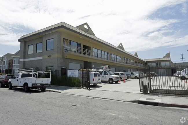
Property Record
14311 Cerise Ave, Hawthorne, CA 90250


Current Lease Availabilities
NEARBY LISTINGS FOR SALE OR LEASE
Property Detail
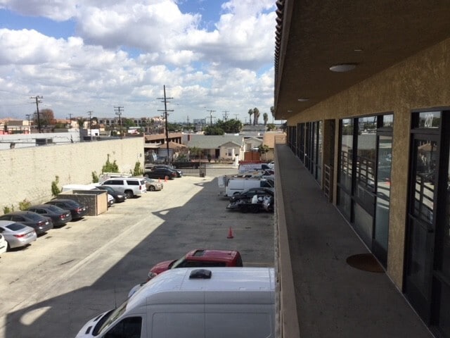
14311 Cerise Ave
Los Angeles-Long Beach-Glendale, CA
993
4071-010-014
TRACT # 993 LOT 73
Warehouse
Los Angeles
X
California
06037C1790F
73
2024
0.72 AC
2025
Gardena/Hawthorne
603705
Los Angeles
21,416 SF
DEMOGRAPHICS near 14311 Cerise Ave
1 Mile
3 Mile
5 Mile
2024 Total Population
57,675
308,559
699,214
2029 Population
56,201
298,906
677,850
Pop Growth 2024-2029
(2.56%)
(3.13%)
(3.06%)
Average Age
37
39
39
2024 Total Households
19,733
102,941
235,149
HH Growth 2024-2029
(2.68%)
(3.35%)
(3.23%)
Median Household Inc
$63,606
$75,172
$79,125
Avg Household Size
2.80
2.90
2.90
2024 Avg HH Vehicles
2.00
2.00
2.00
Median Home Value
$715,087
$747,673
$794,349
Median Year Built
1969
1961
1961
Nearby Places
Map Layers
Map Styles
 Street
 Aerial
- Restaurants
- Banks
- Shops
- Fitness
- Groceries
PUBLIC TRANSPORTATION
AIRPORT
Los Angeles International
DRIVE
WALK
Distance
Los Angeles International
14 min
7.7 mi
Long Beach (Daugherty Field)
DRIVE
WALK
Distance
Long Beach (Daugherty Field)
21 min
14.3 mi
Bob Hope
DRIVE
WALK
Distance
Bob Hope
41 min
31.0 mi
Freight Ports
Port of Long Beach
DRIVE
WALK
Distance
Port of Long Beach
24 min
16.2 mi
Nearby Properties
Address
Land Use
TOTAL SIZE
Lot Size
Zoning
Address
Land Use
TOTAL SIZE
Lot Size
Zoning
584,746 SF
20.38 AC
MNIP
Address
Land Use
TOTAL SIZE
Lot Size
Zoning
Address
Land Use
TOTAL SIZE
Lot Size
Zoning
Address
Land Use
TOTAL SIZE
Lot Size
Zoning
Address
Land Use
TOTAL SIZE
Lot Size
Zoning
Address
Land Use
TOTAL SIZE
Lot Size
Zoning
337,106 SF
9.56 AC
ESCM*
Address
Land Use
TOTAL SIZE
Lot Size
Zoning
944,791 SF
22.53 AC
ESCM*
Address
Land Use
TOTAL SIZE
Lot Size
Zoning
421,934 SF
8.24 AC
ESCM
Address
Land Use
TOTAL SIZE
Lot Size
Zoning
718,086 SF
41.24 AC
RBI-1A
Address
Land Use
TOTAL SIZE
Lot Size
Zoning
848,217 SF
36.09 AC
RBI-1A
Address
Land Use
TOTAL SIZE
Lot Size
Zoning
189,244 SF
3.64 AC
ESCM*
Address
Land Use
TOTAL SIZE
Lot Size
Zoning
604,106 SF
42.72 AC
TOMI-HVY
Address
Land Use
TOTAL SIZE
Lot Size
Zoning
227,596 SF
14.38 AC
HAM1YY
Address
Land Use
TOTAL SIZE
Lot Size
Zoning
279,694 SF
3.19 AC
LCR1*
Address
Land Use
TOTAL SIZE
Lot Size
Zoning
1,504,661 SF
RBCR
Address
Land Use
TOTAL SIZE
Lot Size
Zoning
216,354 SF
3.52 AC
HAC3
Address
Land Use
TOTAL SIZE
Lot Size
Zoning
214,782 SF
3.66 AC
GAR3
Address
Land Use
TOTAL SIZE
Lot Size
Zoning
833,484 SF
6.62 AC
ESM2YY
Address
Land Use
TOTAL SIZE
Lot Size
Zoning
239,992 SF
4.72 AC
RBI-1B
Address
Land Use
TOTAL SIZE
Lot Size
Zoning
92,374 SF
2.59 AC
ESCM*
Address
Land Use
TOTAL SIZE
Lot Size
Zoning
186,683 SF
1.74 AC
LCR1*
Address
Land Use
TOTAL SIZE
Lot Size
Zoning
986,604 SF
42.66 AC
HAM2YY
Address
Land Use
TOTAL SIZE
Lot Size
Zoning
59,422 SF
2.89 AC
HAM2YY
Address
Land Use
TOTAL SIZE
Lot Size
Zoning
203,587 SF
12.09 AC
ESCM*
Address
Land Use
TOTAL SIZE
Lot Size
Zoning
296,083 SF
13.62 AC
ESCM*
Address
Land Use
TOTAL SIZE
Lot Size
Zoning
207,972 SF
11.22 AC
HAM2
Address
Land Use
TOTAL SIZE
Lot Size
Zoning
316,111 SF
12.61 AC
RBI-1
Address
Land Use
TOTAL SIZE
Lot Size
Zoning
74,863 SF
3.06 AC
ESCM*
Address
Land Use
TOTAL SIZE
Lot Size
Zoning
169,758 SF
9.20 AC
LCR1*
The World's #1 Commercial Real Estate Marketplace
Connect with us
© 2025 CoStar Group
The information above has been obtained from sources believed reliable. While we do not doubt its accuracy we have not verified it and make no guarantee, warranty or representation about it. It is your responsibility to independently confirm its accuracy and completeness. Any projections, opinions, assumptions, or estimates used are for example only and do not represent the current or future performance of the property. The value of this transaction to you depends on tax and other factors which should be evaluated by your tax, financial, and legal advisors. You and your advisors should conduct a careful, independent investigation of the property to determine to your satisfaction the suitability of the property for your needs.