Property Record
14315 Old Route 66, Bellemont, AZ 86015
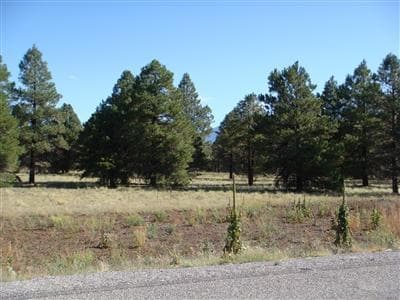

Property Detail
14315 Old Route 66
203-35-010C
SIXTEENTH: NE QUARTER: SE SECTION: 34 TOWNSHIP: 22N RANGE: 05E SIXTEENTH: SE QUARTER: SE SECTION: 34 TOWNSHIP: 22N RANGE: 05E POR PCL BEG C-E 1/16 COR SEC 34 TH S 00-01-14 E 190.54 TPOB; TH SELY ALNG CURVE TO RIGHT 2027.06; TH S 19-49-16 W 1438.61; T
Industrialgeneral
COCONINO
B and X Area of moderate flood hazard, usually the area between the limits of the 100-year and 500-year floods.
Arizona
2024
59.67 AC
2025
Flagstaff
002201
Other Market Areas
43,961 SF
Flagstaff, AZ
NEARBY LISTINGS FOR SALE OR LEASE
DEMOGRAPHICS near 14315 Old Route 66
1 mile
3 mile
5 mile
2025 Total Population
12
1,455
1,497
2030 Population
13
1,515
1,559
Pop Growth 2025-2030
+ 8.33%
+ 4.12%
+ 4.14%
Average Age
35
35
35
2025 Total Households
4
510
526
HH Growth 2025-2030
+ 25.00%
+ 3.33%
+ 3.42%
Median Household Inc
$124,999
$120,890
$120,999
Avg Household Size
2.40
2.80
2.70
2025 Avg HH Vehicles
2.00
2.00
2.00
Median Home Value
$450,000
$512,972
$518,182
Median Year Built
2003
2004
2003
Nearby Places
Map Layers
Map Styles
 Street
 Aerial
Layers
 Traffic
 Biking
Places
Listings with unknown addresses are not visible on the map
- Restaurants
- Banks
- Shops
- Fitness
- Groceries
PUBLIC TRANSPORTATION
AIRPORT
Flagstaff Pulliam
Drive
Walk
Distance
Flagstaff Pulliam
21 min
15.0 mi
Freight Ports
Port of San Diego
Drive
Walk
Distance
Port of San Diego
544 min
497.6 mi
Nearby Properties
Address
Land Use
TOTAL SIZE
Lot Size
Zoning
Address
Land Use
TOTAL SIZE
Lot Size
Zoning
425,176 SF
25 AC
Address
Land Use
TOTAL SIZE
Lot Size
Zoning
133,176 SF
10 AC
Address
Land Use
TOTAL SIZE
Lot Size
Zoning
16,162 SF
7.35 AC
Address
Land Use
TOTAL SIZE
Lot Size
Zoning
23,644 SF
4.48 AC
Address
Land Use
TOTAL SIZE
Lot Size
Zoning
22,501 SF
1.30 AC
Address
Land Use
TOTAL SIZE
Lot Size
Zoning
16,008 SF
5.58 AC
Address
Land Use
TOTAL SIZE
Lot Size
Zoning
9,712 SF
3.57 AC
Address
Land Use
TOTAL SIZE
Lot Size
Zoning
17,700 SF
1.42 AC
Address
Land Use
TOTAL SIZE
Lot Size
Zoning
Address
Land Use
TOTAL SIZE
Lot Size
Zoning
5,438 SF
3.65 AC
Address
Land Use
TOTAL SIZE
Lot Size
Zoning
11,505 SF
0.97 AC
Address
Land Use
TOTAL SIZE
Lot Size
Zoning
Address
Land Use
TOTAL SIZE
Lot Size
Zoning
Address
Land Use
TOTAL SIZE
Lot Size
Zoning
Address
Land Use
TOTAL SIZE
Lot Size
Zoning
8,000 SF
1.36 AC
Address
Land Use
TOTAL SIZE
Lot Size
Zoning
Address
Land Use
TOTAL SIZE
Lot Size
Zoning
4,800 SF
2.03 AC
Address
Land Use
TOTAL SIZE
Lot Size
Zoning
5.66 AC
Address
Land Use
TOTAL SIZE
Lot Size
Zoning
1,056 SF
5.03 AC
Address
Land Use
TOTAL SIZE
Lot Size
Zoning
3,909 SF
5 AC
Address
Land Use
TOTAL SIZE
Lot Size
Zoning
5,947 SF
1.12 AC
Address
Land Use
TOTAL SIZE
Lot Size
Zoning
Address
Land Use
TOTAL SIZE
Lot Size
Zoning
Address
Land Use
TOTAL SIZE
Lot Size
Zoning
2.90 AC
Address
Land Use
TOTAL SIZE
Lot Size
Zoning
Address
Land Use
TOTAL SIZE
Lot Size
Zoning
2,160 SF
4.79 AC
Address
Land Use
TOTAL SIZE
Lot Size
Zoning
4,000 SF
0.96 AC
The World's #1 Commercial Real Estate Marketplace
Connect with us
© 2026 CoStar Group
The information above has been obtained from sources believed reliable. While we do not doubt its accuracy we have not verified it and make no guarantee, warranty or representation about it. It is your responsibility to independently confirm its accuracy and completeness. Any projections, opinions, assumptions, or estimates used are for example only and do not represent the current or future performance of the property. The value of this transaction to you depends on tax and other factors which should be evaluated by your tax, financial, and legal advisors. You and your advisors should conduct a careful, independent investigation of the property to determine to your satisfaction the suitability of the property for your needs.