Property Record
1432 Poplar St, Cayce, SC 29033


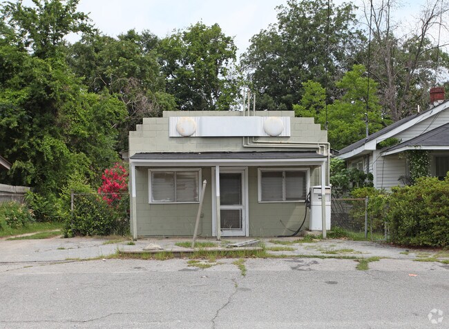
Property Detail
1432 Poplar St
Columbia, SC
LOTS 1 & 2 BLK 151 (100 X 150FT)
005765-06-006
Lexington
Religious
South Carolina
B and X Area of moderate flood hazard, usually the area between the limits of the 100-year and 500-year floods.
1-2
0
0.34 AC
2024
Cayce/West Columbia
020202
Columbia
873 SF
NEARBY LISTINGS FOR SALE OR LEASE
DEMOGRAPHICS near 1432 Poplar St
1 mile
3 mile
5 mile
2025 Total Population
6,611
50,138
125,648
2030 Population
6,914
52,398
131,299
Pop Growth 2025-2030
+ 4.58%
+ 4.51%
+ 4.50%
Average Age
41
36
37
2025 Total Households
3,069
20,976
56,172
HH Growth 2025-2030
+ 4.82%
+ 4.89%
+ 4.84%
Median Household Inc
$43,013
$50,217
$53,250
Avg Household Size
2.10
2.00
2.00
2025 Avg HH Vehicles
2.00
2.00
2.00
Median Home Value
$166,629
$190,077
$226,666
Median Year Built
1963
1975
1975
Nearby Places
Map Layers
Map Styles
 Street
 Aerial
Layers
 Traffic
 Biking
Places
Listings with unknown addresses are not visible on the map
- Restaurants
- Banks
- Shops
- Fitness
- Groceries
PUBLIC TRANSPORTATION
COMMUTER RAIL
Drive
Walk
Distance
8 min
3.7 mi
AIRPORT
Columbia Metro
Drive
Walk
Distance
Columbia Metro
17 min
6.2 mi
Nearby Properties
Address
Land Use
TOTAL SIZE
Lot Size
Zoning
Address
Land Use
TOTAL SIZE
Lot Size
Zoning
106,284 SF
10.83 AC
C-5
Address
Land Use
TOTAL SIZE
Lot Size
Zoning
30,100 SF
3.45 AC
M-2
Address
Land Use
TOTAL SIZE
Lot Size
Zoning
413,000 SF
3.48 AC
MC
Address
Land Use
TOTAL SIZE
Lot Size
Zoning
160,510 SF
0.26 AC
DAC
Address
Land Use
TOTAL SIZE
Lot Size
Zoning
311,754 SF
1.78 AC
DAC
Address
Land Use
TOTAL SIZE
Lot Size
Zoning
440,418 SF
7.23 AC
M-1
Address
Land Use
TOTAL SIZE
Lot Size
Zoning
375,417 SF
3.92 AC
INS-GEN
Address
Land Use
TOTAL SIZE
Lot Size
Zoning
530,349 SF
0.75 AC
DAC
Address
Land Use
TOTAL SIZE
Lot Size
Zoning
119,738 SF
10.30 AC
EC
Address
Land Use
TOTAL SIZE
Lot Size
Zoning
100 SF
9.81 AC
MC
Address
Land Use
TOTAL SIZE
Lot Size
Zoning
311,168 SF
3.98 AC
MC
Address
Land Use
TOTAL SIZE
Lot Size
Zoning
494,384 SF
1.67 AC
MC
Address
Land Use
TOTAL SIZE
Lot Size
Zoning
291,996 SF
0.78 AC
DAC
Address
Land Use
TOTAL SIZE
Lot Size
Zoning
490,633 SF
13.20 AC
RM-2
Address
Land Use
TOTAL SIZE
Lot Size
Zoning
163,868 SF
4.35 AC
CAC
Address
Land Use
TOTAL SIZE
Lot Size
Zoning
100 SF
4.49 AC
INS-GEN
Address
Land Use
TOTAL SIZE
Lot Size
Zoning
100 SF
4.24 AC
INS-GEN
Address
Land Use
TOTAL SIZE
Lot Size
Zoning
352,672 SF
5.16 AC
MC
Address
Land Use
TOTAL SIZE
Lot Size
Zoning
316,822 SF
1.53 AC
C-1
Address
Land Use
TOTAL SIZE
Lot Size
Zoning
300,130 SF
7.56 AC
RAC
Address
Land Use
TOTAL SIZE
Lot Size
Zoning
155,883 SF
2.74 AC
MC
Address
Land Use
TOTAL SIZE
Lot Size
Zoning
22,802 SF
2.64 AC
MC
Address
Land Use
TOTAL SIZE
Lot Size
Zoning
114,137 SF
0.80 AC
C-3
Address
Land Use
TOTAL SIZE
Lot Size
Zoning
364,000 SF
0.58 AC
DAC
Address
Land Use
TOTAL SIZE
Lot Size
Zoning
138,832 SF
3.47 AC
C-1
Address
Land Use
TOTAL SIZE
Lot Size
Zoning
2,908 SF
87.03 AC
C-3
Address
Land Use
TOTAL SIZE
Lot Size
Zoning
155,590 SF
1.18 AC
C-4
Address
Land Use
TOTAL SIZE
Lot Size
Zoning
4.85 AC
MC
Address
Land Use
TOTAL SIZE
Lot Size
Zoning
100 SF
4.94 AC
C-1
Address
Land Use
TOTAL SIZE
Lot Size
Zoning
121,560 SF
8.46 AC
RM-2
The World's #1 Commercial Real Estate Marketplace
Connect with us
© 2026 CoStar Group
The information above has been obtained from sources believed reliable. While we do not doubt its accuracy we have not verified it and make no guarantee, warranty or representation about it. It is your responsibility to independently confirm its accuracy and completeness. Any projections, opinions, assumptions, or estimates used are for example only and do not represent the current or future performance of the property. The value of this transaction to you depends on tax and other factors which should be evaluated by your tax, financial, and legal advisors. You and your advisors should conduct a careful, independent investigation of the property to determine to your satisfaction the suitability of the property for your needs.