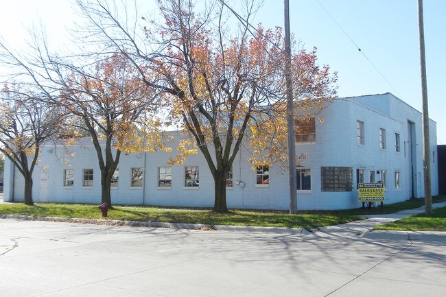
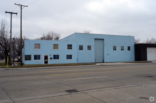
Property Record
14326 E 9 Mile Rd, Warren, MI 48089
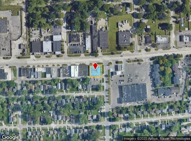
NEARBY LISTINGS FOR SALE OR LEASE
Property Detail
14326 E 9 Mile Rd
Detroit-Warren-Dearborn, MI
Independence Park Subdivision
12-13-36-131-014
HITCHMAN'S INDEPENDENCE PARK SUBDIVISION LOTS 295 TO 299 INCL L7 P56
Lightindustrial
Macomb
X
Michigan
26163C0130F
295-299
2025
0.25 AC
2025
Groesbeck South
264200
Detroit
10,150 SF
DEMOGRAPHICS near 14326 E 9 Mile Rd
1 Mile
3 Mile
5 Mile
2024 Total Population
15,865
156,356
387,877
2029 Population
15,705
155,853
385,382
Pop Growth 2024-2029
(1.01%)
(0.32%)
(0.64%)
Average Age
37
37
39
2024 Total Households
6,104
59,099
151,566
HH Growth 2024-2029
(1.02%)
(0.47%)
(0.76%)
Median Household Inc
$43,156
$46,715
$50,070
Avg Household Size
2.50
2.60
2.50
2024 Avg HH Vehicles
2.00
2.00
2.00
Median Home Value
$85,248
$96,898
$127,116
Median Year Built
1954
1955
1956
Nearby Places
Map Layers
Map Styles
 Street
 Aerial
- Restaurants
- Banks
- Shops
- Fitness
- Groceries
PUBLIC TRANSPORTATION
AIRPORT
Windsor International
DRIVE
WALK
Distance
Windsor International
47 min
21.5 mi
Detroit Metro Wayne County
DRIVE
WALK
Distance
Detroit Metro Wayne County
50 min
31.0 mi
Nearby Properties
Address
Land Use
TOTAL SIZE
Lot Size
Zoning
Address
Land Use
TOTAL SIZE
Lot Size
Zoning
1,034,990 SF
28.60 AC
Address
Land Use
TOTAL SIZE
Lot Size
Zoning
260,164 SF
Address
Land Use
TOTAL SIZE
Lot Size
Zoning
238,144 SF
12.15 AC
MZ
Address
Land Use
TOTAL SIZE
Lot Size
Zoning
450,958 SF
Address
Land Use
TOTAL SIZE
Lot Size
Zoning
661,151 SF
37.28 AC
MZ
Address
Land Use
TOTAL SIZE
Lot Size
Zoning
323,858 SF
20.66 AC
R-3
Address
Land Use
TOTAL SIZE
Lot Size
Zoning
182,866 SF
5.08 AC
PD
Address
Land Use
TOTAL SIZE
Lot Size
Zoning
401,671 SF
19.40 AC
MZ
Address
Land Use
TOTAL SIZE
Lot Size
Zoning
198,064 SF
11.11 AC
MZ
Address
Land Use
TOTAL SIZE
Lot Size
Zoning
362,350 SF
22.39 AC
M-2
Address
Land Use
TOTAL SIZE
Lot Size
Zoning
162,597 SF
17.94 AC
C-2
Address
Land Use
TOTAL SIZE
Lot Size
Zoning
426,764 SF
38.46 AC
R-M
Address
Land Use
TOTAL SIZE
Lot Size
Zoning
197,670 SF
42.84 AC
M4
Address
Land Use
TOTAL SIZE
Lot Size
Zoning
166,064 SF
6.33 AC
M-3
Address
Land Use
TOTAL SIZE
Lot Size
Zoning
92,800 SF
6.71 AC
R-3
Address
Land Use
TOTAL SIZE
Lot Size
Zoning
105,354 SF
2.33 AC
B-3
Address
Land Use
TOTAL SIZE
Lot Size
Zoning
167,589 SF
16.80 AC
B-3
Address
Land Use
TOTAL SIZE
Lot Size
Zoning
184,986 SF
13.49 AC
MZ
Address
Land Use
TOTAL SIZE
Lot Size
Zoning
119,898 SF
14.65 AC
B-2
Address
Land Use
TOTAL SIZE
Lot Size
Zoning
410,359 SF
27.52 AC
M4
Address
Land Use
TOTAL SIZE
Lot Size
Zoning
63,949 SF
10.41 AC
R-1-C
Address
Land Use
TOTAL SIZE
Lot Size
Zoning
180,834 SF
17.97 AC
M-3
Address
Land Use
TOTAL SIZE
Lot Size
Zoning
40,951 SF
42.61 AC
M-2
Address
Land Use
TOTAL SIZE
Lot Size
Zoning
91,739 SF
6.54 AC
B-2
Address
Land Use
TOTAL SIZE
Lot Size
Zoning
182,800 SF
7.86 AC
M-3
Address
Land Use
TOTAL SIZE
Lot Size
Zoning
74,112 SF
4.51 AC
R-M
Address
Land Use
TOTAL SIZE
Lot Size
Zoning
129,636 SF
2.07 AC
C-3
Address
Land Use
TOTAL SIZE
Lot Size
Zoning
165,232 SF
6.56 AC
M-2
Address
Land Use
TOTAL SIZE
Lot Size
Zoning
52,860 SF
2.52 AC
R-M
Address
Land Use
TOTAL SIZE
Lot Size
Zoning
116,778 SF
12.98 AC
MZ
The World's #1 Commercial Real Estate Marketplace
Connect with us
© 2026 CoStar Group
The information above has been obtained from sources believed reliable. While we do not doubt its accuracy we have not verified it and make no guarantee, warranty or representation about it. It is your responsibility to independently confirm its accuracy and completeness. Any projections, opinions, assumptions, or estimates used are for example only and do not represent the current or future performance of the property. The value of this transaction to you depends on tax and other factors which should be evaluated by your tax, financial, and legal advisors. You and your advisors should conduct a careful, independent investigation of the property to determine to your satisfaction the suitability of the property for your needs.