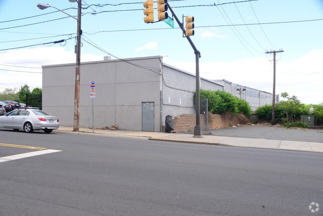
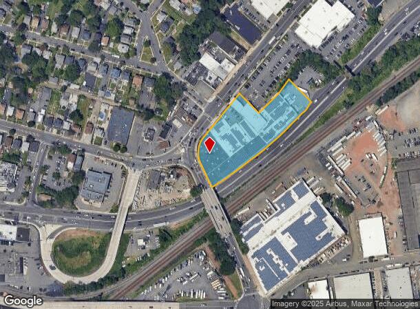
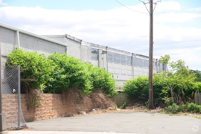
Property Record
1433 N Broad St, Hillside, NJ 07205

NEARBY LISTINGS FOR SALE OR LEASE
Property Detail
1433 N Broad St
07-01012-0000-00001
Township/Hillside
Commercialnec
Union
X
New Jersey
34013C0154F
1
2024
2.33 AC
2025
Route 78/22 East
032300
Northern New Jersey
9,999 SF
Newark, NJ-PA
DEMOGRAPHICS near 1433 N Broad St
1 Mile
3 Mile
5 Mile
2024 Total Population
36,160
312,562
723,659
2029 Population
35,115
303,903
704,316
Pop Growth 2024-2029
(2.89%)
(2.77%)
(2.67%)
Average Age
40
38
38
2024 Total Households
13,010
110,406
257,302
HH Growth 2024-2029
(3.02%)
(2.85%)
(2.71%)
Median Household Inc
$53,601
$54,990
$58,834
Avg Household Size
2.60
2.70
2.70
2024 Avg HH Vehicles
1.00
1.00
1.00
Median Home Value
$325,348
$345,464
$369,432
Median Year Built
1949
1956
1958
Nearby Places
- Restaurants
- Banks
- Shops
- Fitness
- Groceries
PUBLIC TRANSPORTATION
COMMUTER RAIL
North Elizabeth (North Jersey Coast Line - NJ Transit Commuter Rail (NJ Transit), Northeast Corridor Line - NJ Transit Commuter Rail (NJ Transit))
DRIVE
WALK
Distance
North Elizabeth (North Jersey Coast Line - NJ Transit Commuter Rail (NJ Transit), Northeast Corridor Line - NJ Transit Commuter Rail (NJ Transit))
3 min
1.6 mi
Union (Raritan Valley Line - NJ Transit Commuter Rail (NJ Transit))
DRIVE
WALK
Distance
Union (Raritan Valley Line - NJ Transit Commuter Rail (NJ Transit))
5 min
2.7 mi
AIRPORT
Newark Liberty International
DRIVE
WALK
Distance
Newark Liberty International
8 min
5.8 mi
LaGuardia
DRIVE
WALK
Distance
LaGuardia
43 min
25.1 mi
John F Kennedy International
DRIVE
WALK
Distance
John F Kennedy International
52 min
34.5 mi
Freight Ports
Maher Terminal
DRIVE
WALK
Distance
Maher Terminal
9 min
5.8 mi
Nearby Properties
Address
Land Use
TOTAL SIZE
Lot Size
Zoning
Address
Land Use
TOTAL SIZE
Lot Size
Zoning
Address
Land Use
TOTAL SIZE
Lot Size
Zoning
Address
Land Use
TOTAL SIZE
Lot Size
Zoning
Address
Land Use
TOTAL SIZE
Lot Size
Zoning
961.13 AC
Address
Land Use
TOTAL SIZE
Lot Size
Zoning
789.45 AC
Address
Land Use
TOTAL SIZE
Lot Size
Zoning
Address
Land Use
TOTAL SIZE
Lot Size
Zoning
11.36 AC
Address
Land Use
TOTAL SIZE
Lot Size
Zoning
0.61 AC
Address
Land Use
TOTAL SIZE
Lot Size
Zoning
Address
Land Use
TOTAL SIZE
Lot Size
Zoning
Address
Land Use
TOTAL SIZE
Lot Size
Zoning
1,136 SF
6.51 AC
Address
Land Use
TOTAL SIZE
Lot Size
Zoning
Address
Land Use
TOTAL SIZE
Lot Size
Zoning
5.89 AC
Address
Land Use
TOTAL SIZE
Lot Size
Zoning
Address
Land Use
TOTAL SIZE
Lot Size
Zoning
32.27 AC
CCRC
Address
Land Use
TOTAL SIZE
Lot Size
Zoning
Address
Land Use
TOTAL SIZE
Lot Size
Zoning
20,000 SF
30.36 AC
Address
Land Use
TOTAL SIZE
Lot Size
Zoning
4.82 AC
Address
Land Use
TOTAL SIZE
Lot Size
Zoning
1.89 AC
Address
Land Use
TOTAL SIZE
Lot Size
Zoning
2.21 AC
Address
Land Use
TOTAL SIZE
Lot Size
Zoning
0.09 AC
Address
Land Use
TOTAL SIZE
Lot Size
Zoning
Address
Land Use
TOTAL SIZE
Lot Size
Zoning
0.83 AC
Address
Land Use
TOTAL SIZE
Lot Size
Zoning
0.83 AC
Address
Land Use
TOTAL SIZE
Lot Size
Zoning
1 SF
19.95 AC
Address
Land Use
TOTAL SIZE
Lot Size
Zoning
1.01 AC
Address
Land Use
TOTAL SIZE
Lot Size
Zoning
16.14 AC
Address
Land Use
TOTAL SIZE
Lot Size
Zoning
21.25 AC
Address
Land Use
TOTAL SIZE
Lot Size
Zoning
2.22 AC
Address
Land Use
TOTAL SIZE
Lot Size
Zoning
310.45 AC
The World's #1 Commercial Real Estate Marketplace
Connect with us
© 2025 CoStar Group
The information above has been obtained from sources believed reliable. While we do not doubt its accuracy we have not verified it and make no guarantee, warranty or representation about it. It is your responsibility to independently confirm its accuracy and completeness. Any projections, opinions, assumptions, or estimates used are for example only and do not represent the current or future performance of the property. The value of this transaction to you depends on tax and other factors which should be evaluated by your tax, financial, and legal advisors. You and your advisors should conduct a careful, independent investigation of the property to determine to your satisfaction the suitability of the property for your needs.