Property Record
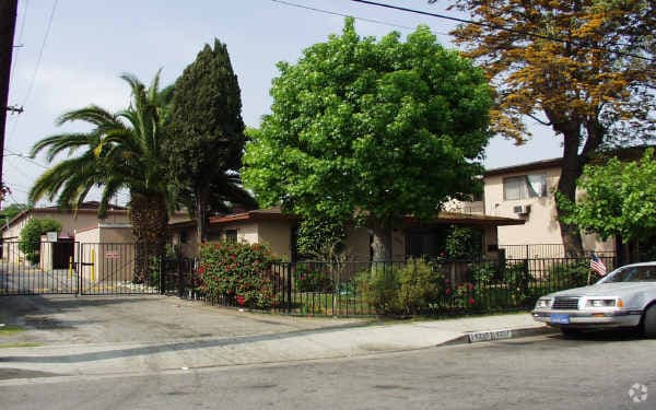
14335 Clark St, Baldwin Park, CA 91706


Property Detail
14335 Clark St
8544-016-023
REVISED MAP OF VINELAND OF THE AZUSA W 96.67 FT EX OF ST OF LOT 26
Multifamilydwelling
Los Angeles
BPR3*
California
B and X Area of moderate flood hazard, usually the area between the limits of the 100-year and 500-year floods.
26
2025
0.96 AC
2025
Baldwin Park
405102
Los Angeles
22,950 SF
Los Angeles-Long Beach-Glendale, CA
NEARBY LISTINGS FOR SALE OR LEASE
DEMOGRAPHICS near 14335 Clark St
1 mile
3 mile
5 mile
2025 Total Population
34,049
167,383
516,477
2030 Population
33,399
164,808
509,718
Pop Growth 2025-2030
(1.91%)
(1.54%)
(1.31%)
Average Age
39
40
40
2025 Total Households
8,465
44,070
146,916
HH Growth 2025-2030
(2.20%)
(1.76%)
(1.48%)
Median Household Inc
$76,680
$87,594
$89,497
Avg Household Size
3.90
3.60
3.40
2025 Avg HH Vehicles
3.00
3.00
2.00
Median Home Value
$693,170
$713,032
$738,548
Median Year Built
1959
1958
1959
Nearby Places
Map Layers
Map Styles
 Street
 Aerial
Layers
 Traffic
 Biking
Places
Listings with unknown addresses are not visible on the map
- Restaurants
- Banks
- Shops
- Fitness
- Groceries
PUBLIC TRANSPORTATION
TRANSIT/SUBWAY
Baldwin Park (San Bernardino Line - Southern California Regional Rail Authority (Metrolink))
Drive
Walk
Distance
Baldwin Park (San Bernardino Line - Southern California Regional Rail Authority (Metrolink))
2 min
10 min
0.5 mi
COMMUTER RAIL
Baldwin Park (San Bernardino Line - Southern California Regional Rail Authority (Metrolink))
Drive
Walk
Distance
Baldwin Park (San Bernardino Line - Southern California Regional Rail Authority (Metrolink))
3 min
12 min
0.6 mi
Covina (San Bernardino Line - Southern California Regional Rail Authority (Metrolink))
Drive
Walk
Distance
Covina (San Bernardino Line - Southern California Regional Rail Authority (Metrolink))
10 min
4.9 mi
AIRPORT
Ontario International
Drive
Walk
Distance
Ontario International
32 min
23.2 mi
Long Beach (Daugherty Field)
Drive
Walk
Distance
Long Beach (Daugherty Field)
37 min
26.9 mi
Bob Hope
Drive
Walk
Distance
Bob Hope
41 min
31.6 mi
Nearby Properties
Address
Land Use
TOTAL SIZE
Lot Size
Zoning
Address
Land Use
TOTAL SIZE
Lot Size
Zoning
1,829,870 SF
24.47 AC
BPCM*
Address
Land Use
TOTAL SIZE
Lot Size
Zoning
453,050 SF
17.48 AC
DUH*
Address
Land Use
TOTAL SIZE
Lot Size
Zoning
702,934 SF
16.81 AC
WCCR
Address
Land Use
TOTAL SIZE
Lot Size
Zoning
546,676 SF
6.38 AC
WCCR*
Address
Land Use
TOTAL SIZE
Lot Size
Zoning
836,910 SF
75.03 AC
IRM25*
Address
Land Use
TOTAL SIZE
Lot Size
Zoning
286,646 SF
21.99 AC
WCOPCC*
Address
Land Use
TOTAL SIZE
Lot Size
Zoning
636,006 SF
27.79 AC
IRM2*
Address
Land Use
TOTAL SIZE
Lot Size
Zoning
1,104,998 SF
28 AC
IRM2*
Address
Land Use
TOTAL SIZE
Lot Size
Zoning
177,480 SF
9.39 AC
WCR3-MF20*
Address
Land Use
TOTAL SIZE
Lot Size
Zoning
202,269 SF
4.04 AC
IRM2
Address
Land Use
TOTAL SIZE
Lot Size
Zoning
375,679 SF
39.70 AC
ARM2*
Address
Land Use
TOTAL SIZE
Lot Size
Zoning
184,820 SF
IRM1*
Address
Land Use
TOTAL SIZE
Lot Size
Zoning
3.29 AC
DUSP
Address
Land Use
TOTAL SIZE
Lot Size
Zoning
357,639 SF
4.34 AC
DUSP
Address
Land Use
TOTAL SIZE
Lot Size
Zoning
862,213 SF
21.22 AC
WCSP
Address
Land Use
TOTAL SIZE
Lot Size
Zoning
627,908 SF
23.08 AC
IRM1*
Address
Land Use
TOTAL SIZE
Lot Size
Zoning
536,803 SF
13.33 AC
BPI*
Address
Land Use
TOTAL SIZE
Lot Size
Zoning
270,111 SF
12.79 AC
IRM2*
Address
Land Use
TOTAL SIZE
Lot Size
Zoning
473,624 SF
4.53 AC
DUH*
Address
Land Use
TOTAL SIZE
Lot Size
Zoning
119,669 SF
1.56 AC
WCCR*
Address
Land Use
TOTAL SIZE
Lot Size
Zoning
398,844 SF
21.55 AC
LCM11/2*
Address
Land Use
TOTAL SIZE
Lot Size
Zoning
100,253 SF
0.96 AC
DUH*
Address
Land Use
TOTAL SIZE
Lot Size
Zoning
328,784 SF
14.73 AC
ARM2*
Address
Land Use
TOTAL SIZE
Lot Size
Zoning
888,572 SF
21.68 AC
IRM2*
Address
Land Use
TOTAL SIZE
Lot Size
Zoning
73,908 SF
7.70 AC
IRM1*
Address
Land Use
TOTAL SIZE
Lot Size
Zoning
104,253 SF
2.88 AC
CVRD2000*
Address
Land Use
TOTAL SIZE
Lot Size
Zoning
120,588 SF
4.50 AC
WCR3-MF20*
Address
Land Use
TOTAL SIZE
Lot Size
Zoning
17.27 AC
IRM2S*
Address
Land Use
TOTAL SIZE
Lot Size
Zoning
195,586 SF
2.58 AC
WCCR*
Address
Land Use
TOTAL SIZE
Lot Size
Zoning
213,749 SF
4.99 AC
IRM2
The World's #1 Commercial Real Estate Marketplace
Connect with us
© 2026 CoStar Group
The information above has been obtained from sources believed reliable. While we do not doubt its accuracy we have not verified it and make no guarantee, warranty or representation about it. It is your responsibility to independently confirm its accuracy and completeness. Any projections, opinions, assumptions, or estimates used are for example only and do not represent the current or future performance of the property. The value of this transaction to you depends on tax and other factors which should be evaluated by your tax, financial, and legal advisors. You and your advisors should conduct a careful, independent investigation of the property to determine to your satisfaction the suitability of the property for your needs.