Property Record
1434 Sturgis Rd, Rock Hill, SC 29730


NEARBY LISTINGS FOR SALE OR LEASE
Property Detail
1434 Sturgis Rd
6980000001
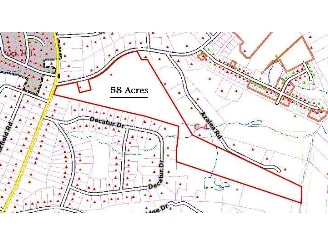
54.626 AC / SPRINDALE RD
Taxexempt
York
AE
South Carolina
45091C0337E
54.63 AC
0
York County
2025
Charlotte
061205
Charlotte-Concord-Gastonia, NC-SC
DEMOGRAPHICS near 1434 Sturgis Rd
1 Mile
3 Mile
5 Mile
2024 Total Population
3,958
19,764
78,836
2029 Population
4,440
22,252
88,832
Pop Growth 2024-2029
+ 12.18%
+ 12.59%
+ 12.68%
Average Age
38
39
38
2024 Total Households
1,609
7,858
30,816
HH Growth 2024-2029
+ 12.49%
+ 12.94%
+ 13.30%
Median Household Inc
$54,039
$64,047
$56,226
Avg Household Size
2.50
2.50
2.40
2024 Avg HH Vehicles
2.00
2.00
2.00
Median Home Value
$308,907
$266,511
$236,042
Median Year Built
2005
2001
1992
Nearby Places
Map Layers
Map Styles
 Street
 Aerial
- Restaurants
- Banks
- Shops
- Fitness
- Groceries
PUBLIC TRANSPORTATION
AIRPORT
Charlotte/Douglas International
DRIVE
WALK
Distance
Charlotte/Douglas International
38 min
23.1 mi
Freight Ports
North Charleston Terminal
DRIVE
WALK
Distance
North Charleston Terminal
199 min
177.3 mi
Nearby Properties
Address
Land Use
TOTAL SIZE
Lot Size
Zoning
Address
Land Use
TOTAL SIZE
Lot Size
Zoning
28,104 SF
11.84 AC
NMU
Address
Land Use
TOTAL SIZE
Lot Size
Zoning
216,000 SF
23.16 AC
Address
Land Use
TOTAL SIZE
Lot Size
Zoning
191,882 SF
24.95 AC
IG
Address
Land Use
TOTAL SIZE
Lot Size
Zoning
215.20 AC
UD
Address
Land Use
TOTAL SIZE
Lot Size
Zoning
10,448 SF
12.95 AC
PUD
Address
Land Use
TOTAL SIZE
Lot Size
Zoning
108,597 SF
14.55 AC
Address
Land Use
TOTAL SIZE
Lot Size
Zoning
74,880 SF
6.52 AC
Address
Land Use
TOTAL SIZE
Lot Size
Zoning
498,580 SF
51.95 AC
Address
Land Use
TOTAL SIZE
Lot Size
Zoning
28,660 SF
19.95 AC
OI
Address
Land Use
TOTAL SIZE
Lot Size
Zoning
163,085 SF
6.84 AC
Address
Land Use
TOTAL SIZE
Lot Size
Zoning
68,486 SF
8.88 AC
IG
Address
Land Use
TOTAL SIZE
Lot Size
Zoning
45.20 AC
Address
Land Use
TOTAL SIZE
Lot Size
Zoning
29,196 SF
28.01 AC
Address
Land Use
TOTAL SIZE
Lot Size
Zoning
113,490 SF
7 AC
Address
Land Use
TOTAL SIZE
Lot Size
Zoning
851,500 SF
72.70 AC
Address
Land Use
TOTAL SIZE
Lot Size
Zoning
57,670 SF
6.48 AC
IG
Address
Land Use
TOTAL SIZE
Lot Size
Zoning
296 AC
RUD
Address
Land Use
TOTAL SIZE
Lot Size
Zoning
57,420 SF
4.72 AC
IG
Address
Land Use
TOTAL SIZE
Lot Size
Zoning
36,432 SF
17.92 AC
Address
Land Use
TOTAL SIZE
Lot Size
Zoning
219,972 SF
29.74 AC
IG
Address
Land Use
TOTAL SIZE
Lot Size
Zoning
471,456 SF
26 AC
ID
Address
Land Use
TOTAL SIZE
Lot Size
Zoning
40,060 SF
4.01 AC
IG
Address
Land Use
TOTAL SIZE
Lot Size
Zoning
460,800 SF
46.11 AC
Address
Land Use
TOTAL SIZE
Lot Size
Zoning
411,620 SF
30.34 AC
IG
Address
Land Use
TOTAL SIZE
Lot Size
Zoning
22,278 SF
4.92 AC
Address
Land Use
TOTAL SIZE
Lot Size
Zoning
28,956 SF
17.89 AC
MF15
Address
Land Use
TOTAL SIZE
Lot Size
Zoning
28,410 SF
18.78 AC
NMU
Address
Land Use
TOTAL SIZE
Lot Size
Zoning
231,000 SF
31.72 AC
Address
Land Use
TOTAL SIZE
Lot Size
Zoning
Address
Land Use
TOTAL SIZE
Lot Size
Zoning
237,723 SF
15.89 AC
PUD
The World's #1 Commercial Real Estate Marketplace
Connect with us
© 2026 CoStar Group
The information above has been obtained from sources believed reliable. While we do not doubt its accuracy we have not verified it and make no guarantee, warranty or representation about it. It is your responsibility to independently confirm its accuracy and completeness. Any projections, opinions, assumptions, or estimates used are for example only and do not represent the current or future performance of the property. The value of this transaction to you depends on tax and other factors which should be evaluated by your tax, financial, and legal advisors. You and your advisors should conduct a careful, independent investigation of the property to determine to your satisfaction the suitability of the property for your needs.