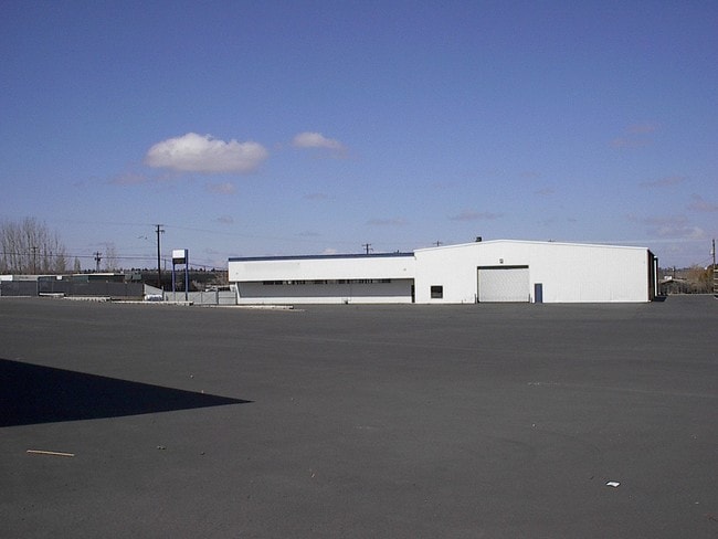
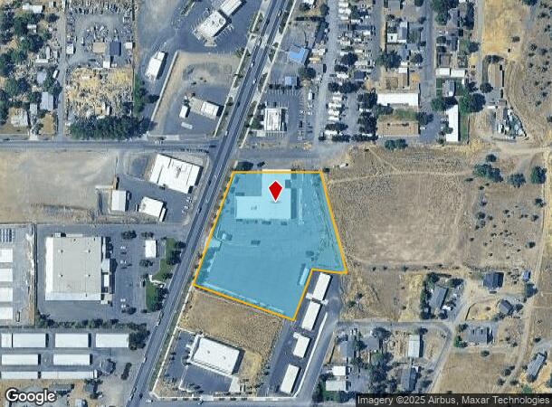
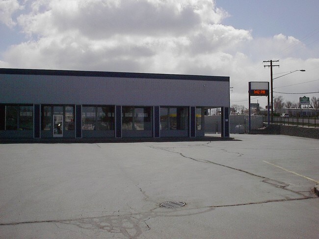
Property Record
1435 Sw Highway 97, Madras, OR 97741
NEARBY LISTINGS FOR SALE OR LEASE
Property Detail
1435 Sw Highway 97
111314-AD-00200
TR SENE SEC 14 / 11 S 13 E 14 AD 00200 00
Commercialnec
Jefferson
2025
Oregon
2025
3.33 AC
960202
Oregon East Area
19,328 SF
Other Market Areas
DEMOGRAPHICS near 1435 Sw Highway 97
1 Mile
3 Mile
5 Mile
2024 Total Population
4,791
11,142
12,123
2029 Population
5,190
12,068
13,102
Pop Growth 2024-2029
+ 8.33%
+ 8.31%
+ 8.08%
Average Age
37
38
38
2024 Total Households
1,672
3,941
4,282
HH Growth 2024-2029
+ 8.01%
+ 7.99%
+ 7.75%
Median Household Inc
$55,807
$53,772
$55,328
Avg Household Size
2.80
2.70
2.70
2024 Avg HH Vehicles
2.00
2.00
2.00
Median Home Value
$277,058
$284,343
$286,523
Median Year Built
1980
1978
1978
Nearby Places
Map Layers
Map Styles
 Street
 Aerial
- Restaurants
- Banks
- Shops
- Fitness
- Groceries
PUBLIC TRANSPORTATION
AIRPORT
Roberts Field
DRIVE
WALK
Distance
Roberts Field
37 min
27.1 mi
SALE & LEASE HISTORY
LISTING DATE
SALE/LEASE

Sep 24, 2016
For Sale
Feb 24, 2025
For Sale
Nearby Properties
Address
Land Use
TOTAL SIZE
Lot Size
Zoning
Address
Land Use
TOTAL SIZE
Lot Size
Zoning
85,692 SF
10.62 AC
OS
Address
Land Use
TOTAL SIZE
Lot Size
Zoning
29,624 SF
2.93 AC
OS
Address
Land Use
TOTAL SIZE
Lot Size
Zoning
111,621 SF
7.67 AC
OS
Address
Land Use
TOTAL SIZE
Lot Size
Zoning
129,027 SF
30.34 AC
A-1
Address
Land Use
TOTAL SIZE
Lot Size
Zoning
35,438 SF
10.11 AC
OS
Address
Land Use
TOTAL SIZE
Lot Size
Zoning
Address
Land Use
TOTAL SIZE
Lot Size
Zoning
Address
Land Use
TOTAL SIZE
Lot Size
Zoning
47,854 SF
8.14 AC
OS
Address
Land Use
TOTAL SIZE
Lot Size
Zoning
31,686 SF
64.20 AC
AM
Address
Land Use
TOTAL SIZE
Lot Size
Zoning
15,580 SF
2.90 AC
OS
Address
Land Use
TOTAL SIZE
Lot Size
Zoning
792 SF
35.10 AC
A-1
Address
Land Use
TOTAL SIZE
Lot Size
Zoning
27,420 SF
3.44 AC
OS
Address
Land Use
TOTAL SIZE
Lot Size
Zoning
44,913 SF
6.73 AC
OS
Address
Land Use
TOTAL SIZE
Lot Size
Zoning
16,036 SF
244.71 AC
A-D
Address
Land Use
TOTAL SIZE
Lot Size
Zoning
32,570 SF
4.24 AC
OS
Address
Land Use
TOTAL SIZE
Lot Size
Zoning
3,128 SF
35.92 AC
OS
Address
Land Use
TOTAL SIZE
Lot Size
Zoning
59,349 SF
6.46 AC
C1
Address
Land Use
TOTAL SIZE
Lot Size
Zoning
2.12 AC
R3
Address
Land Use
TOTAL SIZE
Lot Size
Zoning
25,452 SF
1.32 AC
C3
Address
Land Use
TOTAL SIZE
Lot Size
Zoning
1,350 SF
25.59 AC
OS
Address
Land Use
TOTAL SIZE
Lot Size
Zoning
13,862 SF
4.36 AC
OS
Address
Land Use
TOTAL SIZE
Lot Size
Zoning
20,553 SF
0.83 AC
R2
Address
Land Use
TOTAL SIZE
Lot Size
Zoning
4.04 AC
R1
Address
Land Use
TOTAL SIZE
Lot Size
Zoning
8,354 SF
14.94 AC
OS
Address
Land Use
TOTAL SIZE
Lot Size
Zoning
30,951 SF
1.83 AC
R2
Address
Land Use
TOTAL SIZE
Lot Size
Zoning
10 SF
2.27 AC
I
Address
Land Use
TOTAL SIZE
Lot Size
Zoning
7,472 SF
10 AC
RR-5
Address
Land Use
TOTAL SIZE
Lot Size
Zoning
69.88 AC
OS
Address
Land Use
TOTAL SIZE
Lot Size
Zoning
66 SF
6.18 AC
OS
The World's #1 Commercial Real Estate Marketplace
Connect with us
© 2026 CoStar Group
The information above has been obtained from sources believed reliable. While we do not doubt its accuracy we have not verified it and make no guarantee, warranty or representation about it. It is your responsibility to independently confirm its accuracy and completeness. Any projections, opinions, assumptions, or estimates used are for example only and do not represent the current or future performance of the property. The value of this transaction to you depends on tax and other factors which should be evaluated by your tax, financial, and legal advisors. You and your advisors should conduct a careful, independent investigation of the property to determine to your satisfaction the suitability of the property for your needs.