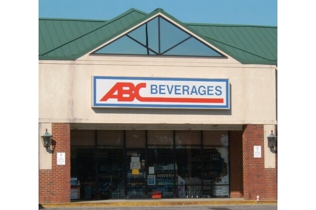
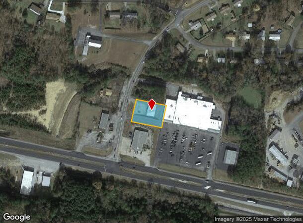
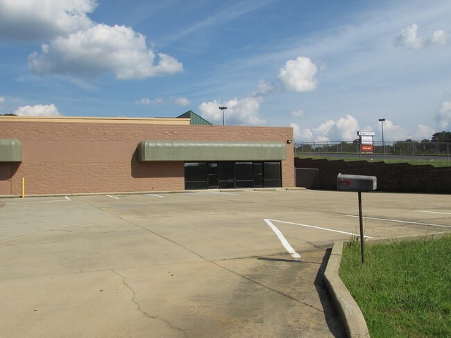
Property Record
1436 Lenlock Ln, Anniston, AL 36206
NEARBY LISTINGS FOR SALE OR LEASE
Property Detail
1436 Lenlock Ln
Storebuilding
SEC 24 TSP 15S R 7E BEG 198.8 NE OF NE INT US HWY 431 & W LENLOCK LN TH SE 200.38 NE 148.17 NW 200.42 SW ALG ROW 146.27 TO PO
X
Calhoun
01015C0303E
Alabama
2025
0.69 AC
2025
Other Market Areas
001700
Anniston-Oxford-Jacksonville, AL
4,000 SF
17-06-24-0-001-005.000
DEMOGRAPHICS near 1436 Lenlock Ln
1 Mile
3 Mile
5 Mile
2024 Total Population
2,835
15,788
35,805
2029 Population
2,774
15,595
35,575
Pop Growth 2024-2029
(2.15%)
(1.22%)
(0.64%)
Average Age
42
41
41
2024 Total Households
1,113
6,518
14,842
HH Growth 2024-2029
(2.25%)
(1.30%)
(0.58%)
Median Household Inc
$70,045
$40,657
$40,053
Avg Household Size
2.50
2.30
2.30
2024 Avg HH Vehicles
3.00
2.00
2.00
Median Home Value
$140,162
$95,068
$97,112
Median Year Built
1979
1974
1972
Nearby Places
Map Layers
Map Styles
 Street
 Aerial
- Restaurants
- Banks
- Shops
- Fitness
- Groceries
PUBLIC TRANSPORTATION
COMMUTER RAIL
Anniston Amtrak Station (Crescent - Amtrak)
DRIVE
WALK
Distance
Anniston Amtrak Station (Crescent - Amtrak)
11 min
5.7 mi
Freight Ports
Port of Panama City
DRIVE
WALK
Distance
Port of Panama City
370 min
295.8 mi
SALE & LEASE HISTORY
LISTING DATE
SALE/LEASE

Sep 25, 2016
For Lease
Sep 23, 2016
For Sale
Jan 21, 2020
For Sale
Nearby Properties
Address
Land Use
TOTAL SIZE
Lot Size
Zoning
Address
Land Use
TOTAL SIZE
Lot Size
Zoning
18.55 AC
Address
Land Use
TOTAL SIZE
Lot Size
Zoning
16,541 SF
19.44 AC
Address
Land Use
TOTAL SIZE
Lot Size
Zoning
138,119 SF
13.55 AC
Address
Land Use
TOTAL SIZE
Lot Size
Zoning
203,573 SF
17.16 AC
Address
Land Use
TOTAL SIZE
Lot Size
Zoning
42,158 SF
5.20 AC
Address
Land Use
TOTAL SIZE
Lot Size
Zoning
71,060 SF
2.20 AC
Address
Land Use
TOTAL SIZE
Lot Size
Zoning
103,550 SF
9.15 AC
Address
Land Use
TOTAL SIZE
Lot Size
Zoning
Address
Land Use
TOTAL SIZE
Lot Size
Zoning
Address
Land Use
TOTAL SIZE
Lot Size
Zoning
9,034 SF
4.70 AC
Address
Land Use
TOTAL SIZE
Lot Size
Zoning
25,325 SF
2.29 AC
Address
Land Use
TOTAL SIZE
Lot Size
Zoning
5,780 SF
62.60 AC
Address
Land Use
TOTAL SIZE
Lot Size
Zoning
27,338 SF
3.60 AC
Address
Land Use
TOTAL SIZE
Lot Size
Zoning
121,812 SF
15.50 AC
Address
Land Use
TOTAL SIZE
Lot Size
Zoning
9,519 SF
17 AC
Address
Land Use
TOTAL SIZE
Lot Size
Zoning
7,924 SF
9.50 AC
Address
Land Use
TOTAL SIZE
Lot Size
Zoning
61,526 SF
5.64 AC
Address
Land Use
TOTAL SIZE
Lot Size
Zoning
4,736 SF
9 AC
Address
Land Use
TOTAL SIZE
Lot Size
Zoning
Address
Land Use
TOTAL SIZE
Lot Size
Zoning
4,004 SF
11.64 AC
Address
Land Use
TOTAL SIZE
Lot Size
Zoning
1,068 SF
7.63 AC
Address
Land Use
TOTAL SIZE
Lot Size
Zoning
45,600 SF
7.80 AC
Address
Land Use
TOTAL SIZE
Lot Size
Zoning
8,143 SF
4.80 AC
Address
Land Use
TOTAL SIZE
Lot Size
Zoning
6,000 SF
35 AC
Address
Land Use
TOTAL SIZE
Lot Size
Zoning
57,900 SF
6.29 AC
Address
Land Use
TOTAL SIZE
Lot Size
Zoning
20,520 SF
2.39 AC
Address
Land Use
TOTAL SIZE
Lot Size
Zoning
19,137 SF
3.82 AC
Address
Land Use
TOTAL SIZE
Lot Size
Zoning
0.75 AC
Address
Land Use
TOTAL SIZE
Lot Size
Zoning
10,602 SF
3.10 AC
Address
Land Use
TOTAL SIZE
Lot Size
Zoning
3,222 SF
0.74 AC
The World's #1 Commercial Real Estate Marketplace
Connect with us
© 2025 CoStar Group
The information above has been obtained from sources believed reliable. While we do not doubt its accuracy we have not verified it and make no guarantee, warranty or representation about it. It is your responsibility to independently confirm its accuracy and completeness. Any projections, opinions, assumptions, or estimates used are for example only and do not represent the current or future performance of the property. The value of this transaction to you depends on tax and other factors which should be evaluated by your tax, financial, and legal advisors. You and your advisors should conduct a careful, independent investigation of the property to determine to your satisfaction the suitability of the property for your needs.