Property Record
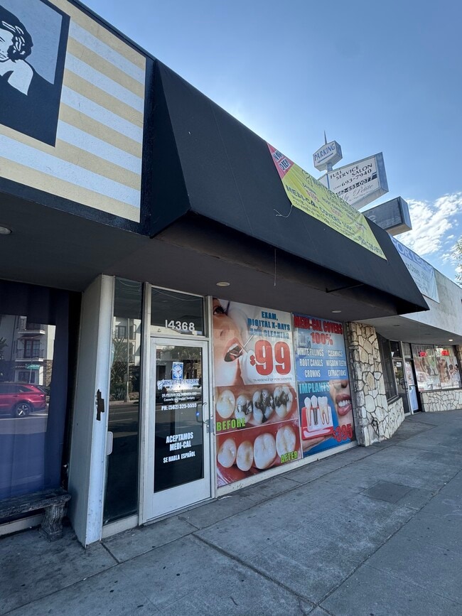
14368 Whittier Blvd, Whittier, CA 90605
Current Lease Availabilities
NEARBY LISTINGS FOR SALE OR LEASE
Property Detail
14368 Whittier Blvd
Los Angeles-Long Beach-Glendale, CA
14427
8160-001-011
RESURVEY OF GUNNS PLAT OF THE BLAISDELL TRACT LOT COM N 56 22 W 103 FT FROM MOST N COR OF LOT 9 TR NO 14427 TH S 53 3136 W TO A PT N 57 33 E 10.5 FT AND S 56 22 E 56 FT FROM MOST N COR OF LOT OF 16.64 AC STRIP AND PART OF LOT 1
Storesoffices
Los Angeles
X
California
06037C1835F
1
2024
0.15 AC
2025
Southeast Los Angeles
501900
Los Angeles
3,000 SF
DEMOGRAPHICS near 14368 Whittier Blvd
1 Mile
3 Mile
5 Mile
2024 Total Population
20,059
158,685
417,134
2029 Population
19,327
153,256
403,094
Pop Growth 2024-2029
(3.65%)
(3.42%)
(3.37%)
Average Age
40
39
40
2024 Total Households
6,209
48,768
125,657
HH Growth 2024-2029
(3.95%)
(3.66%)
(3.59%)
Median Household Inc
$102,782
$87,862
$90,324
Avg Household Size
3.10
3.10
3.20
2024 Avg HH Vehicles
2.00
2.00
2.00
Median Home Value
$753,426
$733,292
$717,107
Median Year Built
1954
1956
1958
Nearby Places
- Restaurants
- Banks
- Shops
- Fitness
- Groceries
PUBLIC TRANSPORTATION
COMMUTER RAIL
Norwalk/Santa Fe Springs (91 Line - Southern California Regional Rail Authority (Metrolink), Orange County Line - Southern California Regional Rail Authority (Metrolink))
DRIVE
WALK
Distance
Norwalk/Santa Fe Springs (91 Line - Southern California Regional Rail Authority (Metrolink), Orange County Line - Southern California Regional Rail Authority (Metrolink))
10 min
4.9 mi
Buena Park (91 Line - Southern California Regional Rail Authority (Metrolink), Orange County Line - Southern California Regional Rail Authority (Metrolink))
DRIVE
WALK
Distance
Buena Park (91 Line - Southern California Regional Rail Authority (Metrolink), Orange County Line - Southern California Regional Rail Authority (Metrolink))
13 min
6.6 mi
AIRPORT
Long Beach (Daugherty Field)
DRIVE
WALK
Distance
Long Beach (Daugherty Field)
30 min
19.5 mi
John Wayne/Orange County
DRIVE
WALK
Distance
John Wayne/Orange County
35 min
25.6 mi
Los Angeles International
DRIVE
WALK
Distance
Los Angeles International
38 min
27.6 mi
Freight Ports
Port of Long Beach
DRIVE
WALK
Distance
Port of Long Beach
37 min
25.1 mi
Nearby Properties
Address
Land Use
TOTAL SIZE
Lot Size
Zoning
Address
Land Use
TOTAL SIZE
Lot Size
Zoning
519,516 SF
25.37 AC
WHR3*
Address
Land Use
TOTAL SIZE
Lot Size
Zoning
1,100,900 SF
22.36 AC
SSM2*
Address
Land Use
TOTAL SIZE
Lot Size
Zoning
322,048 SF
15.54 AC
SSM2-M1*
Address
Land Use
TOTAL SIZE
Lot Size
Zoning
304,549 SF
7.13 AC
SSM2*
Address
Land Use
TOTAL SIZE
Lot Size
Zoning
234,324 SF
10.05 AC
SSM2*
Address
Land Use
TOTAL SIZE
Lot Size
Zoning
300,148 SF
13.01 AC
SSM2*
Address
Land Use
TOTAL SIZE
Lot Size
Zoning
183,000 SF
7.76 AC
SSM2*
Address
Land Use
TOTAL SIZE
Lot Size
Zoning
657,978 SF
31.68 AC
SSM2*
Address
Land Use
TOTAL SIZE
Lot Size
Zoning
89,899 SF
SSM2*
Address
Land Use
TOTAL SIZE
Lot Size
Zoning
74,018 SF
14.92 AC
WHM1*
Address
Land Use
TOTAL SIZE
Lot Size
Zoning
89,514 SF
21.28 AC
WHC2*
Address
Land Use
TOTAL SIZE
Lot Size
Zoning
85,245 SF
7.44 AC
WHT*
Address
Land Use
TOTAL SIZE
Lot Size
Zoning
425,816 SF
30.02 AC
SSM2*
Address
Land Use
TOTAL SIZE
Lot Size
Zoning
320,030 SF
8.81 AC
WHM2*
Address
Land Use
TOTAL SIZE
Lot Size
Zoning
184,230 SF
4.55 AC
SSM2*
Address
Land Use
TOTAL SIZE
Lot Size
Zoning
161,861 SF
17.50 AC
SSC4PD*
Address
Land Use
TOTAL SIZE
Lot Size
Zoning
916,869 SF
21.34 AC
SSM2*
Address
Land Use
TOTAL SIZE
Lot Size
Zoning
397,560 SF
8.25 AC
SSM2*
Address
Land Use
TOTAL SIZE
Lot Size
Zoning
108,296 SF
8.81 AC
WHM2*
Address
Land Use
TOTAL SIZE
Lot Size
Zoning
216,952 SF
23.54 AC
WHR4*
Address
Land Use
TOTAL SIZE
Lot Size
Zoning
393,696 SF
12.73 AC
WHM2*
Address
Land Use
TOTAL SIZE
Lot Size
Zoning
67,692 SF
2.34 AC
WHC2*
Address
Land Use
TOTAL SIZE
Lot Size
Zoning
138,400 SF
3.49 AC
SSM2*
Address
Land Use
TOTAL SIZE
Lot Size
Zoning
151,618 SF
7.70 AC
WHM1*
Address
Land Use
TOTAL SIZE
Lot Size
Zoning
69,056 SF
2.25 AC
WHM1*
Address
Land Use
TOTAL SIZE
Lot Size
Zoning
117,159 SF
1.50 AC
WHC2UD*
Address
Land Use
TOTAL SIZE
Lot Size
Zoning
192,740 SF
10.18 AC
Address
Land Use
TOTAL SIZE
Lot Size
Zoning
97,952 SF
4.18 AC
WHR3*
The World's #1 Commercial Real Estate Marketplace
Connect with us
© 2025 CoStar Group
The information above has been obtained from sources believed reliable. While we do not doubt its accuracy we have not verified it and make no guarantee, warranty or representation about it. It is your responsibility to independently confirm its accuracy and completeness. Any projections, opinions, assumptions, or estimates used are for example only and do not represent the current or future performance of the property. The value of this transaction to you depends on tax and other factors which should be evaluated by your tax, financial, and legal advisors. You and your advisors should conduct a careful, independent investigation of the property to determine to your satisfaction the suitability of the property for your needs.